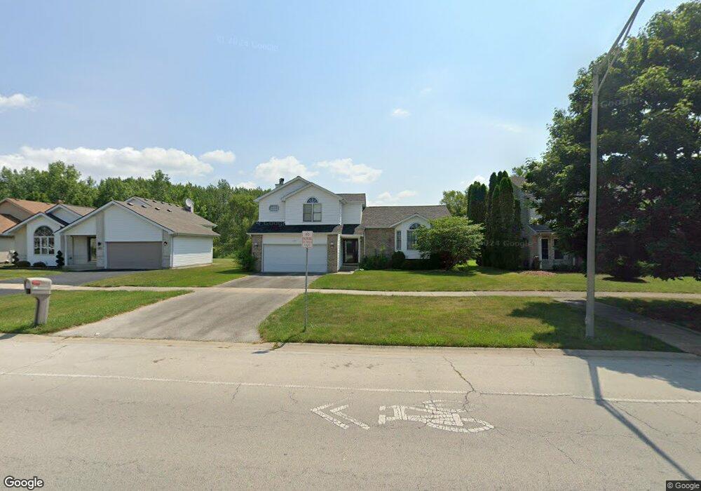
271 Central Ave Matteson, IL 60443
West Matteson NeighborhoodEstimated Value: $303,314 - $314,000
3
Beds
3
Baths
1,972
Sq Ft
$157/Sq Ft
Est. Value
About This Home
This home is located at 271 Central Ave, Matteson, IL 60443 and is currently estimated at $309,579, approximately $156 per square foot. 271 Central Ave is a home located in Cook County with nearby schools including Colin Powell Middle School.
Ownership History
Date
Name
Owned For
Owner Type
Purchase Details
Closed on
Oct 15, 1997
Sold by
Brown Neil David and Brown Yuri E
Bought by
Jones David A and Jones Renata C
Current Estimated Value
Home Financials for this Owner
Home Financials are based on the most recent Mortgage that was taken out on this home.
Original Mortgage
$148,824
Outstanding Balance
$21,346
Interest Rate
7.51%
Estimated Equity
$288,233
Purchase Details
Closed on
Aug 1, 1995
Sold by
Maywood Proviso State Bank
Bought by
Brown Neil David and Brown Yuri E
Home Financials for this Owner
Home Financials are based on the most recent Mortgage that was taken out on this home.
Original Mortgage
$150,000
Interest Rate
7.64%
Mortgage Type
Construction
Create a Home Valuation Report for This Property
The Home Valuation Report is an in-depth analysis detailing your home's value as well as a comparison with similar homes in the area
Home Values in the Area
Average Home Value in this Area
Purchase History
| Date | Buyer | Sale Price | Title Company |
|---|---|---|---|
| Jones David A | $101,333 | -- | |
| Brown Neil David | $48,750 | -- |
Source: Public Records
Mortgage History
| Date | Status | Borrower | Loan Amount |
|---|---|---|---|
| Open | Jones David A | $148,824 | |
| Previous Owner | Brown Neil David | $150,000 |
Source: Public Records
Tax History
| Year | Tax Paid | Tax Assessment Tax Assessment Total Assessment is a certain percentage of the fair market value that is determined by local assessors to be the total taxable value of land and additions on the property. | Land | Improvement |
|---|---|---|---|---|
| 2025 | $10,232 | $28,000 | $5,390 | $22,610 |
| 2024 | $10,232 | $28,000 | $5,390 | $22,610 |
| 2023 | $7,032 | $28,000 | $5,390 | $22,610 |
| 2022 | $7,032 | $16,555 | $4,655 | $11,900 |
| 2021 | $7,146 | $16,554 | $4,655 | $11,899 |
| 2020 | $7,025 | $16,554 | $4,655 | $11,899 |
| 2019 | $8,588 | $19,147 | $4,165 | $14,982 |
| 2018 | $8,460 | $19,147 | $4,165 | $14,982 |
| 2017 | $8,257 | $19,147 | $4,165 | $14,982 |
| 2016 | $8,390 | $18,709 | $3,675 | $15,034 |
| 2015 | $8,174 | $18,709 | $3,675 | $15,034 |
| 2014 | $7,979 | $18,709 | $3,675 | $15,034 |
| 2013 | $8,367 | $20,817 | $3,675 | $17,142 |
Source: Public Records
Map
Nearby Homes
- 322 Central Ave
- 5620 Feathercreek Rd
- 5628 Crestwood Rd
- 5327 Northwestern Dr
- 51 Manor Dr
- 5804 Kathryn Ln
- 5808 Allemong Dr
- 156 Cloverleaf Rd
- 175 Owen St
- 5102 Monroe St
- 133 Deerpath Rd
- 78 Kenneth St
- 40 Huntingwood Rd
- 5742 Woodgate Dr
- 152 Oakhurst Rd
- 5631 Colgate Ln
- 763 Cambridge Ave
- 123 Oriole Rd
- 124 Oriole Rd
- 98 Lawrence Ln
- 303 Central Ave
- 267 Central Ave
- 309 Central Ave
- 261 Central Ave
- 315 Central Ave
- 5506 Mallard Dr
- 262 Central Ave
- 5503 Mallard Dr
- 321 Central Ave
- 256 Central Ave
- 249 Central Ave
- 5507 Feathercreek Rd
- 5509 Mallard Dr
- 327 Central Ave
- 5512 Mallard Dr
- 316 Central Ave
- 5513 Feathercreek Rd
- 5516 Mallard Dr
- 333 Central Ave
- 232 Central Ave
Your Personal Tour Guide
Ask me questions while you tour the home.