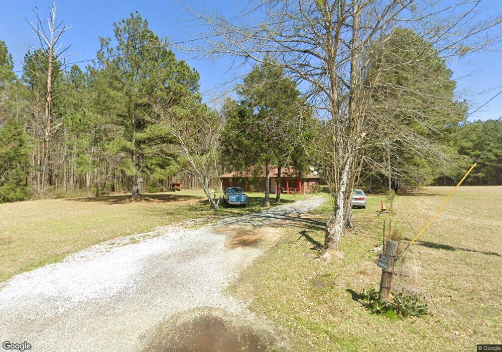
271 Deer Ridge Rd Brandon, MS 39042
Estimated Value: $152,000 - $172,000
3
Beds
3
Baths
932
Sq Ft
$173/Sq Ft
Est. Value
About This Home
This home is located at 271 Deer Ridge Rd, Brandon, MS 39042 and is currently estimated at $160,866, approximately $172 per square foot. 271 Deer Ridge Rd is a home located in Rankin County with nearby schools including Rouse Elementary School, Brandon Elementary School, and Stonebridge Elementary School.
Ownership History
Date
Name
Owned For
Owner Type
Purchase Details
Closed on
May 15, 2025
Sold by
Jenkins Bill R and Nutt Tommy Mclyn
Bought by
Boling John Kirkland and Holmes Rebecca Kaye
Current Estimated Value
Purchase Details
Closed on
Nov 30, 2018
Sold by
Prothro Doris
Bought by
Scott David L
Home Financials for this Owner
Home Financials are based on the most recent Mortgage that was taken out on this home.
Original Mortgage
$44,308
Interest Rate
3.9%
Mortgage Type
Unknown
Purchase Details
Closed on
Sep 5, 2008
Sold by
Jones Barbara
Bought by
Scott David Len
Create a Home Valuation Report for This Property
The Home Valuation Report is an in-depth analysis detailing your home's value as well as a comparison with similar homes in the area
Home Values in the Area
Average Home Value in this Area
Purchase History
| Date | Buyer | Sale Price | Title Company |
|---|---|---|---|
| Boling John Kirkland | -- | None Listed On Document | |
| Boling John Kirkland | -- | None Listed On Document | |
| Scott David L | -- | -- | |
| Scott David Len | -- | -- |
Source: Public Records
Mortgage History
| Date | Status | Borrower | Loan Amount |
|---|---|---|---|
| Previous Owner | Scott David L | $44,308 | |
| Previous Owner | Scott David L | $36,385 |
Source: Public Records
Tax History Compared to Growth
Tax History
| Year | Tax Paid | Tax Assessment Tax Assessment Total Assessment is a certain percentage of the fair market value that is determined by local assessors to be the total taxable value of land and additions on the property. | Land | Improvement |
|---|---|---|---|---|
| 2024 | $873 | $8,847 | $0 | $0 |
| 2023 | $776 | $7,866 | $0 | $0 |
| 2022 | $765 | $7,866 | $0 | $0 |
| 2021 | $699 | $7,191 | $0 | $0 |
| 2020 | $699 | $7,191 | $0 | $0 |
| 2019 | $637 | $6,371 | $0 | $0 |
| 2018 | $624 | $6,371 | $0 | $0 |
| 2017 | $624 | $6,371 | $0 | $0 |
| 2016 | $609 | $6,551 | $0 | $0 |
| 2015 | $609 | $6,551 | $0 | $0 |
| 2014 | $595 | $6,551 | $0 | $0 |
| 2013 | $595 | $6,551 | $0 | $0 |
Source: Public Records
Map
Nearby Homes
- 0 Hebron Hill Dr
- 00 Hebron Hill Dr
- 130 Deer Ridge Rd
- 144 Kathryn Dr
- 111 Meadow Pointe Cove
- 0 Nottingham Rd
- 127 Canterbury Rd
- 305 Flagstone Dr
- 409 Sand Stone Place
- 509 Stone Brook Place
- 507 Stone Brook Place
- 505 Stone Brook Place
- 503 Stone Brook Place
- 504 Stone Brook Place
- 508 Stone Brook Place
- 548 Stone Brook Place
- 544 Stone Brook Place
- 535 Stone Brook Place
- 1178 Sanctuary Dr
- 223 New Haven Ln
- 270 Deer Ridge Rd
- 111 Cedar Ridge Dr
- 118 Cedar Ridge Cove
- 107 Cedar Ridge Dr
- 113 Cedar Ridge Dr
- 116 Cedar Ridge Cove
- 105 Cedar Ridge Dr
- 346 Hebron Hill Dr
- 338 Hebron Hill Dr
- 350 Hebron Hill Dr
- 330 Hebron Hill Dr
- 196 Cedar Springs Cir
- 324 Hebron Hill Dr
- 114 Cedar Ridge Cove
- 316 Hebron Hill Dr
- 112 Cedar Ridge Cove
- 347 Hebron Hill Dr
- 339 Hebron Hill Dr
- 106 Cedar Ridge Dr
- 331 Hebron Hill Dr