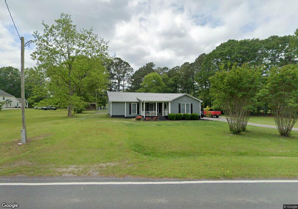
271 Hardy Rd Brooks, GA 30205
Estimated Value: $352,000 - $477,000
3
Beds
2
Baths
2,214
Sq Ft
$183/Sq Ft
Est. Value
About This Home
This home is located at 271 Hardy Rd, Brooks, GA 30205 and is currently estimated at $404,980, approximately $182 per square foot. 271 Hardy Rd is a home located in Fayette County with nearby schools including Peeples Elementary School, Whitewater Middle School, and Whitewater High School.
Ownership History
Date
Name
Owned For
Owner Type
Purchase Details
Closed on
Oct 20, 2020
Sold by
Mcdonald Tracy
Bought by
Mcdonald Casey Wayne
Current Estimated Value
Home Financials for this Owner
Home Financials are based on the most recent Mortgage that was taken out on this home.
Original Mortgage
$124,480
Outstanding Balance
$100,204
Interest Rate
2.9%
Mortgage Type
New Conventional
Estimated Equity
$304,776
Purchase Details
Closed on
Aug 27, 1997
Sold by
Dollar Donnie G
Bought by
Mcdonald Michael W and Mcdonald Tracey
Create a Home Valuation Report for This Property
The Home Valuation Report is an in-depth analysis detailing your home's value as well as a comparison with similar homes in the area
Home Values in the Area
Average Home Value in this Area
Purchase History
| Date | Buyer | Sale Price | Title Company |
|---|---|---|---|
| Mcdonald Casey Wayne | $155,600 | -- | |
| Mcdonald Michael W | $75,000 | -- |
Source: Public Records
Mortgage History
| Date | Status | Borrower | Loan Amount |
|---|---|---|---|
| Open | Mcdonald Casey Wayne | $124,480 | |
| Closed | Mcdonald Michael W | -- |
Source: Public Records
Tax History Compared to Growth
Tax History
| Year | Tax Paid | Tax Assessment Tax Assessment Total Assessment is a certain percentage of the fair market value that is determined by local assessors to be the total taxable value of land and additions on the property. | Land | Improvement |
|---|---|---|---|---|
| 2024 | $2,776 | $143,632 | $24,628 | $119,004 |
| 2023 | $2,776 | $134,840 | $21,640 | $113,200 |
| 2022 | $2,803 | $126,760 | $19,400 | $107,360 |
| 2021 | $2,644 | $113,948 | $17,908 | $96,040 |
| 2020 | $2,875 | $102,016 | $16,416 | $85,600 |
| 2019 | $2,766 | $97,176 | $16,416 | $80,760 |
| 2018 | $2,587 | $89,900 | $14,180 | $75,720 |
| 2017 | $2,255 | $78,312 | $13,432 | $64,880 |
| 2016 | $2,070 | $70,472 | $13,432 | $57,040 |
| 2015 | $1,933 | $64,792 | $13,432 | $51,360 |
| 2014 | $1,781 | $58,752 | $13,432 | $45,320 |
| 2013 | -- | $56,768 | $0 | $0 |
Source: Public Records
Map
Nearby Homes
- 395 W Mcintosh Rd
- 160 Carrington Ln
- 130 Brooklet Way
- 0 W Mcintosh Rd Unit 10527676
- 5555 W Mcintosh Rd
- 190 Gable Rd
- 4101 W Ellis Rd
- 0 Price Rd Unit LOT 2
- 0 Price Rd Unit LOT 1
- 423 Mask Rd
- 0 Mask and Lynch Rd Unit 10611467
- 786 Highway 85 Connector
- 184 Quail Rd
- 350 Lakeview Dr
- 5092 W Mcintosh Rd
- 275 Lakeview Dr
- 165 Grace Hope Dr
- 0 Hogan Rd Unit 10611382
- 531 Grant Rd
- 250 Friendship Church Rd
- 275 Hardy Rd
- 253 Hardy Rd
- 100 Coogler Way
- 295 Hardy Rd
- 120 Coogler Way
- 125 Coogler Way
- 105 Coogler Way Unit 1 & 2 125
- 248 Hardy Rd
- 205 Hardy Rd
- 309 Hardy Rd
- 227 Hardy Rd
- 130 Coogler Way
- 297 Hardy Rd
- 107 Carson Rd
- 322 Hardy Rd
- 140 Coogler Way
- 135 Coogler Way
- Lot 7 Hardy Rd
- 150 Coogler Way
- 106 Carson Rd