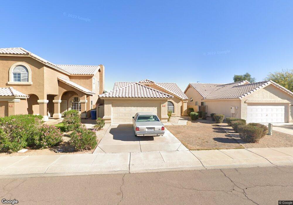
271 N Brookside St Chandler, AZ 85225
East Chandler NeighborhoodEstimated Value: $394,744 - $510,000
--
Bed
3
Baths
1,600
Sq Ft
$283/Sq Ft
Est. Value
About This Home
This home is located at 271 N Brookside St, Chandler, AZ 85225 and is currently estimated at $452,436, approximately $282 per square foot. 271 N Brookside St is a home located in Maricopa County with nearby schools including Sanborn Elementary School, Willis Junior High School, and Chandler High School.
Ownership History
Date
Name
Owned For
Owner Type
Purchase Details
Closed on
Dec 14, 2004
Sold by
Szymanski James M and Szymanski Katherine A
Bought by
Szymanski James M and Szymanski Katherine A
Current Estimated Value
Purchase Details
Closed on
Mar 14, 2002
Sold by
Brady Richard V and Brady Susan M
Bought by
Szymanski James M and Szymanski Katherine A
Home Financials for this Owner
Home Financials are based on the most recent Mortgage that was taken out on this home.
Original Mortgage
$116,450
Outstanding Balance
$47,925
Interest Rate
6.85%
Mortgage Type
New Conventional
Estimated Equity
$404,511
Purchase Details
Closed on
Sep 28, 1994
Sold by
U S Home Corp
Bought by
Brady Richard and Brady Susan M
Create a Home Valuation Report for This Property
The Home Valuation Report is an in-depth analysis detailing your home's value as well as a comparison with similar homes in the area
Home Values in the Area
Average Home Value in this Area
Purchase History
| Date | Buyer | Sale Price | Title Company |
|---|---|---|---|
| Szymanski James M | -- | -- | |
| Szymanski James M | $137,000 | First American Title | |
| Brady Richard | $105,742 | Stewart Title & Trust |
Source: Public Records
Mortgage History
| Date | Status | Borrower | Loan Amount |
|---|---|---|---|
| Open | Szymanski James M | $116,450 |
Source: Public Records
Tax History Compared to Growth
Tax History
| Year | Tax Paid | Tax Assessment Tax Assessment Total Assessment is a certain percentage of the fair market value that is determined by local assessors to be the total taxable value of land and additions on the property. | Land | Improvement |
|---|---|---|---|---|
| 2025 | $1,492 | $19,152 | -- | -- |
| 2024 | $1,441 | $18,240 | -- | -- |
| 2023 | $1,441 | $32,420 | $6,480 | $25,940 |
| 2022 | $1,390 | $24,750 | $4,950 | $19,800 |
| 2021 | $1,457 | $23,250 | $4,650 | $18,600 |
| 2020 | $1,451 | $21,520 | $4,300 | $17,220 |
| 2019 | $1,395 | $19,900 | $3,980 | $15,920 |
| 2018 | $1,351 | $17,910 | $3,580 | $14,330 |
| 2017 | $1,259 | $16,500 | $3,300 | $13,200 |
| 2016 | $1,213 | $15,610 | $3,120 | $12,490 |
| 2015 | $1,175 | $15,380 | $3,070 | $12,310 |
Source: Public Records
Map
Nearby Homes
- 155 N Lakeview Blvd Unit 208
- 155 N Lakeview Blvd Unit 108
- 155 N Lakeview Blvd Unit 204
- 1605 E Chandler Blvd Unit 26
- 1664 E Buffalo Cir
- 83 N Amber Ct
- 420 N Leoma Ln
- 110 N Velero St
- 111 N Soho Place
- 1467 E Boston St
- 642 N Danyell Ct
- 195 N Cottonwood St Unit 21
- 382 N Ashley Dr
- 25 N Cottonwood St Unit 41
- 1075 E Chandler Blvd Unit 119
- 1405 E Chicago Cir
- 1438 E Cindy St
- 1422 E Cindy St
- 1731 E Folley Ct
- 245 N Bedford St
- 281 N Brookside St
- 261 N Brookside St
- 291 N Brookside St
- 1732 E Detroit St
- 301 N Brookside St
- 1731 E Flint St
- 1722 E Detroit St Unit 1
- 311 N Brookside St
- 1761 E Detroit St
- 1741 E Detroit St
- 1721 E Flint St
- 1771 E Flint St
- 1731 E Detroit St
- 1712 E Detroit St Unit 1
- 321 N Brookside St Unit 1
- 1711 E Flint St
- 1781 E Flint St
- 1721 E Detroit St
- 1702 E Detroit St
- 331 N Brookside St Unit 1