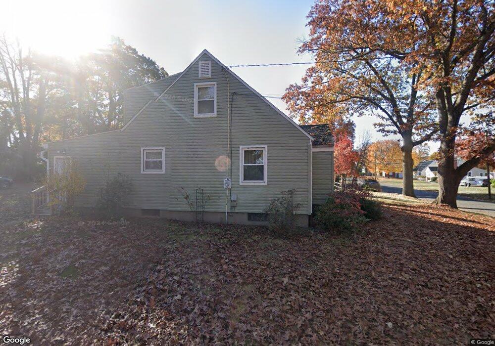
271 Pershing Ave New Britain, CT 06053
Estimated Value: $261,000 - $325,000
3
Beds
2
Baths
1,592
Sq Ft
$188/Sq Ft
Est. Value
About This Home
This home is located at 271 Pershing Ave, New Britain, CT 06053 and is currently estimated at $299,908, approximately $188 per square foot. 271 Pershing Ave is a home located in Hartford County with nearby schools including Gaffney School and Slade Middle School.
Ownership History
Date
Name
Owned For
Owner Type
Purchase Details
Closed on
Oct 21, 1997
Sold by
Yourwith William J
Bought by
French Kenneth and French Cynthia
Current Estimated Value
Purchase Details
Closed on
Jun 13, 1997
Sold by
Cebulski Anna M Est
Bought by
Yourwith William J
Create a Home Valuation Report for This Property
The Home Valuation Report is an in-depth analysis detailing your home's value as well as a comparison with similar homes in the area
Home Values in the Area
Average Home Value in this Area
Purchase History
| Date | Buyer | Sale Price | Title Company |
|---|---|---|---|
| French Kenneth | $86,500 | -- | |
| Yourwith William J | $45,000 | -- |
Source: Public Records
Mortgage History
| Date | Status | Borrower | Loan Amount |
|---|---|---|---|
| Open | Yourwith William J | $13,653 | |
| Closed | Yourwith William J | $4,062 | |
| Closed | Yourwith William J | $4,300 | |
| Closed | Yourwith William J | $20,479 |
Source: Public Records
Tax History
| Year | Tax Paid | Tax Assessment Tax Assessment Total Assessment is a certain percentage of the fair market value that is determined by local assessors to be the total taxable value of land and additions on the property. | Land | Improvement |
|---|---|---|---|---|
| 2025 | $5,384 | $137,410 | $53,340 | $84,070 |
| 2024 | $5,440 | $137,410 | $53,340 | $84,070 |
| 2023 | $5,260 | $137,410 | $53,340 | $84,070 |
| 2022 | $4,816 | $97,300 | $24,570 | $72,730 |
| 2021 | $4,816 | $97,300 | $24,570 | $72,730 |
| 2020 | $4,914 | $97,300 | $24,570 | $72,730 |
| 2019 | $4,914 | $97,300 | $24,570 | $72,730 |
| 2018 | $4,882 | $96,670 | $24,570 | $72,100 |
| 2017 | $4,443 | $87,990 | $20,510 | $67,480 |
| 2016 | $4,443 | $87,990 | $20,510 | $67,480 |
| 2015 | $4,312 | $87,990 | $20,510 | $67,480 |
| 2014 | $4,312 | $87,990 | $20,510 | $67,480 |
Source: Public Records
Map
Nearby Homes
- 19 Maplehurst Ave
- 230 Hillhurst Ave
- 240 Hillhurst Ave
- 54 Fairlane Dr
- 37 Richard St
- 25 Clinton St
- 527 Burritt St
- 234 Pierremount Ave
- 7 Ledyard Rd
- 134 Russwin Rd
- 266 Grove St
- 164 Curtis St
- 77 Booth St
- 36 N Mountain Rd Unit D
- 80 Gold St
- 55 Allen St
- 18 Woodruff Ct
- 50 Curtin Ave
- 21 Skipper St
- 24 Pentlow Ave
- 265 Pershing Ave
- 54 Fortress St
- 283 Pershing Ave
- 57 Fortress St
- 48 Fortress St
- 255 Pershing Ave
- 49 Fortress St
- 266 Pershing Ave
- 276 Pershing Ave
- 44 Fortress St
- 291 Pershing Ave
- 282 Pershing Ave
- 43 Fortress St
- 262 Pershing Ave
- 288 Pershing Ave
- 40 Fortress St
- 91 Maplehurst Ave
- 297 Pershing Ave
- 245 Pershing Ave
- 252 Pershing Ave
Your Personal Tour Guide
Ask me questions while you tour the home.