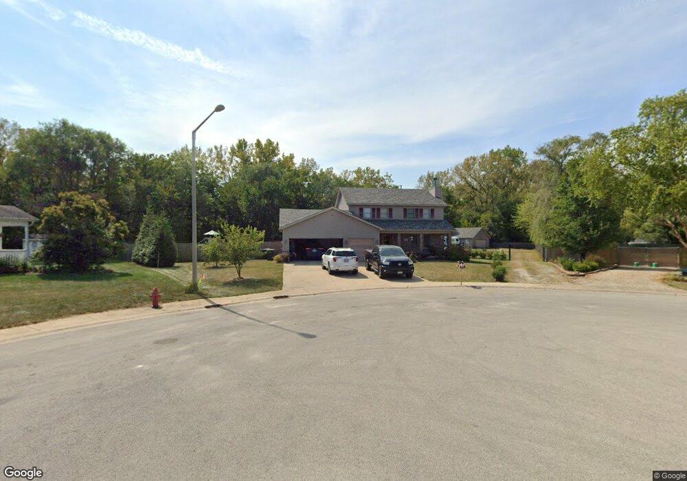
271 Quail Ct Braidwood, IL 60408
Estimated Value: $306,000 - $366,583
Studio
--
Bath
--
Sq Ft
30,492
Sq Ft
About This Home
This home is located at 271 Quail Ct, Braidwood, IL 60408 and is currently estimated at $339,646. 271 Quail Ct is a home located in Will County with nearby schools including Reed-Custer Intermediate School, Reed-Custer Middle School, and Reed-Custer High School.
Ownership History
Date
Name
Owned For
Owner Type
Purchase Details
Closed on
Aug 7, 2017
Sold by
Leimbach Robert W
Bought by
Barrow Michael W and Barrow Kaylie N
Current Estimated Value
Home Financials for this Owner
Home Financials are based on the most recent Mortgage that was taken out on this home.
Original Mortgage
$211,500
Outstanding Balance
$177,237
Interest Rate
4.12%
Mortgage Type
New Conventional
Estimated Equity
$162,409
Purchase Details
Closed on
Oct 13, 2016
Sold by
Leimbach Kimberly K
Bought by
Leimbach Robert W
Purchase Details
Closed on
Jan 3, 2003
Sold by
K & A Development Inc
Bought by
Leimbach Robert W and Leimbach Kimberly K
Create a Home Valuation Report for This Property
The Home Valuation Report is an in-depth analysis detailing your home's value as well as a comparison with similar homes in the area
Home Values in the Area
Average Home Value in this Area
Purchase History
| Date | Buyer | Sale Price | Title Company |
|---|---|---|---|
| Barrow Michael W | $235,000 | Fidelity National Title | |
| Leimbach Robert W | -- | Attorney | |
| Leimbach Robert W | $40,000 | -- |
Source: Public Records
Mortgage History
| Date | Status | Borrower | Loan Amount |
|---|---|---|---|
| Open | Barrow Michael W | $211,500 |
Source: Public Records
Tax History
| Year | Tax Paid | Tax Assessment Tax Assessment Total Assessment is a certain percentage of the fair market value that is determined by local assessors to be the total taxable value of land and additions on the property. | Land | Improvement |
|---|---|---|---|---|
| 2024 | $7,257 | $116,772 | $12,811 | $103,961 |
| 2023 | $7,257 | $104,587 | $11,474 | $93,113 |
| 2022 | $6,110 | $94,907 | $10,412 | $84,495 |
| 2021 | $5,917 | $90,586 | $9,938 | $80,648 |
| 2020 | $5,618 | $85,822 | $9,415 | $76,407 |
| 2019 | $5,302 | $81,040 | $8,890 | $72,150 |
| 2018 | $5,099 | $77,550 | $8,507 | $69,043 |
| 2017 | $5,003 | $76,029 | $8,340 | $67,689 |
| 2016 | $4,875 | $73,529 | $8,066 | $65,463 |
| 2015 | $4,718 | $71,631 | $7,858 | $63,773 |
| 2014 | $4,718 | $71,631 | $7,858 | $63,773 |
| 2013 | $4,718 | $76,610 | $8,404 | $68,206 |
Source: Public Records
Map
Nearby Homes
- 000 W Cermak Rd
- 560 N Washington St
- 46 Lakeshore Dr
- 302 Oak St
- 106 Harbor Landing
- 158 S Railroad St
- 459 N School St
- 470 N School St
- 599 N School St
- 386 W 3rd St
- 13 Hole in The Wall Rd
- 271 Fossil Bay Ct
- 295 Vita Ln
- 364 W Anndon St
- 484 W 3rd St
- 0000 N Division St
- 495 N Division St
- 222 S Lincoln St
- 68 Fossil Cove Ln
- 134 Fossil Lake Rd
- 266 Quail Ct
- 273 Quail Ct
- 275 Quail Ct
- 267 Partridge Run Dr
- 261 Partridge Run Dr
- 277 Quail Ct
- 257 Partridge Run Dr
- 279 Partridge Run Dr
- 232 Teal Ln
- 281 Partridge Run Dr
- 234 Teal Ln
- 285 Partridge Run Dr
- 260 Partridge Run Dr
- 287 Partridge Run Dr
- 264 Partridge Run Dr
- 256 Partridge Run Dr
- 270 Partridge Run Dr
- 450 Wildwood St
- 403 N Mitchell St
- 250 Partridge Run Dr
Your Personal Tour Guide
Ask me questions while you tour the home.