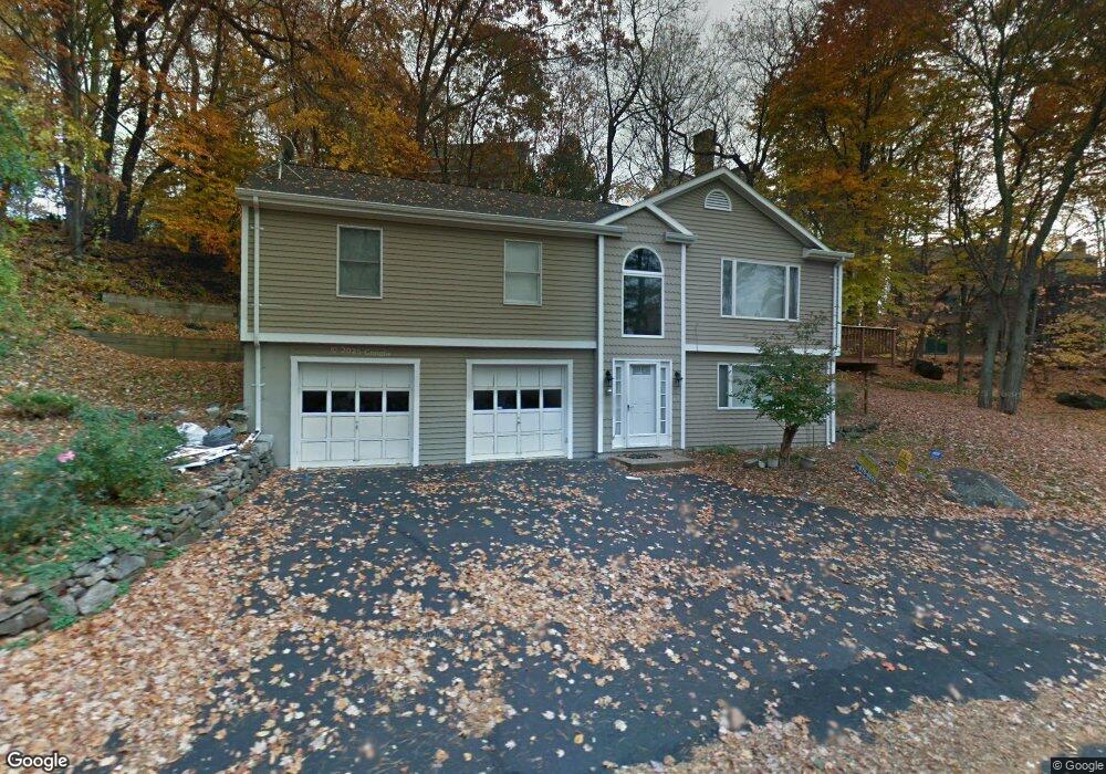
271 Samp Mortar Dr Fairfield, CT 06824
University NeighborhoodEstimated Value: $778,000 - $1,063,000
3
Beds
3
Baths
1,962
Sq Ft
$464/Sq Ft
Est. Value
About This Home
This home is located at 271 Samp Mortar Dr, Fairfield, CT 06824 and is currently estimated at $909,741, approximately $463 per square foot. 271 Samp Mortar Dr is a home located in Fairfield County with nearby schools including Burr Elementary School, Tomlinson Middle School, and Fairfield Warde High School.
Ownership History
Date
Name
Owned For
Owner Type
Purchase Details
Closed on
May 30, 2024
Sold by
Katsetos Christos and Katsetos Mary
Bought by
Christos Katsetos Lt and Katsetos
Current Estimated Value
Purchase Details
Closed on
Mar 24, 2021
Sold by
Parker Richard G and Parker Carrie E
Bought by
Katsetos Christos and Katsetos Mary
Create a Home Valuation Report for This Property
The Home Valuation Report is an in-depth analysis detailing your home's value as well as a comparison with similar homes in the area
Home Values in the Area
Average Home Value in this Area
Purchase History
| Date | Buyer | Sale Price | Title Company |
|---|---|---|---|
| Christos Katsetos Lt | -- | None Available | |
| Christos Katsetos Lt | -- | None Available | |
| Christos Katsetos Lt | -- | None Available | |
| Katsetos Christos | -- | None Available | |
| Katsetos Christos | -- | None Available | |
| Katsetos Christos | -- | None Available |
Source: Public Records
Tax History Compared to Growth
Tax History
| Year | Tax Paid | Tax Assessment Tax Assessment Total Assessment is a certain percentage of the fair market value that is determined by local assessors to be the total taxable value of land and additions on the property. | Land | Improvement |
|---|---|---|---|---|
| 2025 | $8,853 | $311,850 | $187,040 | $124,810 |
| 2024 | $8,701 | $311,850 | $187,040 | $124,810 |
| 2023 | $8,579 | $311,850 | $187,040 | $124,810 |
| 2022 | $8,495 | $311,850 | $187,040 | $124,810 |
| 2021 | $8,414 | $311,850 | $187,040 | $124,810 |
| 2020 | $7,991 | $298,270 | $162,470 | $135,800 |
| 2019 | $7,991 | $298,270 | $162,470 | $135,800 |
| 2018 | $7,862 | $298,270 | $162,470 | $135,800 |
| 2017 | $7,701 | $298,270 | $162,470 | $135,800 |
| 2016 | $7,591 | $298,270 | $162,470 | $135,800 |
| 2015 | $7,677 | $309,680 | $179,200 | $130,480 |
| 2014 | $7,556 | $309,680 | $179,200 | $130,480 |
Source: Public Records
Map
Nearby Homes
- 210 Pansy Rd
- 706 Judd St
- 28 Stillson Place
- 31 High Ridge Rd
- 115 Mayfair Rd
- 2107 N Benson Rd
- 1137 Stillson Rd
- 79 Mayfair Rd
- 1165 Stillson Rd
- 1207 Stillson Rd
- 359 Reid St
- 338 Orchard Hill Ln
- 41 Pepperbush Ln
- 25 Millspaugh Dr
- 947 Galloping Hill Rd
- 750 Burr St
- 45 Robin Cir
- 180 Oakwood Dr
- 251 Winnepoge Dr
- 99 Old Academy Rd
- 233 Samp Mortar Dr
- 61 Guydan Ln
- 55 Guydan Ln
- 244 Samp Mortar Dr
- 270 Samp Mortar Dr
- 217 Samp Mortar Dr
- 43 Guydan Ln
- 45 Abbey Rd
- 222 Samp Mortar Dr
- 203 Samp Mortar Dr
- 60 Guydan Ln
- 204 Samp Mortar Dr
- 320 Samp Mortar Dr
- 21 Guydan Ln
- 31 Abbey Rd
- 98 Brookside Dr
- 10 Guydan Ln
- 152 Brookside Dr
- 122 Brookside Dr
- 323 Samp Mortar Dr