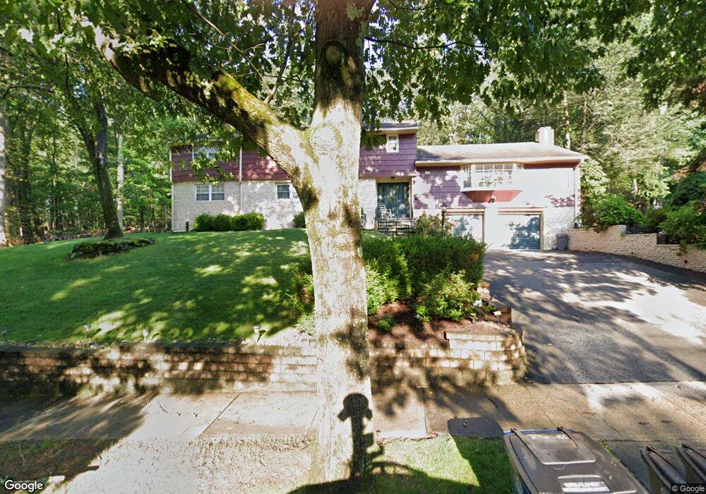
271 Stevenson Rd New Haven, CT 06515
Westville NeighborhoodEstimated Value: $574,000 - $762,212
5
Beds
3
Baths
3,786
Sq Ft
$175/Sq Ft
Est. Value
About This Home
This home is located at 271 Stevenson Rd, New Haven, CT 06515 and is currently estimated at $660,803, approximately $174 per square foot. 271 Stevenson Rd is a home located in New Haven County with nearby schools including Davis Academy for Arts & Design Innovation, Elm City Montessori School, and Hopkins School.
Ownership History
Date
Name
Owned For
Owner Type
Purchase Details
Closed on
Apr 22, 1998
Sold by
Chang Chhin Chhi and Chang Kani Sun
Bought by
Brooks Theodore L and Brooks Lillie J
Current Estimated Value
Create a Home Valuation Report for This Property
The Home Valuation Report is an in-depth analysis detailing your home's value as well as a comparison with similar homes in the area
Home Values in the Area
Average Home Value in this Area
Purchase History
| Date | Buyer | Sale Price | Title Company |
|---|---|---|---|
| Brooks Theodore L | $172,000 | -- |
Source: Public Records
Mortgage History
| Date | Status | Borrower | Loan Amount |
|---|---|---|---|
| Open | Brooks Theodore L | $283,000 | |
| Closed | Brooks Theodore L | $295,000 | |
| Closed | Brooks Theodore L | $294,000 | |
| Closed | Brooks Theodore L | $208,000 |
Source: Public Records
Tax History
| Year | Tax Paid | Tax Assessment Tax Assessment Total Assessment is a certain percentage of the fair market value that is determined by local assessors to be the total taxable value of land and additions on the property. | Land | Improvement |
|---|---|---|---|---|
| 2025 | $14,110 | $358,120 | $65,030 | $293,090 |
| 2024 | $13,788 | $358,120 | $65,030 | $293,090 |
| 2023 | $13,322 | $358,120 | $65,030 | $293,090 |
| 2022 | $14,235 | $358,120 | $65,030 | $293,090 |
| 2021 | $12,056 | $274,750 | $42,210 | $232,540 |
| 2020 | $12,056 | $274,750 | $42,210 | $232,540 |
| 2019 | $11,809 | $274,750 | $42,210 | $232,540 |
| 2018 | $11,809 | $274,750 | $42,210 | $232,540 |
| 2017 | $10,627 | $274,750 | $42,210 | $232,540 |
| 2016 | $11,875 | $285,810 | $43,890 | $241,920 |
| 2015 | $11,875 | $285,810 | $43,890 | $241,920 |
| 2014 | $11,875 | $285,810 | $43,890 | $241,920 |
Source: Public Records
Map
Nearby Homes
- 690 Forest Rd Unit 702
- 690 Forest Rd Unit 761
- 690 Forest Rd Unit 501
- 690 Forest Rd Unit 651
- 56 Roger Rd
- 224 Ray Rd
- 21 Richmond Ave
- 119 Westwood Rd
- 125 Lowin Ave
- 51 Fountain Terrace
- 50 Morris Ave
- 55 Marvel Rd
- 252 Alden Ave
- 420 Central Ave
- 50 Maltby Ave
- 143 Fountain St Unit A11
- 34 Maltby Ave
- 110 Fenwick St
- 846 Beechwood Rd
- 107 Glen View Terrace
- 257 Stevenson Rd
- 285 Stevenson Rd
- 270 Stevenson Rd
- 284 Stevenson Rd
- 262 Stevenson Rd
- 245 Stevenson Rd
- 250 Stevenson Rd
- 295 Stevenson Rd
- 294 Stevenson Rd
- 235 Stevenson Rd
- 240 Stevenson Rd
- 36 Spencer Place
- 26 Spencer Place
- 46 Spencer Place
- 305 Stevenson Rd
- 16 Spencer Place
- 207 Whittier Rd
- 230 Stevenson Rd
- 225 Stevenson Rd
- 315 Stevenson Rd
Your Personal Tour Guide
Ask me questions while you tour the home.