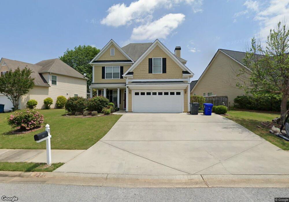
271 Turnbridge Cir Peachtree City, GA 30269
Estimated Value: $474,842 - $516,000
4
Beds
3
Baths
2,014
Sq Ft
$245/Sq Ft
Est. Value
About This Home
This home is located at 271 Turnbridge Cir, Peachtree City, GA 30269 and is currently estimated at $493,461, approximately $245 per square foot. 271 Turnbridge Cir is a home located in Fayette County with nearby schools including Peachtree City Elementary School, Booth Middle School, and McIntosh High School.
Ownership History
Date
Name
Owned For
Owner Type
Purchase Details
Closed on
Aug 18, 2011
Sold by
Secretary Of Housing And U
Bought by
Jamched Krishna Mohan and Jamched Padmaja
Current Estimated Value
Purchase Details
Closed on
Oct 5, 2010
Sold by
Freedom Mtg Corp
Bought by
Hud-Housing Of Urban Dev
Purchase Details
Closed on
Oct 8, 2008
Sold by
Ravin Homes Inc
Bought by
Harrison Robin D
Home Financials for this Owner
Home Financials are based on the most recent Mortgage that was taken out on this home.
Original Mortgage
$230,138
Interest Rate
5.78%
Mortgage Type
FHA
Create a Home Valuation Report for This Property
The Home Valuation Report is an in-depth analysis detailing your home's value as well as a comparison with similar homes in the area
Home Values in the Area
Average Home Value in this Area
Purchase History
| Date | Buyer | Sale Price | Title Company |
|---|---|---|---|
| Jamched Krishna Mohan | $195,000 | -- | |
| Hud-Housing Of Urban Dev | -- | -- | |
| Harrison Robin D | $233,800 | -- |
Source: Public Records
Mortgage History
| Date | Status | Borrower | Loan Amount |
|---|---|---|---|
| Previous Owner | Harrison Robin D | $230,138 |
Source: Public Records
Tax History Compared to Growth
Tax History
| Year | Tax Paid | Tax Assessment Tax Assessment Total Assessment is a certain percentage of the fair market value that is determined by local assessors to be the total taxable value of land and additions on the property. | Land | Improvement |
|---|---|---|---|---|
| 2024 | $4,160 | $170,388 | $22,000 | $148,388 |
| 2023 | $3,515 | $153,080 | $22,000 | $131,080 |
| 2022 | $3,822 | $139,920 | $22,000 | $117,920 |
| 2021 | $3,585 | $120,080 | $22,000 | $98,080 |
| 2020 | $3,676 | $120,360 | $22,000 | $98,360 |
| 2019 | $3,567 | $115,720 | $22,000 | $93,720 |
| 2018 | $3,496 | $111,680 | $22,000 | $89,680 |
| 2017 | $3,577 | $113,480 | $22,000 | $91,480 |
| 2016 | $3,304 | $101,200 | $22,000 | $79,200 |
| 2015 | $3,218 | $97,040 | $19,600 | $77,440 |
| 2014 | $3,208 | $95,120 | $19,600 | $75,520 |
| 2013 | -- | $73,680 | $0 | $0 |
Source: Public Records
Map
Nearby Homes
- 147 Westberry St
- 405 Abbey Rd
- 719 Gittings Ave
- 138 Wynnmeade Pkwy
- 412 Constitution Cir
- 124 Kings Ridge Dr
- 111 S Fairfield Dr
- 169 Wynnmeade Pkwy
- 713 S Fairfield Dr
- 171 Wynnmeade Pkwy
- 505 N Fairfield Dr
- 64 Star Spangled Ln
- 826 Richmond Cir
- 22 Star Spangled Ln
- 405 Sherrels Ford
- 844 Richmond Cir Unit 7
- 637 N Fairfield Dr
- 327 Walnut Grove Rd
- 308 Bandon Way
- 101 Eadestowne Way
- 269 Turnbridge Cir
- 273 Turnbridge Cir
- 119 Saint Albans Way
- 119 St Albans Way
- 267 Turnbridge Cir
- 298 Turnbridge Cir
- 0 Saint Albans Way Unit 8721610
- 0 Saint Albans Way Unit 8536923
- 0 Saint Albans Way Unit 8052114
- 0 Saint Albans Way Unit 8281906
- 0 Saint Albans Way Unit 8244480
- 0 Saint Albans Way Unit 8654294
- 0 Saint Albans Way Unit 8776378
- 0 Saint Albans Way Unit 8677943
- 0 Saint Albans Way Unit 8660388
- 0 Saint Albans Way Unit 8563463
- 0 Saint Albans Way Unit 8400855
- 0 Saint Albans Way Unit 8387678
- 0 Saint Albans Way Unit 8134607
- 0 Saint Albans Way Unit 8125400