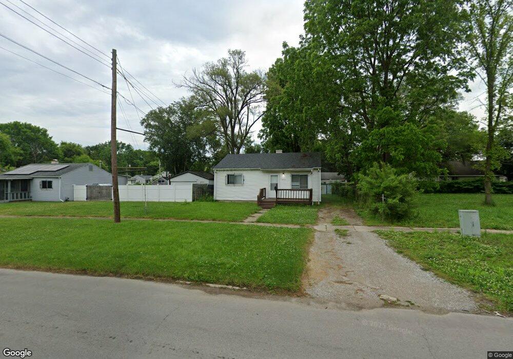
2710 Branch Rd Flint, MI 48506
Potter Longway NeighborhoodEstimated Value: $35,000 - $56,508
2
Beds
1
Bath
720
Sq Ft
$68/Sq Ft
Est. Value
About This Home
This home is located at 2710 Branch Rd, Flint, MI 48506 and is currently estimated at $48,877, approximately $67 per square foot. 2710 Branch Rd is a home located in Genesee County with nearby schools including Potter School, Richfield Public School Academy, and Richfield Early Learning Center.
Ownership History
Date
Name
Owned For
Owner Type
Purchase Details
Closed on
Sep 26, 2017
Sold by
Sharps Baker Kim
Bought by
Tryad Llc
Current Estimated Value
Purchase Details
Closed on
Nov 26, 2012
Sold by
Boston Enterprises Llc
Bought by
Tryad Llc
Purchase Details
Closed on
Jul 23, 2012
Sold by
Sharps Baker Kim
Bought by
Boston Enterprises Llc
Purchase Details
Closed on
Feb 2, 2009
Sold by
Sharps Kim Marie and Hecko Earl C
Bought by
Sharps Kim Marie
Purchase Details
Closed on
Apr 2, 2008
Sold by
Sharps Kim Marie and Hecko Leona M
Bought by
Sharps Kim Marie and Hecko Earl C
Create a Home Valuation Report for This Property
The Home Valuation Report is an in-depth analysis detailing your home's value as well as a comparison with similar homes in the area
Home Values in the Area
Average Home Value in this Area
Purchase History
| Date | Buyer | Sale Price | Title Company |
|---|---|---|---|
| Tryad Llc | -- | None Available | |
| Tryad Llc | -- | None Available | |
| Boston Enterprises Llc | -- | None Available | |
| Sharps Kim Marie | -- | None Available | |
| Sharps Kim Marie | -- | Cislo Title Company |
Source: Public Records
Tax History Compared to Growth
Tax History
| Year | Tax Paid | Tax Assessment Tax Assessment Total Assessment is a certain percentage of the fair market value that is determined by local assessors to be the total taxable value of land and additions on the property. | Land | Improvement |
|---|---|---|---|---|
| 2025 | $1,218 | $18,000 | $0 | $0 |
| 2024 | $1,127 | $16,700 | $0 | $0 |
| 2023 | $1,100 | $12,700 | $0 | $0 |
| 2022 | $0 | $10,100 | $0 | $0 |
| 2021 | $689 | $9,500 | $0 | $0 |
| 2020 | $644 | $8,100 | $0 | $0 |
| 2019 | $636 | $6,000 | $0 | $0 |
| 2018 | $605 | $5,500 | $0 | $0 |
| 2017 | $702 | $0 | $0 | $0 |
| 2016 | $698 | $0 | $0 | $0 |
| 2015 | -- | $0 | $0 | $0 |
| 2014 | -- | $0 | $0 | $0 |
| 2012 | -- | $9,400 | $0 | $0 |
Source: Public Records
Map
Nearby Homes
- 2719 Branch Rd
- 3116 Beechwood Ave
- 3214 Maryland Ave
- 3149 Whittier Ave
- 3205 Holly Ave
- 3010 Wyoming Ave
- 2426 Hoff St
- 2211 Torrance St
- 3602 Dakota Ave
- 3232 Dale Ave
- 3514 Whittier Ave
- 3226 Mcclure Ave
- 3713 Risedorph Ave
- 3702 Branch Rd
- 3401 Davison Rd
- 3710 Branch Rd
- 3617 Churchill Ave
- 3809 Delaware Ave
- 2506 Arlington Ave
- 3617 Davison Rd
- 2714 Branch Rd
- 3109 Delaware Ave
- 2718 Branch Rd
- 3112 Maryland Ave
- 3111 Delaware Ave
- 3116 Maryland Ave
- 3120 Maryland Ave
- 2715 Branch Rd
- 3103 Maryland Ave
- 2620 Branch Rd
- 3124 Maryland Ave
- 3111 Maryland Ave
- 3116 Delaware Ave
- 2808 Branch Rd
- 3115 Maryland Ave
- 3128 Maryland Ave
- 3127 Delaware Ave
- 3123 Delaware Ave
- 3020 Maryland Ave
- 2801 Branch Rd