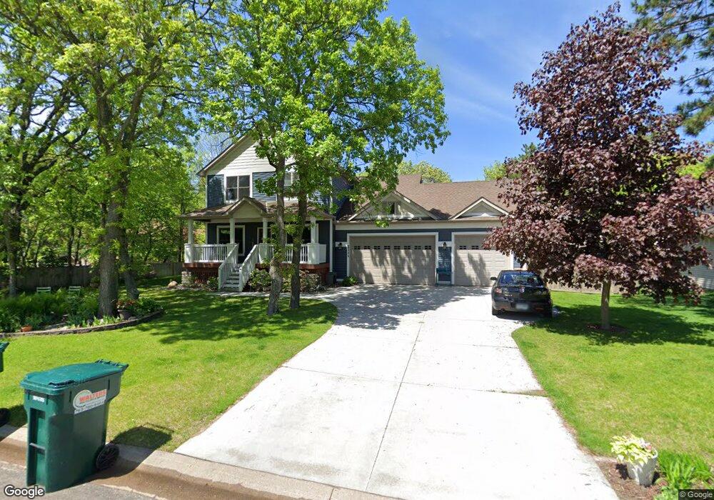
2711 92nd Ln NE Minneapolis, MN 55449
Estimated Value: $529,000 - $587,000
4
Beds
4
Baths
2,082
Sq Ft
$264/Sq Ft
Est. Value
About This Home
This home is located at 2711 92nd Ln NE, Minneapolis, MN 55449 and is currently estimated at $549,559, approximately $263 per square foot. 2711 92nd Ln NE is a home located in Anoka County with nearby schools including Northpoint Elementary School, Westwood Intermediate and Middle School, and Avail Academy - Blaine Campus.
Ownership History
Date
Name
Owned For
Owner Type
Purchase Details
Closed on
Nov 3, 2008
Sold by
Fort Snelling Fcu
Bought by
Rieke Peter G and Rieke Elise
Current Estimated Value
Home Financials for this Owner
Home Financials are based on the most recent Mortgage that was taken out on this home.
Original Mortgage
$295,075
Outstanding Balance
$190,508
Interest Rate
5.75%
Mortgage Type
FHA
Estimated Equity
$359,051
Create a Home Valuation Report for This Property
The Home Valuation Report is an in-depth analysis detailing your home's value as well as a comparison with similar homes in the area
Home Values in the Area
Average Home Value in this Area
Purchase History
| Date | Buyer | Sale Price | Title Company |
|---|---|---|---|
| Rieke Peter G | $310,000 | -- |
Source: Public Records
Mortgage History
| Date | Status | Borrower | Loan Amount |
|---|---|---|---|
| Open | Rieke Peter G | $295,075 |
Source: Public Records
Tax History Compared to Growth
Tax History
| Year | Tax Paid | Tax Assessment Tax Assessment Total Assessment is a certain percentage of the fair market value that is determined by local assessors to be the total taxable value of land and additions on the property. | Land | Improvement |
|---|---|---|---|---|
| 2025 | $5,946 | $545,800 | $110,000 | $435,800 |
| 2024 | $5,946 | $528,800 | $108,200 | $420,600 |
| 2023 | $5,225 | $518,700 | $103,000 | $415,700 |
| 2022 | $5,006 | $514,400 | $90,000 | $424,400 |
| 2021 | $4,900 | $427,900 | $75,000 | $352,900 |
| 2020 | $5,105 | $408,400 | $75,000 | $333,400 |
| 2019 | $4,806 | $405,600 | $67,000 | $338,600 |
| 2018 | $4,949 | $373,500 | $0 | $0 |
| 2017 | $4,632 | $372,700 | $0 | $0 |
| 2016 | $4,578 | $335,400 | $0 | $0 |
| 2015 | -- | $335,400 | $64,700 | $270,700 |
| 2014 | -- | $286,400 | $52,000 | $234,400 |
Source: Public Records
Map
Nearby Homes
- 2715 90th Ln NE
- 9459 Jamestown St NE
- 3320 92nd Dr NE
- 8843 Naples St NE
- 8504 Edison St NE
- 1730 93rd Ln NE
- 8795 Hastings Cir NE
- 8805 Hastings Cir NE
- 8724 Hastings Cir NE
- 8612 Kenyon Ct NE Unit B
- 8460 Fairchild Ave
- 2743 103rd Ct NE
- 2556 Ardan Ave
- 2649 Ardan Ave
- 3881 Oak Ln NE
- 3811 Restwood Rd
- 1524 89th Ave NE
- 5931 Prairie Ridge Dr Unit 267
- 10590 Alamo St NE
- 7943 Greenfield Ave
- XXX 92nd Ln NE
- 2721 92nd Ln NE
- 2690 93rd Ave NE
- 2710 2710 93rd-Avenue-ne
- 2710 93rd Ave NE
- 9194 Zumbrota St NE
- 9187 Zumbrota St NE
- 2680 93rd Ave NE
- 2729 92nd Ln NE
- 9186 Zumbrota St NE
- 2730 93rd Ave NE
- 9186 Zumbrota St NE
- 9188 Alamo St NE
- 9179 Zumbrota St NE
- 9182 Zumbrota St NE
- 9182 Zumbrota St NE
- 9261 Yancy St NE
- 9180 Alamo St NE
- 9197 Yancy St NE
- 2711 93rd Ave NE