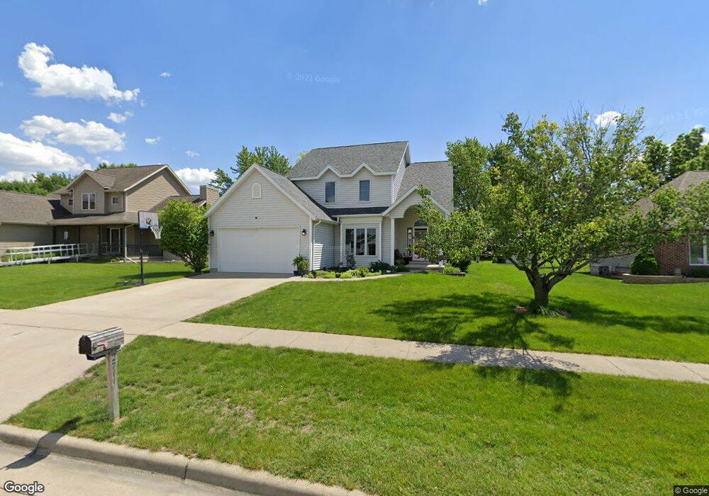
2711 Ashwood Ln Fort Dodge, IA 50501
Estimated Value: $315,668 - $363,000
4
Beds
4
Baths
1,833
Sq Ft
$184/Sq Ft
Est. Value
About This Home
This home is located at 2711 Ashwood Ln, Fort Dodge, IA 50501 and is currently estimated at $337,667, approximately $184 per square foot. 2711 Ashwood Ln is a home located in Webster County with nearby schools including Cooper Elementary School, Fort Dodge Middle School, and Fort Dodge Senior High School.
Ownership History
Date
Name
Owned For
Owner Type
Purchase Details
Closed on
Feb 3, 2010
Sold by
Hamison John R and Jamison Kim A
Bought by
Hansen Jason M
Current Estimated Value
Home Financials for this Owner
Home Financials are based on the most recent Mortgage that was taken out on this home.
Original Mortgage
$174,600
Outstanding Balance
$116,017
Interest Rate
5.11%
Mortgage Type
New Conventional
Estimated Equity
$221,650
Create a Home Valuation Report for This Property
The Home Valuation Report is an in-depth analysis detailing your home's value as well as a comparison with similar homes in the area
Home Values in the Area
Average Home Value in this Area
Purchase History
| Date | Buyer | Sale Price | Title Company |
|---|---|---|---|
| Hansen Jason M | $180,000 | None Available |
Source: Public Records
Mortgage History
| Date | Status | Borrower | Loan Amount |
|---|---|---|---|
| Open | Hansen Jason M | $174,600 |
Source: Public Records
Tax History Compared to Growth
Tax History
| Year | Tax Paid | Tax Assessment Tax Assessment Total Assessment is a certain percentage of the fair market value that is determined by local assessors to be the total taxable value of land and additions on the property. | Land | Improvement |
|---|---|---|---|---|
| 2025 | $6,606 | $330,370 | $38,000 | $292,370 |
| 2024 | $6,606 | $316,050 | $38,000 | $278,050 |
| 2023 | $6,620 | $316,050 | $38,000 | $278,050 |
| 2022 | $6,410 | $279,570 | $38,000 | $241,570 |
| 2021 | $6,252 | $279,570 | $38,000 | $241,570 |
| 2020 | $6,252 | $259,200 | $38,000 | $221,200 |
| 2019 | $5,770 | $259,710 | $39,600 | $220,110 |
| 2018 | $5,686 | $236,100 | $36,000 | $200,100 |
| 2017 | $5,686 | $214,910 | $0 | $0 |
| 2016 | $5,176 | $214,910 | $0 | $0 |
| 2015 | $5,176 | $214,910 | $0 | $0 |
| 2014 | $5,070 | $214,910 | $0 | $0 |
Source: Public Records
Map
Nearby Homes
- 2511 Hickory Cir
- 2526 Hickory Cir
- 2954 22nd Ave N
- 2914 20th Ave N
- 1914 N 28th St
- 2915 20th Ave N
- 2223 19th Ave N
- 1611 N 27th St
- 1622 N 25th St
- 1617 N 25th St
- 1604 N 27th St
- 2407 16th Ave N
- 1751 Jonathan Dr
- 2717 15th Ave N
- 1516 Timberlane
- 1607 N 22nd St
- 1518 N 22nd St
- 1650 Jonathan Dr
- 1122 Cooper Dr
- 1229 N 29th St
- 2717 Ashwood Ln
- 2705 Ashwood Ln
- 2723 Ashwood Ln
- 2750 25th Ave N
- 2646 25th Ave N
- 2638 25th Ave N
- 2712 Ashwood Ln
- 2718 Ashwood Ln
- 2609 N 27th St
- 2724 Ashwood Ln
- 2518 27th St
- 2729 Ashwood Ln
- 2524 27th St
- 2606 27th St
- 2770 25th Ave N
- 2540 25th Ave N
- 2711 27th Ave N
- 2730 Ashwood Ln
- 2717 27th Ave N
- 2612 N 27th St