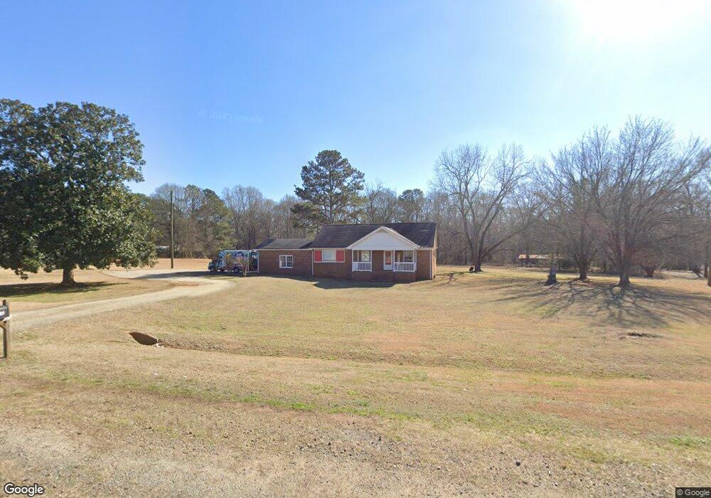
2711 Monroe Hwy Bogart, GA 30622
Estimated Value: $312,000 - $388,684
--
Bed
--
Bath
--
Sq Ft
3.11
Acres
About This Home
This home is located at 2711 Monroe Hwy, Bogart, GA 30622 and is currently estimated at $353,171. 2711 Monroe Hwy is a home located in Oconee County with nearby schools including Rocky Branch Elementary School, Malcom Bridge Middle School, and North Oconee High School.
Ownership History
Date
Name
Owned For
Owner Type
Purchase Details
Closed on
Jan 26, 2015
Sold by
Roach Charles Terry
Bought by
J L Baker Building Inc
Current Estimated Value
Home Financials for this Owner
Home Financials are based on the most recent Mortgage that was taken out on this home.
Original Mortgage
$101,192
Interest Rate
3.9%
Mortgage Type
New Conventional
Purchase Details
Closed on
Feb 26, 1996
Bought by
Roach Charles Terry
Create a Home Valuation Report for This Property
The Home Valuation Report is an in-depth analysis detailing your home's value as well as a comparison with similar homes in the area
Home Values in the Area
Average Home Value in this Area
Purchase History
| Date | Buyer | Sale Price | Title Company |
|---|---|---|---|
| J L Baker Building Inc | $135,000 | -- | |
| Roach Charles Terry | $79,000 | -- |
Source: Public Records
Mortgage History
| Date | Status | Borrower | Loan Amount |
|---|---|---|---|
| Closed | J L Baker Building Inc | $101,192 |
Source: Public Records
Tax History Compared to Growth
Tax History
| Year | Tax Paid | Tax Assessment Tax Assessment Total Assessment is a certain percentage of the fair market value that is determined by local assessors to be the total taxable value of land and additions on the property. | Land | Improvement |
|---|---|---|---|---|
| 2024 | $2,568 | $131,087 | $59,946 | $71,141 |
| 2023 | $2,449 | $122,156 | $55,506 | $66,650 |
| 2022 | $2,167 | $100,994 | $44,405 | $56,589 |
| 2021 | $2,107 | $90,996 | $40,368 | $50,628 |
| 2020 | $1,944 | $83,852 | $36,698 | $47,154 |
| 2019 | $1,801 | $77,685 | $31,911 | $45,774 |
| 2018 | $1,622 | $68,483 | $29,010 | $39,473 |
| 2017 | $1,417 | $59,839 | $24,175 | $35,664 |
| 2016 | $1,242 | $52,440 | $21,978 | $30,462 |
| 2015 | $1,324 | $55,777 | $26,015 | $29,762 |
| 2014 | $1,266 | $52,146 | $23,650 | $28,496 |
| 2013 | -- | $50,828 | $23,654 | $27,173 |
Source: Public Records
Map
Nearby Homes
- 1010 Garland Dr
- 0 Monroe Hwy Unit 1025452
- 6601 Hog Mountain Hwy - Hwy 53 Unit PARCEL B
- 0 Whitehead Rd Unit CL335631
- 0 Whitehead Rd Unit 10574962
- 1640 Madison Ct
- 2479 Eisenhower Ave
- 1665 Eisenhower Ave
- 3377 Clayton Dr
- 3451 Clayton Dr
- 1216 Ray's River Run
- 0 Us 78 Hwy
- 1 Us 78 Hwy
- 3164 Malcom Estates Dr
- 1021 Bedford Trail
- 2130 Keeneland Dr
- 2130 Keeneland Dr
- 1020 Timber Ridge Rd
- 0 Ruth Jackson Rd Unit 10582108
- 00 Ruth Jackson Rd
- 2691 Monroe Hwy
- 1001 Ruth Jackson Rd
- 2780 Monroe Hwy
- 2591 Clotfelter Rd
- 2581 Clotfelter Rd
- 2781 Monroe Hwy
- 2781 Monroe Hwy
- 2770 Monroe Hwy
- 1060 Ruth Jackson Rd
- 2820 Monroe Hwy
- 189 Bear Club Way
- 2881 Monroe Hwy Unit 501
- 1100 Ruth Jackson Rd
- 2760 Avalon Dr
- 1190 Avalon Cir
- 1270 Avalon Cir Unit 16
- 1270 Avalon Cir
- 1930 New Jimmie Daniel Rd
- 1140 Avalon Cir Unit 14A
- 1140 Avalon Cir