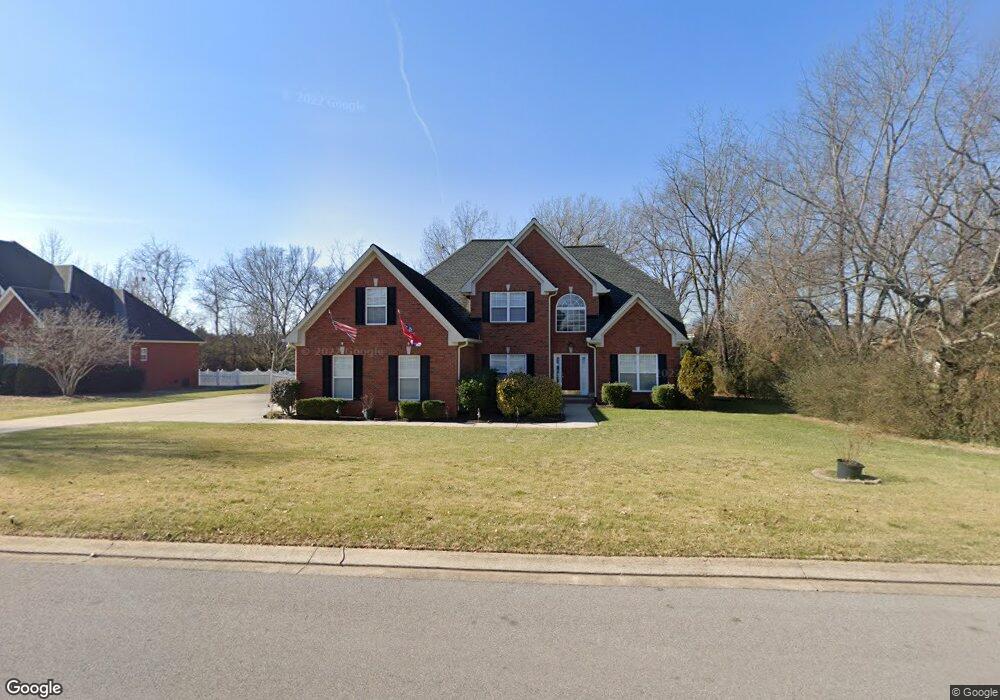
2711 Ormond St Murfreesboro, TN 37130
Estimated Value: $556,284 - $669,000
Studio
4
Baths
3,058
Sq Ft
$201/Sq Ft
Est. Value
About This Home
This home is located at 2711 Ormond St, Murfreesboro, TN 37130 and is currently estimated at $614,071, approximately $200 per square foot. 2711 Ormond St is a home located in Rutherford County with nearby schools including John Pittard Elementary School, Oakland Middle School, and Oakland High School.
Ownership History
Date
Name
Owned For
Owner Type
Purchase Details
Closed on
May 14, 2024
Sold by
Carpenetti Ben W and Carpenetti Anna L
Bought by
Accept Trust and Carpenetti
Current Estimated Value
Purchase Details
Closed on
Jun 9, 2004
Sold by
Erner John G and Erner Robin
Bought by
Carpenetti Ben W and Carpenetti Anna L
Home Financials for this Owner
Home Financials are based on the most recent Mortgage that was taken out on this home.
Original Mortgage
$216,000
Interest Rate
6.09%
Create a Home Valuation Report for This Property
The Home Valuation Report is an in-depth analysis detailing your home's value as well as a comparison with similar homes in the area
Home Values in the Area
Average Home Value in this Area
Purchase History
| Date | Buyer | Sale Price | Title Company |
|---|---|---|---|
| Accept Trust | -- | None Listed On Document | |
| Accept Trust | -- | None Listed On Document | |
| Carpenetti Ben W | $270,000 | -- |
Source: Public Records
Mortgage History
| Date | Status | Borrower | Loan Amount |
|---|---|---|---|
| Previous Owner | Carpenetti Ben W | $216,000 |
Source: Public Records
Tax History
| Year | Tax Paid | Tax Assessment Tax Assessment Total Assessment is a certain percentage of the fair market value that is determined by local assessors to be the total taxable value of land and additions on the property. | Land | Improvement |
|---|---|---|---|---|
| 2025 | $3,258 | $115,175 | $15,625 | $99,550 |
| 2024 | $3,258 | $115,175 | $15,625 | $99,550 |
| 2023 | $2,161 | $115,175 | $15,625 | $99,550 |
| 2022 | $1,861 | $115,175 | $15,625 | $99,550 |
| 2021 | $1,783 | $80,350 | $15,625 | $64,725 |
| 2020 | $1,783 | $80,350 | $15,625 | $64,725 |
| 2019 | $1,783 | $80,350 | $15,625 | $64,725 |
| 2018 | $2,450 | $80,350 | $0 | $0 |
| 2017 | $2,700 | $69,475 | $0 | $0 |
| 2016 | $2,700 | $69,475 | $0 | $0 |
| 2015 | $2,700 | $69,475 | $0 | $0 |
| 2014 | $1,728 | $69,475 | $0 | $0 |
| 2013 | -- | $69,475 | $0 | $0 |
Source: Public Records
Map
Nearby Homes
- 1180 Ithaca St
- 1021 Shoreham St
- 2904 Pomoa Place
- 710 Fenwick Close
- 1005 Ithaca St
- 2403 Franklin Ln
- 2418 Taylor Close
- 707 Bradford Place
- 2308 Alexander Blvd
- 718 Dallas Ct
- 2422 English Hill Dr
- 2403 English Hill Dr
- 2292 Alexander Blvd
- 3202 Folcroft Dr
- 2719 Rocking Horse Ln
- 1518 Anatole Ct
- 2926 Roellen Rd
- 3207 Livermore Ln
- 2722 Crowne Pointe Dr
- 1151 Osborne Ln
- 2707 Ormond St
- 1154 Bayard Ave
- 1150 Bayard Ave
- 2708 Ormond St
- 2703 Ormond St
- 1146 Bayard Ave
- 1164 Bayard Ave
- 1162 Gaylord Ct
- 1142 Bayard Ave
- 1165 Gaylord Ct
- 1168 Bayard Ave
- 1153 Bayard Ave
- 1166 Gaylord Ct
- 1149 Bayard Ave
- 1138 Bayard Ave
- 2718 Ormond St
- 1169 Gaylord Ct
- 1145 Bayard Ave
- 1172 Bayard Ave
- 1170 Gaylord Ct
Your Personal Tour Guide
Ask me questions while you tour the home.