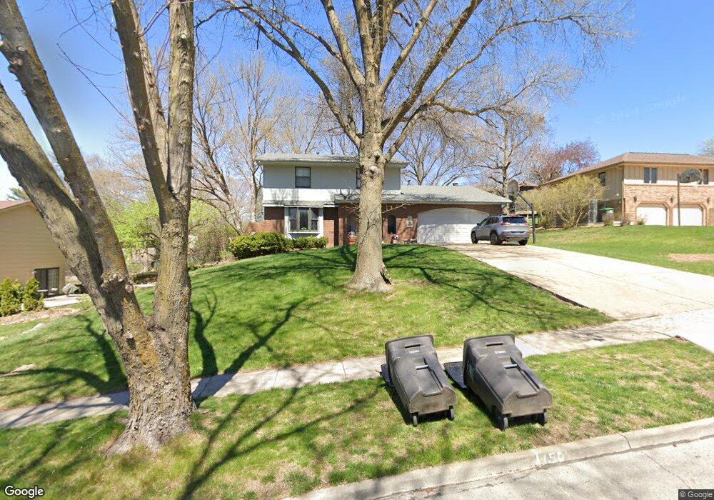
2711 Thornton Ave Des Moines, IA 50321
Southwestern Hills NeighborhoodEstimated Value: $350,000 - $455,000
4
Beds
3
Baths
1,872
Sq Ft
$204/Sq Ft
Est. Value
About This Home
This home is located at 2711 Thornton Ave, Des Moines, IA 50321 and is currently estimated at $381,482, approximately $203 per square foot. 2711 Thornton Ave is a home located in Polk County with nearby schools including Jefferson Elementary School, Brody Middle School, and Lincoln High School.
Ownership History
Date
Name
Owned For
Owner Type
Purchase Details
Closed on
Nov 30, 2004
Sold by
Harrison D Scott and Harrison Penelope A
Bought by
Campero Santos and Campero Tanya D
Current Estimated Value
Home Financials for this Owner
Home Financials are based on the most recent Mortgage that was taken out on this home.
Original Mortgage
$157,600
Outstanding Balance
$78,280
Interest Rate
5.71%
Mortgage Type
Purchase Money Mortgage
Estimated Equity
$303,202
Purchase Details
Closed on
Jul 20, 1999
Sold by
Bohlig Paul M and Aten Margaret W
Bought by
Harrison D Scott and Harrison Penelope A
Home Financials for this Owner
Home Financials are based on the most recent Mortgage that was taken out on this home.
Original Mortgage
$111,000
Interest Rate
7.54%
Create a Home Valuation Report for This Property
The Home Valuation Report is an in-depth analysis detailing your home's value as well as a comparison with similar homes in the area
Home Values in the Area
Average Home Value in this Area
Purchase History
| Date | Buyer | Sale Price | Title Company |
|---|---|---|---|
| Campero Santos | $196,500 | -- | |
| Harrison D Scott | $140,000 | -- |
Source: Public Records
Mortgage History
| Date | Status | Borrower | Loan Amount |
|---|---|---|---|
| Open | Campero Santos | $157,600 | |
| Previous Owner | Harrison D Scott | $111,000 |
Source: Public Records
Tax History Compared to Growth
Tax History
| Year | Tax Paid | Tax Assessment Tax Assessment Total Assessment is a certain percentage of the fair market value that is determined by local assessors to be the total taxable value of land and additions on the property. | Land | Improvement |
|---|---|---|---|---|
| 2025 | $6,280 | $334,800 | $58,500 | $276,300 |
| 2024 | $6,280 | $319,200 | $55,000 | $264,200 |
| 2023 | $5,874 | $319,200 | $55,000 | $264,200 |
| 2022 | $5,828 | $249,200 | $44,200 | $205,000 |
| 2021 | $5,836 | $249,200 | $44,200 | $205,000 |
| 2020 | $6,064 | $233,900 | $41,800 | $192,100 |
| 2019 | $5,580 | $233,900 | $41,800 | $192,100 |
| 2018 | $5,522 | $207,600 | $36,300 | $171,300 |
| 2017 | $5,042 | $207,600 | $36,300 | $171,300 |
| 2016 | $4,912 | $186,400 | $32,100 | $154,300 |
| 2015 | $4,912 | $186,400 | $32,100 | $154,300 |
| 2014 | $4,712 | $184,000 | $31,200 | $152,800 |
Source: Public Records
Map
Nearby Homes
- 3500 SW 28th St
- 2614 Caulder Ave
- 5815 Rose Cir
- 5821 Rose Cir
- 5817 Rose Cir
- 5822 Rose Cir
- 5813 Rose Cir
- 2900 Caulder Ave
- 2802 Park Ave
- 4440 SW 23rd St
- 3407 SW 31st St
- 3921 SW 29th St
- 3212 Wauwatosa Dr
- 3901 Wakonda Dr
- 2209 Park Ave
- 3200 Park Ave
- 3131 Fleur Dr Unit 206 & 208
- 1914 Park Ave
- 2822 Cheyenne Cir
- 3619 SW 34th St
- 2701 Thornton Ave
- 2717 Thornton Ave
- 3525 SW 28th St
- 3516 SW 27th St
- 2611 Thornton Ave
- 3521 SW 28th St
- 2626 Thornton Ave
- 3515 SW 28th St
- 2601 Thornton Ave
- 2612 Thornton Ave
- 3510 SW 27th St
- 3515 SW 27th St
- 2700 Thornton Ave
- 2600 Thornton Ave
- 2708 Thornton Ave
- 3524 SW 28th St
- 3530 SW 28th St
- 2712 Thornton Ave
- 3511 SW 28th St
- 3516 SW 28th St