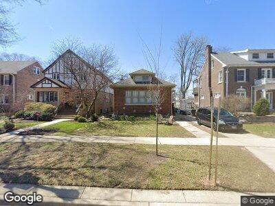
2712 Asbury Ave Evanston, IL 60201
Estimated Value: $587,000 - $759,000
4
Beds
2
Baths
1,419
Sq Ft
$490/Sq Ft
Est. Value
About This Home
This home is located at 2712 Asbury Ave, Evanston, IL 60201 and is currently estimated at $694,640, approximately $489 per square foot. 2712 Asbury Ave is a home located in Cook County with nearby schools including Orrington Elementary School, Haven Middle School, and Evanston Township High School.
Ownership History
Date
Name
Owned For
Owner Type
Purchase Details
Closed on
Jul 15, 2021
Sold by
Deutsche Bank National Trust Company
Bought by
Melonides John S
Current Estimated Value
Purchase Details
Closed on
Oct 5, 1995
Sold by
Schmidt Helen Brown
Bought by
Melonides John S and Melonides Kiki
Home Financials for this Owner
Home Financials are based on the most recent Mortgage that was taken out on this home.
Original Mortgage
$196,000
Interest Rate
7.41%
Create a Home Valuation Report for This Property
The Home Valuation Report is an in-depth analysis detailing your home's value as well as a comparison with similar homes in the area
Home Values in the Area
Average Home Value in this Area
Purchase History
| Date | Buyer | Sale Price | Title Company |
|---|---|---|---|
| Melonides John S | -- | Attorney | |
| Melonides John S | $207,000 | -- |
Source: Public Records
Mortgage History
| Date | Status | Borrower | Loan Amount |
|---|---|---|---|
| Previous Owner | Melonides John S | $430,000 | |
| Previous Owner | Melonides John S | $150,000 | |
| Previous Owner | Cenedella Stephen H | $162,500 | |
| Previous Owner | Melonides John S | $196,000 |
Source: Public Records
Tax History Compared to Growth
Tax History
| Year | Tax Paid | Tax Assessment Tax Assessment Total Assessment is a certain percentage of the fair market value that is determined by local assessors to be the total taxable value of land and additions on the property. | Land | Improvement |
|---|---|---|---|---|
| 2024 | $10,121 | $46,994 | $12,938 | $34,056 |
| 2023 | $10,121 | $46,994 | $12,938 | $34,056 |
| 2022 | $10,121 | $46,994 | $12,938 | $34,056 |
| 2021 | $9,995 | $40,993 | $8,437 | $32,556 |
| 2020 | $10,544 | $43,373 | $8,437 | $34,936 |
| 2019 | $11,490 | $52,469 | $8,437 | $44,032 |
| 2018 | $9,934 | $39,696 | $7,031 | $32,665 |
| 2017 | $9,691 | $39,696 | $7,031 | $32,665 |
| 2016 | $10,559 | $44,222 | $7,031 | $37,191 |
| 2015 | $8,623 | $34,783 | $5,906 | $28,877 |
| 2014 | $9,402 | $37,970 | $5,906 | $32,064 |
| 2013 | $9,170 | $37,970 | $5,906 | $32,064 |
Source: Public Records
Map
Nearby Homes
- 250 3rd St
- 1210 Central St Unit 2
- 1214 Central St Unit 2N
- 203 5th St
- 1319 Lincoln St
- 1404 Lincoln St
- 824 Ingleside Place
- 2635 Poplar Ave
- 736 Central St
- 320 Linden Ave
- 721 Central St
- 511 Linden Ave
- 515 Linden Ave
- 2761 Woodbine Ave
- 221 Greenleaf Ave
- 1821 Lincoln St
- 2245 Wesley Ave
- 810 Lincoln St
- 2459 Prairie Ave Unit 2F
- 109 Woodbine Ave
- 2712 Asbury Ave
- 2708 Asbury Ave
- 2716 Asbury Ave
- 2706 Asbury Ave
- 2718 Asbury Ave
- 1311 Livingston St
- 2700 Asbury Ave
- 2728 Asbury Ave
- 1314 Jenks St
- 1317 Livingston St
- 2734 Asbury Ave
- 1316 Jenks St
- 2715 Asbury Ave
- 2719 Asbury Ave
- 2711 Asbury Ave
- 2721 Asbury Ave
- 2723 Asbury Ave
- 2707 Asbury Ave
- 1320 Jenks St
- 2727 Asbury Ave