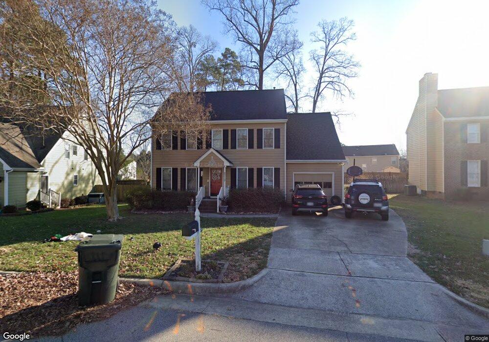
2712 Dalford Ct Raleigh, NC 27604
Northeast Raleigh NeighborhoodEstimated Value: $404,000 - $452,000
4
Beds
4
Baths
2,403
Sq Ft
$178/Sq Ft
Est. Value
About This Home
This home is located at 2712 Dalford Ct, Raleigh, NC 27604 and is currently estimated at $428,503, approximately $178 per square foot. 2712 Dalford Ct is a home located in Wake County with nearby schools including Wilburn Elementary, Durant Road Middle, and Millbrook High School.
Ownership History
Date
Name
Owned For
Owner Type
Purchase Details
Closed on
Feb 28, 2007
Sold by
Allen Michael K and Allen Paula F
Bought by
Pizzino Jason A and Pizzino Kelly C
Current Estimated Value
Home Financials for this Owner
Home Financials are based on the most recent Mortgage that was taken out on this home.
Original Mortgage
$140,250
Outstanding Balance
$84,426
Interest Rate
6.16%
Mortgage Type
Purchase Money Mortgage
Estimated Equity
$344,077
Purchase Details
Closed on
Nov 21, 2003
Sold by
Street Suzanne M and Street Fred
Bought by
Laprade Daniel and Laprade Teressa
Home Financials for this Owner
Home Financials are based on the most recent Mortgage that was taken out on this home.
Original Mortgage
$159,862
Interest Rate
5.93%
Mortgage Type
FHA
Create a Home Valuation Report for This Property
The Home Valuation Report is an in-depth analysis detailing your home's value as well as a comparison with similar homes in the area
Home Values in the Area
Average Home Value in this Area
Purchase History
| Date | Buyer | Sale Price | Title Company |
|---|---|---|---|
| Pizzino Jason A | $187,000 | None Available | |
| Laprade Daniel | $162,000 | -- |
Source: Public Records
Mortgage History
| Date | Status | Borrower | Loan Amount |
|---|---|---|---|
| Open | Pizzino Jason A | $140,250 | |
| Closed | Pizzino Jason A | $46,750 | |
| Previous Owner | Laprade Daniel | $159,862 |
Source: Public Records
Tax History Compared to Growth
Tax History
| Year | Tax Paid | Tax Assessment Tax Assessment Total Assessment is a certain percentage of the fair market value that is determined by local assessors to be the total taxable value of land and additions on the property. | Land | Improvement |
|---|---|---|---|---|
| 2025 | $3,572 | $407,276 | $85,000 | $322,276 |
| 2024 | $3,557 | $407,276 | $85,000 | $322,276 |
| 2023 | $2,819 | $256,816 | $45,000 | $211,816 |
| 2022 | $2,620 | $256,816 | $45,000 | $211,816 |
| 2021 | $2,519 | $256,816 | $45,000 | $211,816 |
| 2020 | $2,473 | $256,816 | $45,000 | $211,816 |
| 2019 | $2,264 | $193,655 | $38,000 | $155,655 |
| 2018 | $2,136 | $193,655 | $38,000 | $155,655 |
| 2017 | $2,035 | $193,655 | $38,000 | $155,655 |
| 2016 | $1,993 | $193,655 | $38,000 | $155,655 |
| 2015 | $2,010 | $192,136 | $38,000 | $154,136 |
| 2014 | $1,906 | $183,881 | $38,000 | $145,881 |
Source: Public Records
Map
Nearby Homes
- 4905 Knightsbridge Way
- 4913 Knightsbridge Way
- 2712 Kempsford Place
- 511 Edgecreek Ct
- 2704 Rockbridge Ct
- 5121 Amberfield Way
- 4309 Birmingham Way
- 4400 Knightsbridge Way
- 2509 Westham Place
- 2761 Andover Glen Rd
- 2737 Andover Glen Rd
- 2401 Laurel Valley Way
- 3017 Barnsley Ln
- 4948 Southern Magnolia Dr
- 2817 Roundleaf Ct
- 2301 Laurel Valley Way
- 4608 Dresden Village Dr
- 4109 Stonewall Dr
- 2037 Summer Shire Way
- 2848 Roundleaf Ct
- 2716 Dalford Ct
- 2708 Dalford Ct
- 3029 Bethwicke Ct
- 3025 Bethwicke Ct
- 3033 Bethwicke Ct
- 4728 Cooksbury Ct
- 3021 Bethwicke Ct
- 2704 Dalford Ct
- 4732 Cooksbury Ct
- 2717 Dalford Ct
- 3037 Bethwicke Ct
- 2709 Dalford Ct
- 3017 Bethwicke Ct
- 2721 Dalford Ct
- 3041 Bethwicke Ct
- 4736 Cooksbury Ct
- 3009 Bethwicke Ct
- 2700 Dalford Ct
- 4716 Cooksbury Ct
- 3045 Bethwicke Ct