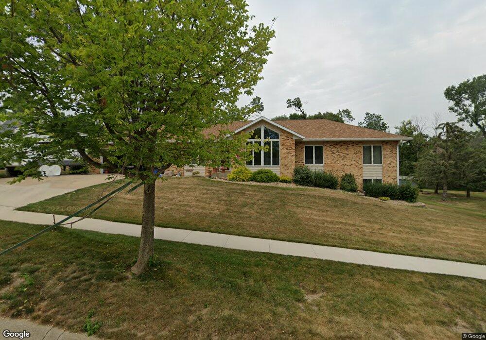
2712 Forest Ridge Ct SE Cedar Rapids, IA 52403
Estimated Value: $294,000 - $410,000
4
Beds
4
Baths
1,986
Sq Ft
$174/Sq Ft
Est. Value
About This Home
This home is located at 2712 Forest Ridge Ct SE, Cedar Rapids, IA 52403 and is currently estimated at $345,662, approximately $174 per square foot. 2712 Forest Ridge Ct SE is a home located in Linn County with nearby schools including Grant Wood Elementary School, McKinley STEAM Academy, and George Washington High School.
Ownership History
Date
Name
Owned For
Owner Type
Purchase Details
Closed on
Dec 6, 2021
Sold by
Takes Thomas G and Takes Mary L
Bought by
Takes Thomas G and Takes Mary L
Current Estimated Value
Purchase Details
Closed on
Mar 31, 2009
Sold by
Parker Brothers Company
Bought by
30Th St Dr Se Llc
Purchase Details
Closed on
Jun 30, 2005
Sold by
Pfeiler Donald H and Pfeiler Karen J
Bought by
Takes Thomas G and 1756 E Avenue Ne Llc
Home Financials for this Owner
Home Financials are based on the most recent Mortgage that was taken out on this home.
Original Mortgage
$220,000
Interest Rate
5.69%
Mortgage Type
Unknown
Create a Home Valuation Report for This Property
The Home Valuation Report is an in-depth analysis detailing your home's value as well as a comparison with similar homes in the area
Home Values in the Area
Average Home Value in this Area
Purchase History
| Date | Buyer | Sale Price | Title Company |
|---|---|---|---|
| Takes Thomas G | -- | None Available | |
| 30Th St Dr Se Llc | -- | None Available | |
| Takes Thomas G | $174,500 | -- |
Source: Public Records
Mortgage History
| Date | Status | Borrower | Loan Amount |
|---|---|---|---|
| Previous Owner | Takes Thomas G | $220,000 |
Source: Public Records
Tax History Compared to Growth
Tax History
| Year | Tax Paid | Tax Assessment Tax Assessment Total Assessment is a certain percentage of the fair market value that is determined by local assessors to be the total taxable value of land and additions on the property. | Land | Improvement |
|---|---|---|---|---|
| 2025 | $4,980 | $368,100 | $58,300 | $309,800 |
| 2024 | $6,038 | $319,500 | $58,300 | $261,200 |
| 2023 | $6,038 | $298,900 | $47,200 | $251,700 |
| 2022 | $5,928 | $295,100 | $47,200 | $247,900 |
| 2021 | $5,952 | $295,100 | $47,200 | $247,900 |
| 2020 | $5,952 | $278,400 | $36,100 | $242,300 |
| 2019 | $4,912 | $236,400 | $36,100 | $200,300 |
| 2018 | $4,772 | $236,400 | $36,100 | $200,300 |
| 2017 | $4,695 | $227,200 | $36,100 | $191,100 |
| 2016 | $4,695 | $220,900 | $36,100 | $184,800 |
| 2015 | $5,245 | $246,511 | $44,441 | $202,070 |
| 2014 | $5,060 | $246,511 | $44,441 | $202,070 |
| 2013 | $4,948 | $246,511 | $44,441 | $202,070 |
Source: Public Records
Map
Nearby Homes
- 1649 Memorial Dr SE
- 1524 Memorial Dr SE
- 1635 31st St SE
- 2861 Seely Ave SE
- 1521 Oak Ridge Ln SE Unit 3
- 1325 Hertz Dr SE
- 1158 28th St SE
- 3509 Pioneer Ave SE
- 1331 34th St SE
- 3535 Pioneer Ave SE
- 1325 36th St SE
- 1401 Harold Dr SE
- 2420 11th Ave SE
- 1333 Harold Dr SE
- 2700 Mount Vernon Rd SE
- 2315 11th Ave SE
- 2600 Mount Vernon Rd SE
- 700 Memorial Dr SE
- 705 Grant Wood Dr SE
- 1013 36th St SE
- 2706 Forest Ridge Ct SE
- 2716 Forest Ridge Ct SE
- 2715 Forest Ridge Ct SE
- 2705 Forest Ridge Ct SE
- 2704 Forest Ridge Ct SE
- 2720 Forest Ridge Ct SE
- 2721 Forest Ridge Ct SE
- 2703 Forest Ridge Ct SE
- 2700 Forest Ridge Ct SE
- 2724 Forest Ridge Ct SE
- 2701 Forest Ridge Ct SE
- 1758 Memorial Dr SE
- 1700 Memorial Dr SE
- 2728 Forest Ridge Ct SE
- 1719 Memorial Dr SE
- 1770 Memorial Dr SE
- 1701 Memorial Dr SE
- 1715 Memorial Dr SE
- 1800 Memorial Dr SE
- 1632 Memorial Dr SE