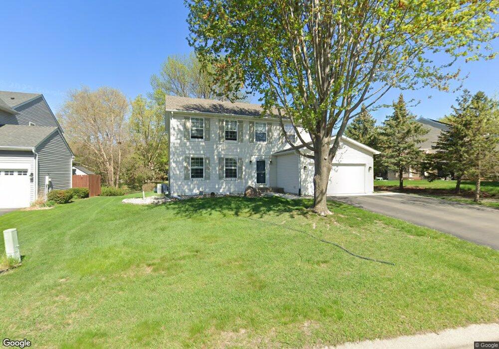
2712 Simons Dr Chaska, MN 55318
Estimated Value: $468,140 - $602,000
5
Beds
4
Baths
2,092
Sq Ft
$254/Sq Ft
Est. Value
About This Home
This home is located at 2712 Simons Dr, Chaska, MN 55318 and is currently estimated at $532,285, approximately $254 per square foot. 2712 Simons Dr is a home located in Carver County with nearby schools including Jonathan Elementary School, Chaska Middle School East, and Chaska High School.
Ownership History
Date
Name
Owned For
Owner Type
Purchase Details
Closed on
Sep 23, 2019
Sold by
Stark Dean R and Stark Terri S
Bought by
Stark Dean R and Stark Terri S
Current Estimated Value
Purchase Details
Closed on
Aug 20, 2004
Sold by
Vanepern Steve and Vanepern Anne K
Bought by
Stark Terri S
Purchase Details
Closed on
Aug 8, 2002
Sold by
Goltz Timothy J and Goltz Mary S
Bought by
Vanepern Steve and Vanepern Anne K
Purchase Details
Closed on
Jun 24, 1998
Sold by
Ryland Homes
Bought by
Goltz Timothy J and Goltz Mary S
Purchase Details
Closed on
Jan 15, 1995
Sold by
Chaska Investment Ltd Partnership
Bought by
The Ryland Group Inc
Create a Home Valuation Report for This Property
The Home Valuation Report is an in-depth analysis detailing your home's value as well as a comparison with similar homes in the area
Home Values in the Area
Average Home Value in this Area
Purchase History
| Date | Buyer | Sale Price | Title Company |
|---|---|---|---|
| Stark Dean R | -- | None Available | |
| Stark Terri S | $345,000 | -- | |
| Vanepern Steve | $277,000 | -- | |
| Goltz Timothy J | $195,390 | -- | |
| The Ryland Group Inc | $535,000 | -- |
Source: Public Records
Tax History
| Year | Tax Paid | Tax Assessment Tax Assessment Total Assessment is a certain percentage of the fair market value that is determined by local assessors to be the total taxable value of land and additions on the property. | Land | Improvement |
|---|---|---|---|---|
| 2025 | $5,250 | $456,100 | $120,000 | $336,100 |
| 2024 | $5,118 | $442,500 | $120,000 | $322,500 |
| 2023 | $5,058 | $436,100 | $120,000 | $316,100 |
| 2022 | $4,504 | $449,900 | $111,600 | $338,300 |
| 2021 | $4,188 | $350,300 | $93,000 | $257,300 |
| 2020 | $4,222 | $350,300 | $93,000 | $257,300 |
| 2019 | $4,142 | $329,800 | $88,500 | $241,300 |
| 2018 | $4,048 | $329,800 | $88,500 | $241,300 |
| 2017 | $3,788 | $319,700 | $80,500 | $239,200 |
| 2016 | $4,130 | $297,800 | $0 | $0 |
| 2015 | $3,678 | $280,700 | $0 | $0 |
| 2014 | $3,678 | $252,800 | $0 | $0 |
Source: Public Records
Map
Nearby Homes
- 2890 Autumn Woods Dr
- 2888 Forest Ridge
- 2658 Shadow Ln
- 9580 Madison Dr Unit 4
- 9575 Jefferson Dr Unit 1
- 9620 Washington Blvd Unit 1
- 1840 Freedom Ln Unit 104
- 1846 Plymouth Ln Unit 101
- 1953 Commonwealth Blvd Unit 3
- 1949 Commonwealth Blvd Unit 2
- 1968 Lincoln Ln
- 1157 Ridge Bluff Ct
- 9534 Roosevelt Dr
- 2338 Manuela Dr
- 3 Birdie Ln
- 319 Wilderness Dr Unit 22
- 2 Hazeltine Estates
- 1460 Jersey Way
- 1570 Avienda Ln
- 1500 Avienda Pkwy
- 2706 Simons Dr
- 2718 Simons Dr
- 2742 Autumn Woods Dr
- 2724 Simons Dr
- 2717 Simons Dr
- 2725 Simons Dr
- 2771 Autumn Woods Dr
- 2738 Autumn Woods Dr
- 2730 Simons Dr
- 2736 Simons Dr
- 2735 Simons Dr
- 2734 Autumn Woods Dr
- 2791 Autumn Woods Dr
- 2750 Autumn Woods Dr
- 2745 Simons Dr
- 2732 Autumn Woods Dr
- 2733 Autumn Woods Dr
- 2746 Simons Dr
- 2857 Ironwood Blvd
- 2847 Ironwood Blvd
Your Personal Tour Guide
Ask me questions while you tour the home.