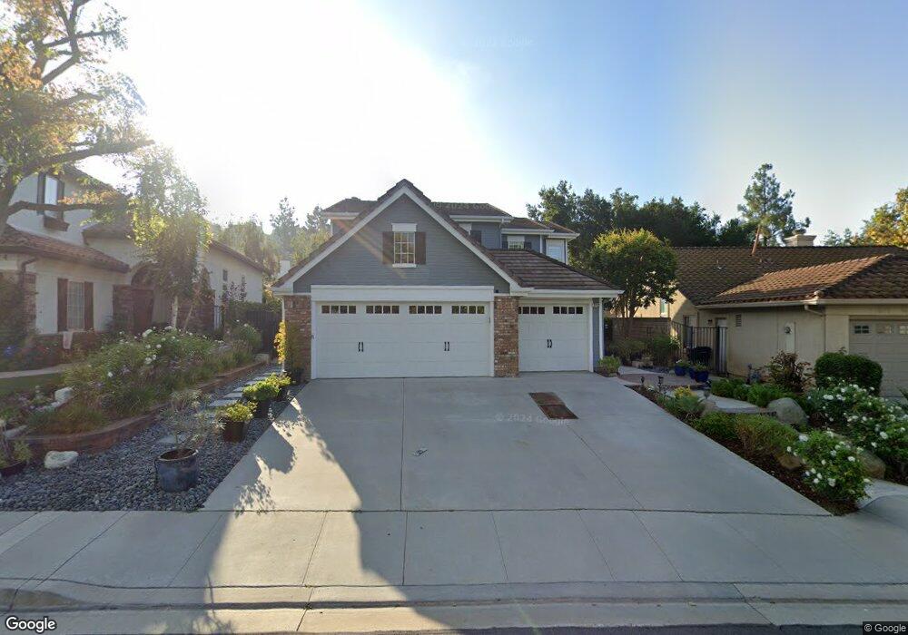
2712 Westham Cir Thousand Oaks, CA 91362
Estimated Value: $1,234,504 - $1,396,000
4
Beds
3
Baths
2,322
Sq Ft
$572/Sq Ft
Est. Value
About This Home
This home is located at 2712 Westham Cir, Thousand Oaks, CA 91362 and is currently estimated at $1,328,376, approximately $572 per square foot. 2712 Westham Cir is a home located in Ventura County with nearby schools including Lang Ranch, Los Cerritos Middle School, and Westlake High School.
Ownership History
Date
Name
Owned For
Owner Type
Purchase Details
Closed on
Dec 10, 2017
Sold by
Philips Robert L and Philips Julie A
Bought by
Phillips Robert and Phillips Julie
Current Estimated Value
Purchase Details
Closed on
Apr 27, 1994
Sold by
Standard Pacific Corp
Bought by
Phillips Robert L and Phillips Julie A
Home Financials for this Owner
Home Financials are based on the most recent Mortgage that was taken out on this home.
Original Mortgage
$227,150
Interest Rate
5.25%
Create a Home Valuation Report for This Property
The Home Valuation Report is an in-depth analysis detailing your home's value as well as a comparison with similar homes in the area
Home Values in the Area
Average Home Value in this Area
Purchase History
| Date | Buyer | Sale Price | Title Company |
|---|---|---|---|
| Phillips Robert | -- | None Available | |
| Phillips Robert L | -- | None Available | |
| Phillips Robert L | $284,000 | Chicago Title |
Source: Public Records
Mortgage History
| Date | Status | Borrower | Loan Amount |
|---|---|---|---|
| Previous Owner | Phillips Robert L | $227,150 |
Source: Public Records
Tax History Compared to Growth
Tax History
| Year | Tax Paid | Tax Assessment Tax Assessment Total Assessment is a certain percentage of the fair market value that is determined by local assessors to be the total taxable value of land and additions on the property. | Land | Improvement |
|---|---|---|---|---|
| 2025 | $6,295 | $527,758 | $187,019 | $340,739 |
| 2024 | $6,295 | $517,410 | $183,352 | $334,058 |
| 2023 | $6,103 | $507,265 | $179,757 | $327,508 |
| 2022 | $5,979 | $497,319 | $176,232 | $321,087 |
| 2021 | $5,855 | $487,568 | $172,776 | $314,792 |
| 2020 | $5,419 | $482,570 | $171,005 | $311,565 |
| 2019 | $5,274 | $473,108 | $167,652 | $305,456 |
| 2018 | $5,162 | $463,832 | $164,365 | $299,467 |
| 2017 | $5,057 | $454,739 | $161,143 | $293,596 |
| 2016 | $5,003 | $445,824 | $157,984 | $287,840 |
| 2015 | $4,912 | $439,129 | $155,612 | $283,517 |
| 2014 | $4,837 | $430,529 | $152,565 | $277,964 |
Source: Public Records
Map
Nearby Homes
- 2848 Bayham Cir
- 2347 Laurelwood Dr
- 2311 Gillingham Cir
- 2535 Rikkard Dr
- 2001 Brookfield Dr
- 2252 Northpark St
- 3128 Casino Dr
- 2321 Sunny Point St
- 3249 Springbrook St
- 1825 Sweet Briar Place
- 2499 Springbrook St
- 2427 Springbrook St
- 3182 Toulouse Cir
- 3180 Versaille Ct
- 2225 Calle Riscoso
- 2847 Cedar Wood Place
- 3240 Casino Dr
- 1764 Shady Brook Dr
- 1972 Olivewood Ct
- 2724 Westham Cir
- 2700 Westham Cir
- 2730 Westham Cir
- 2736 Irongate Place
- 2742 Westham Cir
- 2738 Knightsbridge Ave
- 2714 Knightsbridge Ave
- 2702 Knightsbridge Ave
- 2748 Irongate Place
- 2701 Irongate Place
- 2711 Irongate Place
- 2750 Knightsbridge Ave
- 2723 Irongate Place
- 2754 Westham Cir
- 2690 Knightsbridge Ave
- 2749 Westham Cir
- 2735 Irongate Place
- 2760 Irongate Place
- 2762 Knightsbridge Ave
- 2726 Knightsbridge Ave