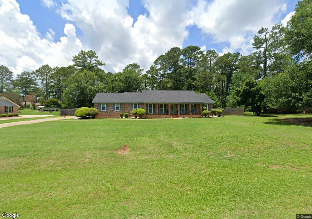
2713 Brittany Rd Albany, GA 31721
Estimated Value: $199,000 - $233,000
3
Beds
2
Baths
1,882
Sq Ft
$114/Sq Ft
Est. Value
About This Home
This home is located at 2713 Brittany Rd, Albany, GA 31721 and is currently estimated at $215,411, approximately $114 per square foot. 2713 Brittany Rd is a home located in Dougherty County with nearby schools including Live Oak Elementary School, Merry Acres Middle School, and Westover High School.
Ownership History
Date
Name
Owned For
Owner Type
Purchase Details
Closed on
Sep 24, 1997
Sold by
Stalnaker Deborah A and Stalnaker John B
Bought by
Green Charles and Barbara Ann
Current Estimated Value
Purchase Details
Closed on
Jun 23, 1995
Sold by
Davis Bernard C and Linda Lou
Bought by
Stalnaker Deborah and Stalnaker John B
Purchase Details
Closed on
Sep 25, 1991
Sold by
Lapierre Robert M
Bought by
Davis Bernard C
Purchase Details
Closed on
Jul 27, 1987
Sold by
Akers Barton D
Bought by
Lapierre Robert M
Create a Home Valuation Report for This Property
The Home Valuation Report is an in-depth analysis detailing your home's value as well as a comparison with similar homes in the area
Home Values in the Area
Average Home Value in this Area
Purchase History
| Date | Buyer | Sale Price | Title Company |
|---|---|---|---|
| Green Charles | $112,000 | -- | |
| Stalnaker Deborah | $106,000 | -- | |
| Davis Bernard C | $95,000 | -- | |
| Lapierre Robert M | $92,700 | -- |
Source: Public Records
Tax History Compared to Growth
Tax History
| Year | Tax Paid | Tax Assessment Tax Assessment Total Assessment is a certain percentage of the fair market value that is determined by local assessors to be the total taxable value of land and additions on the property. | Land | Improvement |
|---|---|---|---|---|
| 2024 | -- | $63,560 | $12,080 | $51,480 |
| 2023 | $0 | $63,560 | $12,080 | $51,480 |
| 2022 | $2,756 | $63,560 | $12,080 | $51,480 |
| 2021 | $2,669 | $63,560 | $12,080 | $51,480 |
| 2020 | $2,675 | $63,560 | $12,080 | $51,480 |
| 2019 | $2,685 | $63,560 | $12,080 | $51,480 |
| 2018 | $0 | $63,560 | $12,080 | $51,480 |
| 2017 | $2,512 | $63,560 | $12,080 | $51,480 |
| 2016 | $2,513 | $63,560 | $12,080 | $51,480 |
| 2015 | $2,520 | $63,560 | $12,080 | $51,480 |
| 2014 | $2,513 | $64,160 | $12,680 | $51,480 |
Source: Public Records
Map
Nearby Homes
- 3408 Forest Ridge Dr
- 134 Hollister Dr
- 171 Hollister Dr
- 2600 Shannon Rd
- 2732 Dover Ln
- 2738 Dover Ln
- 127 Cambridge Rd
- 112 Berkeley Rd
- N/A N Doublegate Dr
- 316 N Doublegate Dr
- 2707 Somerset Dr
- 2527 Brookhaven Ct
- 2715 N Doublegate Dr
- 274 N Doublegate Dr
- 2509 E Alberson Dr
- 219 Somerset Dr
- 3101 Old Dawson Rd
- 245 N Doublegate Dr
- 150 Hugh Rd
- 2511 Wexford Dr
- 2715 Brittany Rd
- 2711 Brittany Rd
- 2717 Brittany Rd
- 2709 Brittany Rd
- 2710 Abbey Ln
- 2712 Abbey Ln
- 2712 Brittany Rd
- 2714 Brittany Rd
- 2714 Abbey Ln
- 2708 Abbey Ln
- 2716 Abbey Ln
- 2708 Brittany Rd
- 2719 Brittany Rd
- 2716 Brittany Rd
- 2718 Abbey Ln
- 2706 Abbey Ln
- 2706 Brittany Rd
- 2718 Brittany Rd
- 2705 Brittany Rd
- 2715 Abbey Ln