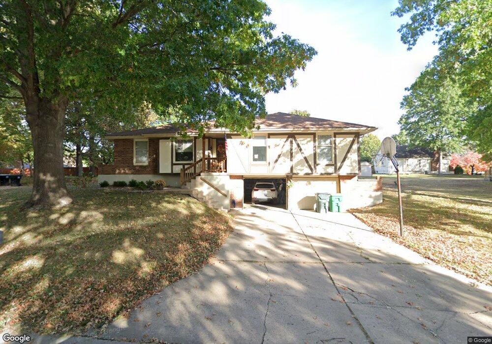
2713 S Sioux Ave Independence, MO 64057
Blackburn NeighborhoodEstimated Value: $276,000 - $328,000
3
Beds
2
Baths
1,513
Sq Ft
$198/Sq Ft
Est. Value
About This Home
This home is located at 2713 S Sioux Ave, Independence, MO 64057 and is currently estimated at $299,813, approximately $198 per square foot. 2713 S Sioux Ave is a home located in Jackson County with nearby schools including LITTLE BLUE ELEM., Bridger Middle School, and Pioneer Ridge Middle School.
Ownership History
Date
Name
Owned For
Owner Type
Purchase Details
Closed on
May 27, 1997
Sold by
Spradling Robert W and Spradling Toni M
Bought by
Perry James C and Perry Deborah K
Current Estimated Value
Home Financials for this Owner
Home Financials are based on the most recent Mortgage that was taken out on this home.
Original Mortgage
$99,750
Outstanding Balance
$14,508
Interest Rate
8.17%
Mortgage Type
FHA
Estimated Equity
$285,305
Create a Home Valuation Report for This Property
The Home Valuation Report is an in-depth analysis detailing your home's value as well as a comparison with similar homes in the area
Home Values in the Area
Average Home Value in this Area
Purchase History
| Date | Buyer | Sale Price | Title Company |
|---|---|---|---|
| Perry James C | -- | -- |
Source: Public Records
Mortgage History
| Date | Status | Borrower | Loan Amount |
|---|---|---|---|
| Open | Perry James C | $99,750 |
Source: Public Records
Tax History Compared to Growth
Tax History
| Year | Tax Paid | Tax Assessment Tax Assessment Total Assessment is a certain percentage of the fair market value that is determined by local assessors to be the total taxable value of land and additions on the property. | Land | Improvement |
|---|---|---|---|---|
| 2025 | $3,625 | $40,957 | $6,926 | $34,031 |
| 2024 | $3,625 | $52,326 | $5,309 | $47,017 |
| 2023 | $3,543 | $52,327 | $6,679 | $45,648 |
| 2022 | $2,288 | $30,970 | $3,518 | $27,452 |
| 2021 | $2,287 | $30,970 | $3,518 | $27,452 |
| 2020 | $2,242 | $29,503 | $3,518 | $25,985 |
| 2019 | $2,206 | $29,503 | $3,518 | $25,985 |
| 2018 | $2,011 | $25,677 | $3,062 | $22,615 |
| 2017 | $2,019 | $25,677 | $3,062 | $22,615 |
| 2016 | $2,019 | $25,520 | $4,110 | $21,410 |
| 2014 | $1,917 | $24,776 | $3,990 | $20,786 |
Source: Public Records
Map
Nearby Homes
- 2912 Iva Dr
- 2961 Iva Dr
- 2977 Iva Dr
- 2972 Iva Dr
- 2901 Tepee Ave
- 2840 Tepee Ave
- 18800 E 28th Terrace S
- 18701 E 28th Terrace S
- 18608 E 26th Terrace S
- 2920 S Seminole Dr
- 3208 Tepee Ct
- 3308 S Sioux Ct
- 2320 S Old Mill Ave
- 3107 S Cochise Ave
- 19307 E 34th St S
- 2431 S Ponca Ave
- 3401 Bryn Mawr Dr
- 19012 E 34th St S
- 2423 S Ponca Ave
- 18205 E 24th Terrace S
- 2717 S Sioux Ave
- 2709 S Sioux Ave
- 2712 S Sioux Ave
- 2708 S Sioux Ave
- 2712 Mohican Ave
- 2716 S Sioux Ave
- 2705 S Sioux Ave
- 2708 Mohican Ave
- 19410 E 28th St S
- 2704 S Sioux Ave
- 2801 S Sioux Ave
- 2704 Mohican Ave
- 19304 E 28th St S
- 2800 S Sioux Ave
- 19210 E 28th St S
- 2701 S Sioux Ave
- 2713 Mohican Ave
- 2800 Mohican Ave
- 19307 E 28th St S
- 2717 Mohican Ave