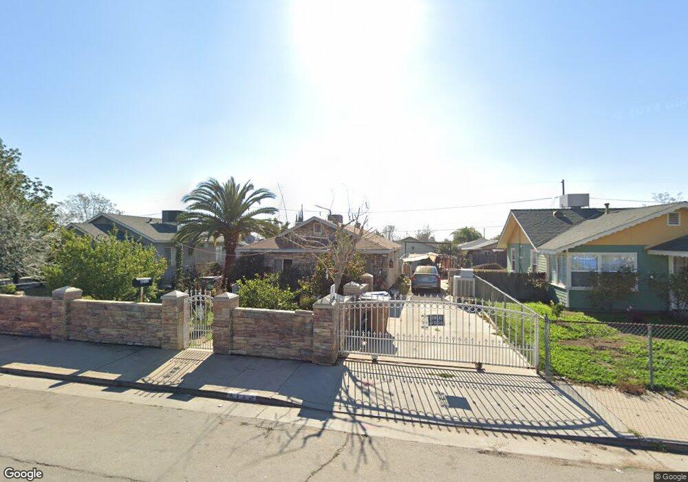
2713 Security Ave Bakersfield, CA 93306
West Pioneer Dr NeighborhoodEstimated Value: $237,000 - $245,429
3
Beds
1
Bath
468
Sq Ft
$518/Sq Ft
Est. Value
About This Home
This home is located at 2713 Security Ave, Bakersfield, CA 93306 and is currently estimated at $242,357, approximately $517 per square foot. 2713 Security Ave is a home located in Kern County with nearby schools including Ramon Garza Elementary School, Sierra Middle School, and East Bakersfield High School.
Ownership History
Date
Name
Owned For
Owner Type
Purchase Details
Closed on
Jan 11, 2005
Sold by
Mendez Salud
Bought by
Mendez Jose
Current Estimated Value
Home Financials for this Owner
Home Financials are based on the most recent Mortgage that was taken out on this home.
Original Mortgage
$89,250
Interest Rate
7.05%
Mortgage Type
New Conventional
Create a Home Valuation Report for This Property
The Home Valuation Report is an in-depth analysis detailing your home's value as well as a comparison with similar homes in the area
Home Values in the Area
Average Home Value in this Area
Purchase History
| Date | Buyer | Sale Price | Title Company |
|---|---|---|---|
| Mendez Jose | -- | Stewart Title |
Source: Public Records
Mortgage History
| Date | Status | Borrower | Loan Amount |
|---|---|---|---|
| Closed | Mendez Jose | $89,250 | |
| Closed | Mendez Jose | $20,000 |
Source: Public Records
Tax History
| Year | Tax Paid | Tax Assessment Tax Assessment Total Assessment is a certain percentage of the fair market value that is determined by local assessors to be the total taxable value of land and additions on the property. | Land | Improvement |
|---|---|---|---|---|
| 2025 | $2,725 | $160,280 | $34,837 | $125,443 |
| 2024 | $2,635 | $157,138 | $34,154 | $122,984 |
| 2023 | $2,635 | $154,058 | $33,485 | $120,573 |
| 2022 | $2,530 | $151,038 | $32,829 | $118,209 |
| 2021 | $2,300 | $137,000 | $34,000 | $103,000 |
| 2020 | $2,091 | $121,000 | $30,000 | $91,000 |
| 2019 | $1,656 | $86,000 | $24,000 | $62,000 |
| 2018 | $1,525 | $76,000 | $19,000 | $57,000 |
| 2017 | $1,575 | $81,000 | $20,000 | $61,000 |
| 2016 | $1,259 | $68,000 | $17,000 | $51,000 |
| 2015 | $1,164 | $58,000 | $16,000 | $42,000 |
| 2014 | $1,062 | $50,000 | $13,000 | $37,000 |
Source: Public Records
Map
Nearby Homes
- 2711 Trust Ave
- 2740 Center St
- 2728 Kentucky St
- 2608 Lake St
- 2717 Monterey St
- 0 Niles St
- 2641 Niles St
- 2915 Edison Hwy
- 2512 Niles St
- 2930 Potomac Ave
- 3101 Pioneer Dr
- 2525 Avenida Escuela
- 3017 Potomac Ave
- 2229 Lucky St
- 404 Hill St
- 2712 Primera Vista
- 1604 Glenwood Dr
- 401 Mcclean Ave
- 420 Oswell St Unit 37
- 1312 Tate St
- 2717 Security Ave
- 2709 Security Ave
- 2719 Security Ave
- 2707 Security Ave
- 2710 Trust Ave
- 2708 Trust Ave
- 2721 Security Ave
- 2705 Security Ave
- 2720 Trust Ave
- 2706 Trust Ave
- 2722 Trust Ave
- 2710 Security Ave
- 2708 Security Ave
- 2734 Security Ave
- 2727 Security Ave
- 2703 Security Ave
- 2736 Security Ave Unit B
- 2736 Security Ave
- 2726 Trust Ave
- 2704 Trust Ave
Your Personal Tour Guide
Ask me questions while you tour the home.