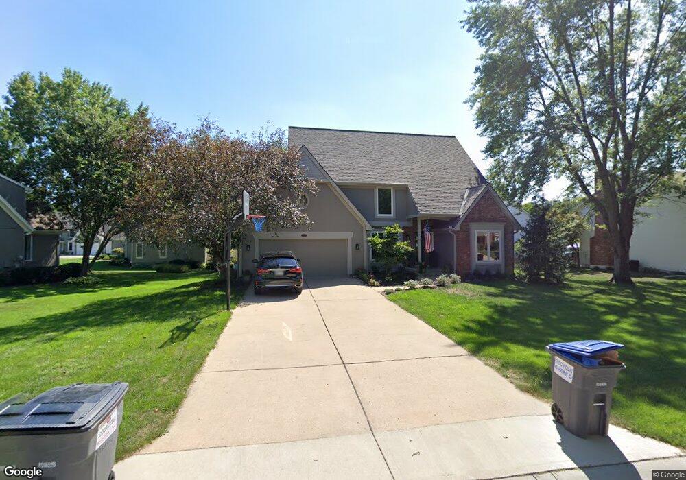
2715 W 131st St Leawood, KS 66209
Estimated Value: $648,000 - $708,000
4
Beds
4
Baths
3,190
Sq Ft
$212/Sq Ft
Est. Value
About This Home
This home is located at 2715 W 131st St, Leawood, KS 66209 and is currently estimated at $674,787, approximately $211 per square foot. 2715 W 131st St is a home located in Johnson County with nearby schools including Mission Trail Elementary School, Leawood Middle School, and Blue Valley North High School.
Ownership History
Date
Name
Owned For
Owner Type
Purchase Details
Closed on
Nov 23, 2023
Sold by
Dennis Christopher J and Dennis Christie A
Bought by
Christopher J Dennis And Christie A Dennis Tr and Dennis
Current Estimated Value
Purchase Details
Closed on
Jun 25, 2001
Sold by
Manufacturers & Traders Trust Company
Bought by
Dennis Christopher J and Dennis Christie A
Home Financials for this Owner
Home Financials are based on the most recent Mortgage that was taken out on this home.
Original Mortgage
$225,578
Interest Rate
7.16%
Purchase Details
Closed on
Mar 20, 2001
Sold by
Benson Robert K and Benson Susan
Bought by
Securitization Series 1998-2
Create a Home Valuation Report for This Property
The Home Valuation Report is an in-depth analysis detailing your home's value as well as a comparison with similar homes in the area
Home Values in the Area
Average Home Value in this Area
Purchase History
| Date | Buyer | Sale Price | Title Company |
|---|---|---|---|
| Christopher J Dennis And Christie A Dennis Tr | -- | None Listed On Document | |
| Dennis Christopher J | -- | Guarantee Title | |
| Securitization Series 1998-2 | $216,400 | -- |
Source: Public Records
Mortgage History
| Date | Status | Borrower | Loan Amount |
|---|---|---|---|
| Previous Owner | Dennis Christopher J | $225,578 |
Source: Public Records
Tax History Compared to Growth
Tax History
| Year | Tax Paid | Tax Assessment Tax Assessment Total Assessment is a certain percentage of the fair market value that is determined by local assessors to be the total taxable value of land and additions on the property. | Land | Improvement |
|---|---|---|---|---|
| 2024 | $7,291 | $65,631 | $14,855 | $50,776 |
| 2023 | $6,801 | $60,398 | $14,855 | $45,543 |
| 2022 | $6,941 | $60,283 | $14,855 | $45,428 |
| 2021 | $6,564 | $54,430 | $14,855 | $39,575 |
| 2020 | $6,148 | $49,979 | $14,855 | $35,124 |
| 2019 | $5,544 | $44,298 | $13,509 | $30,789 |
| 2018 | $4,868 | $38,237 | $12,276 | $25,961 |
| 2017 | $4,443 | $34,351 | $10,233 | $24,118 |
| 2016 | $4,212 | $32,614 | $8,531 | $24,083 |
| 2015 | $4,149 | $31,740 | $8,531 | $23,209 |
| 2013 | -- | $31,418 | $7,749 | $23,669 |
Source: Public Records
Map
Nearby Homes
- 2549 W 132nd Terrace
- 12854 Pembroke Cir
- 12725 High Dr
- 12851 Pembroke Cir
- 12815 Pembroke Cir
- 13240 Falmouth St
- 2229 Condolea Terrace
- The Forester Plan at East Village
- Fleetwood Villa Plan at East Village
- 2218 Condolea Terrace
- The Aspen Plan at East Village - Twin Villas
- The Breckenridge 2 Car Plan at East Village - Twin Villas
- The Breckenridge 3 Car Plan at East Village - Twin Villas
- The Basalt Plan at East Village - Twin Villas
- The Avon Plan at East Village - Twin Villas
- 12854 Cambridge Terrace
- 13280 Falmouth St
- 12768 Overbrook Rd
- 12763 Overbrook Rd
- The Belmont Plan at Regents Park - Twin Home Plans
- 2713 W 131st St
- 2801 W 131st St
- 2711 W 131st St
- 2844 W 131st Terrace
- 2712 W 131st St
- 2800 W 131st St
- 2708 W 131st St
- 2840 W 131st Terrace
- 2804 W 131st St
- 2709 W 131st St
- 2809 W 131st St
- 2700 W 131st St
- 2701 W 131st St
- 2752 W 131st Terrace
- 12836 Sagamore Rd
- 12834 Sagamore Rd
- 12838 Sagamore Rd
- 2849 W 131st Terrace
- 2705 W 131st St
- 2748 W 131st Terrace