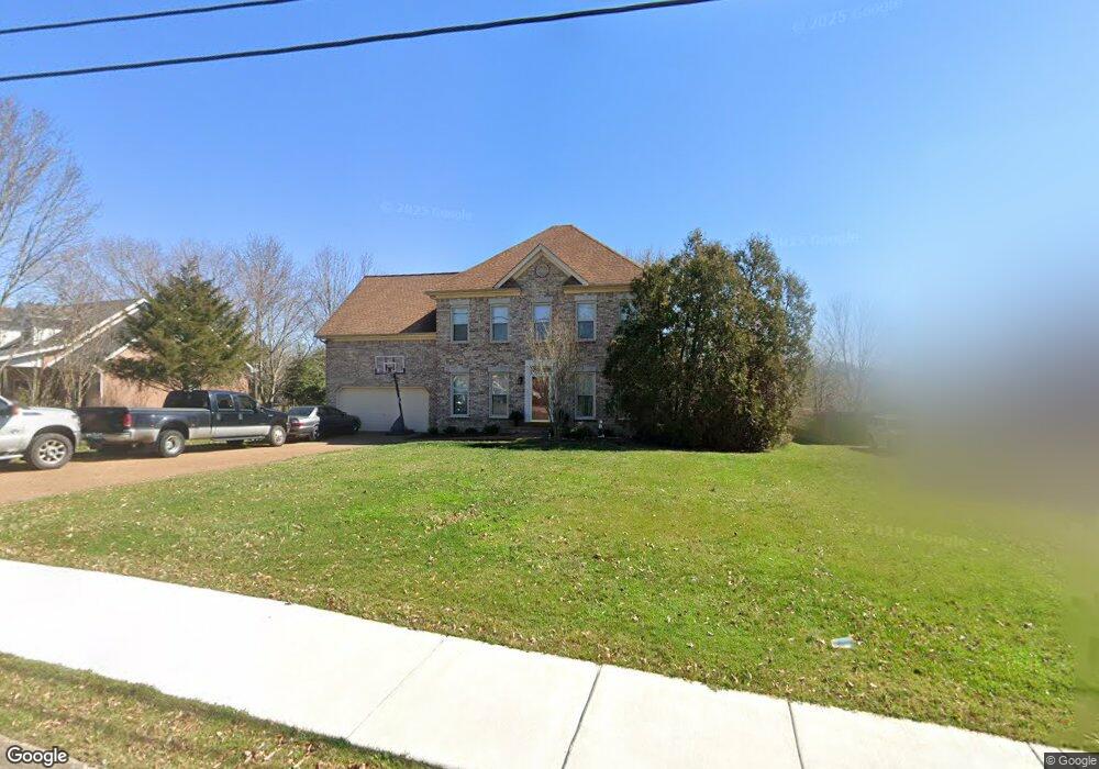
2716 New Port Royal Rd Thompsons Station, TN 37179
Estimated Value: $535,672 - $587,000
--
Bed
3
Baths
2,312
Sq Ft
$241/Sq Ft
Est. Value
About This Home
This home is located at 2716 New Port Royal Rd, Thompsons Station, TN 37179 and is currently estimated at $556,418, approximately $240 per square foot. 2716 New Port Royal Rd is a home located in Williamson County with nearby schools including Primrose School of Spring Hill.
Ownership History
Date
Name
Owned For
Owner Type
Purchase Details
Closed on
Sep 30, 2004
Sold by
John Maher Builders Inc
Bought by
Stribling Finis L and Stribling Laquita R
Current Estimated Value
Home Financials for this Owner
Home Financials are based on the most recent Mortgage that was taken out on this home.
Original Mortgage
$162,320
Outstanding Balance
$85,041
Interest Rate
6.75%
Mortgage Type
Stand Alone First
Estimated Equity
$471,377
Create a Home Valuation Report for This Property
The Home Valuation Report is an in-depth analysis detailing your home's value as well as a comparison with similar homes in the area
Home Values in the Area
Average Home Value in this Area
Purchase History
| Date | Buyer | Sale Price | Title Company |
|---|---|---|---|
| Stribling Finis L | $202,900 | Mid State Title & Escrow Inc |
Source: Public Records
Mortgage History
| Date | Status | Borrower | Loan Amount |
|---|---|---|---|
| Open | Stribling Finis L | $162,320 | |
| Closed | Stribling Finis L | $40,580 |
Source: Public Records
Tax History Compared to Growth
Tax History
| Year | Tax Paid | Tax Assessment Tax Assessment Total Assessment is a certain percentage of the fair market value that is determined by local assessors to be the total taxable value of land and additions on the property. | Land | Improvement |
|---|---|---|---|---|
| 2025 | $652 | $132,350 | $38,750 | $93,600 |
| 2024 | $652 | $88,275 | $20,000 | $68,275 |
| 2023 | $652 | $88,275 | $20,000 | $68,275 |
| 2022 | $1,615 | $88,275 | $20,000 | $68,275 |
| 2021 | $1,615 | $88,275 | $20,000 | $68,275 |
| 2020 | $1,446 | $66,925 | $15,000 | $51,925 |
| 2019 | $1,446 | $66,925 | $15,000 | $51,925 |
| 2018 | $1,399 | $66,925 | $15,000 | $51,925 |
| 2017 | $1,385 | $66,925 | $15,000 | $51,925 |
| 2016 | $0 | $66,925 | $15,000 | $51,925 |
| 2015 | -- | $56,075 | $12,500 | $43,575 |
| 2014 | -- | $56,075 | $12,500 | $43,575 |
Source: Public Records
Map
Nearby Homes
- 2112 Loudenslager Dr
- 2127 Loudenslager Dr
- 2104 Loudenslager Dr
- 458 Buckwood Ave W
- 311 Buckwood Ln N
- 452 Buckwood Ave W
- 465 Buckwood Ave
- 2836 Pedigo Place
- 446 Buckwood Ave W
- 307 Buckwood Ln N
- 454 Buckwood Ave E
- 303 Buckwood Ln N
- 301 Buckwood Ave N
- 309 Buckwood Ln W
- 464 Buckwood Ave W
- 317 Buckwood Ln N
- 456 Buckwood Ave N
- 455 Buckwood Ave W
- 460 Buckwood Ave
- 319 Buckwood Ln
- 2714 New Port Royal Rd
- 2718 New Port Royal Rd
- 2821 Biggers Dr
- 2712 New Port Royal Rd
- 2817 Biggers Dr
- 2720 New Port Royal Rd
- 2717 New Port Royal Rd
- 2715 New Port Royal Rd
- 2825 Biggers Dr
- 2719 New Port Royal Rd
- 2710 New Port Royal Rd
- 2813 Biggers Dr
- 2713 Nottingham Ct
- 2722 New Port Royal Rd
- 2702 Nottingham Ct
- 2708 New Port Royal Rd
- 2721 New Port Royal Rd
- 2287 Nottingham Ct
- 2286 Nottingham Ct
- 2682 Nottingham Ct