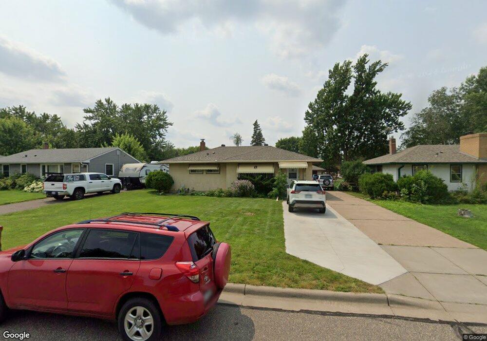
2719 Apache Rd N Saint Paul, MN 55109
Estimated Value: $288,000 - $315,000
3
Beds
2
Baths
404
Sq Ft
$750/Sq Ft
Est. Value
About This Home
This home is located at 2719 Apache Rd N, Saint Paul, MN 55109 and is currently estimated at $302,947, approximately $749 per square foot. 2719 Apache Rd N is a home located in Ramsey County with nearby schools including Richardson Elementary School, John Glenn Middle School, and Christ Lutheran School.
Ownership History
Date
Name
Owned For
Owner Type
Purchase Details
Closed on
Apr 22, 2021
Sold by
Yang Soua
Bought by
Yang Tou Long
Current Estimated Value
Home Financials for this Owner
Home Financials are based on the most recent Mortgage that was taken out on this home.
Original Mortgage
$156,000
Outstanding Balance
$140,962
Interest Rate
3.05%
Mortgage Type
New Conventional
Estimated Equity
$161,985
Purchase Details
Closed on
Dec 3, 2020
Sold by
Yang Soua
Bought by
Yang Tou Long
Home Financials for this Owner
Home Financials are based on the most recent Mortgage that was taken out on this home.
Original Mortgage
$156,000
Interest Rate
3.05%
Mortgage Type
New Conventional
Purchase Details
Closed on
Oct 13, 2017
Sold by
Blossom Susan M
Bought by
Yang Soua
Home Financials for this Owner
Home Financials are based on the most recent Mortgage that was taken out on this home.
Original Mortgage
$156,800
Interest Rate
3.78%
Mortgage Type
New Conventional
Create a Home Valuation Report for This Property
The Home Valuation Report is an in-depth analysis detailing your home's value as well as a comparison with similar homes in the area
Home Values in the Area
Average Home Value in this Area
Purchase History
We collect this data history from publicly available records. To have your information removed, we recommend requesting removal directly through your county’s website.
| Date | Buyer | Sale Price | Title Company |
|---|---|---|---|
| Yang Tou Long | $255,000 | Titlesmart | |
| Yang Tou Long | $255,000 | Titlesmart Inc | |
| Yang Soua | $196,000 | None Available |
Source: Public Records
Mortgage History
We collect this data history from publicly available records. To have your information removed, we recommend requesting removal directly through your county’s website.
| Date | Status | Borrower | Loan Amount |
|---|---|---|---|
| Open | Yang Tou Long | $156,000 | |
| Previous Owner | Yang Tou Long | $156,000 | |
| Previous Owner | Yang Soua | $156,800 |
Source: Public Records
Tax History
| Year | Tax Paid | Tax Assessment Tax Assessment Total Assessment is a certain percentage of the fair market value that is determined by local assessors to be the total taxable value of land and additions on the property. | Land | Improvement |
|---|---|---|---|---|
| 2025 | $3,664 | $284,600 | $51,000 | $233,600 |
| 2023 | $3,664 | $267,900 | $51,000 | $216,900 |
| 2022 | $3,166 | $245,700 | $51,000 | $194,700 |
| 2021 | $3,184 | $223,400 | $51,000 | $172,400 |
| 2020 | $3,194 | $226,400 | $51,000 | $175,400 |
| 2019 | $2,734 | $214,300 | $51,000 | $163,300 |
| 2018 | $2,616 | $186,900 | $51,000 | $135,900 |
| 2017 | $2,856 | $177,600 | $51,000 | $126,600 |
| 2016 | $2,556 | $0 | $0 | $0 |
| 2015 | $2,408 | $151,700 | $51,000 | $100,700 |
| 2014 | $1,786 | $0 | $0 | $0 |
Source: Public Records
Map
Nearby Homes
- 2753 Delaware Ave
- 2662 Delaware Ave
- 2654 Delaware Ave
- 2327 17th Ave E
- 2317 17th Ave E
- 2333 17th Ave E
- 2339 17th Ave E
- 2345 17th Ave E
- 2183 Radatz Ave
- 2445 16th Ave E
- 2401 14th Ave E
- 2946 Mcknight Rd N
- 2548 17th Ave E
- 2076 Flanders Rd
- 2457 Crestwood Dr
- 1995 11th Ave E Unit 2
- 1995 11th Ave E Unit 1
- 2065 Woodlynn Ave
- 3044 Lake St N
- 2719 16th Ave E
- 2713 Apache Rd N
- 2725 Apache Rd N
- 2707 Apache Rd N
- 2729 Apache Rd N
- 2718 Mcknight Rd N
- 2701 Apache Rd N
- 2735 Apache Rd N
- 2712 Mcknight Rd N
- 2724 Apache Rd N
- 2718 Apache Rd N
- 2706 Mcknight Rd N
- 2730 Mcknight Rd N
- 2712 2712 McKnight Rd N
- 2730 2730 Apache Rd N
- 2730 2730 Apache-Road-n
- 2730 Apache Rd N
- 2712 Apache Rd N
- 2697 Apache Rd N
- 2741 Apache Rd N
- 2736 Apache Rd N
Your Personal Tour Guide
Ask me questions while you tour the home.