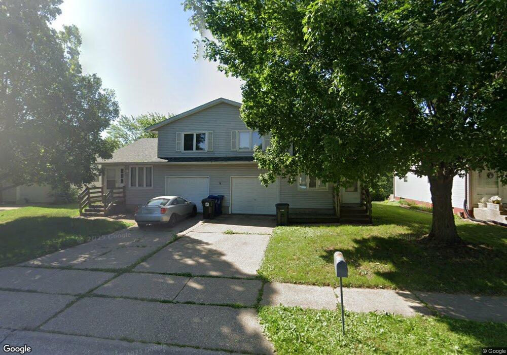
2719 W 34th St Davenport, IA 52806
Northwest Davenport NeighborhoodEstimated Value: $174,000 - $232,000
4
Beds
2
Baths
1,664
Sq Ft
$122/Sq Ft
Est. Value
About This Home
This home is located at 2719 W 34th St, Davenport, IA 52806 and is currently estimated at $203,604, approximately $122 per square foot. 2719 W 34th St is a home located in Scott County with nearby schools including Tygart Creek Elementary School, South Christian Elementary School, and Adams Elementary School.
Ownership History
Date
Name
Owned For
Owner Type
Purchase Details
Closed on
Oct 20, 2025
Sold by
Brown Nicolas R and Brown Megan N
Bought by
Latimer Elijah and Latimer Gary L
Current Estimated Value
Purchase Details
Closed on
Nov 16, 2007
Sold by
Motto Vincent J and Motto Connie S
Bought by
Quinn Gregory A and Quinn Angela G
Create a Home Valuation Report for This Property
The Home Valuation Report is an in-depth analysis detailing your home's value as well as a comparison with similar homes in the area
Home Values in the Area
Average Home Value in this Area
Purchase History
| Date | Buyer | Sale Price | Title Company |
|---|---|---|---|
| Latimer Elijah | $215,000 | None Listed On Document | |
| Quinn Gregory A | $125,500 | None Available |
Source: Public Records
Tax History Compared to Growth
Tax History
| Year | Tax Paid | Tax Assessment Tax Assessment Total Assessment is a certain percentage of the fair market value that is determined by local assessors to be the total taxable value of land and additions on the property. | Land | Improvement |
|---|---|---|---|---|
| 2025 | $3,085 | $174,470 | $29,450 | $145,020 |
| 2024 | $3,130 | $156,340 | $29,450 | $126,890 |
| 2023 | $3,372 | $156,340 | $29,450 | $126,890 |
| 2022 | $3,271 | $140,360 | $24,260 | $116,100 |
| 2021 | $3,012 | $140,360 | $24,260 | $116,100 |
| 2020 | $2,864 | $131,840 | $24,260 | $107,580 |
| 2019 | $2,953 | $125,450 | $24,260 | $101,190 |
| 2018 | $2,898 | $125,450 | $24,260 | $101,190 |
| 2017 | $2,873 | $115,230 | $24,260 | $90,970 |
| 2016 | $2,883 | $115,230 | $0 | $0 |
| 2015 | $2,524 | $114,550 | $0 | $0 |
| 2014 | $2,544 | $113,490 | $0 | $0 |
| 2013 | $2,478 | $0 | $0 | $0 |
| 2012 | -- | $116,550 | $28,940 | $87,610 |
Source: Public Records
Map
Nearby Homes
- 3812 N Thornwood Ave
- 3205 N Pine St
- 2223 W 34th St
- 2724 W 38th Place
- 2728 W 38th Place
- 3011 N Pine St
- 3112 W 34th St
- 3117 W 34th St
- 2159 W 35th St
- 2905 N Pine St
- 2222 W 30th St
- Lot 29 W 34th St
- 2149 W 30th St
- 2804 Oak St
- 4104 N Linwood Ave
- 3240 Heatherton Dr
- 3234 Heatherton Dr Unit 6
- 2236 W Columbia Ave
- 4036 Hillandale Rd
- 3932 N Elsie Ave
- 2725 W 34th St
- 2709 W 34th St
- 2731 W 34th St
- 2722 W 34th St
- 2703 W 34th St
- 2737 W 34th St
- 3404 N Thornwood Ave
- 2739 W 34th St
- 3415 Hazelwood Ct
- 2740 W 34th St
- 3410 N Thornwood Ave
- 2677 W 34th St
- 2745 W 34th St
- 3412 Hazelwood Ct
- 3421 Hazelwood Ct
- 3418 Hazelwood Ct
- 3416 N Thornwood Ave
- 2751 W 34th St
- 3405 N Birchwood Ave
- 2671 W 34th St