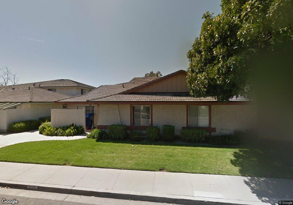
2719 Wendy Place Unit B Port Hueneme, CA 93041
Estimated Value: $473,145 - $526,000
2
Beds
2
Baths
1,268
Sq Ft
$399/Sq Ft
Est. Value
About This Home
This home is located at 2719 Wendy Place Unit B, Port Hueneme, CA 93041 and is currently estimated at $505,786, approximately $398 per square foot. 2719 Wendy Place Unit B is a home located in Ventura County with nearby schools including Marina West Elementary School and Oxnard High School.
Ownership History
Date
Name
Owned For
Owner Type
Purchase Details
Closed on
Nov 3, 2021
Sold by
Humphrey Thomas D
Bought by
Humphrey Thomas D and The Thomas D Humphry 2021 Trus
Current Estimated Value
Purchase Details
Closed on
Mar 21, 1996
Sold by
Carter Debbie A
Bought by
Humphreys Thomas D
Home Financials for this Owner
Home Financials are based on the most recent Mortgage that was taken out on this home.
Original Mortgage
$76,150
Outstanding Balance
$3,228
Interest Rate
7.84%
Mortgage Type
FHA
Estimated Equity
$502,558
Purchase Details
Closed on
Aug 26, 1993
Sold by
Federal Home Loan Mortgage Corporation
Bought by
Carter Cliff and Carter Debi
Home Financials for this Owner
Home Financials are based on the most recent Mortgage that was taken out on this home.
Original Mortgage
$106,450
Interest Rate
6.91%
Mortgage Type
FHA
Create a Home Valuation Report for This Property
The Home Valuation Report is an in-depth analysis detailing your home's value as well as a comparison with similar homes in the area
Home Values in the Area
Average Home Value in this Area
Purchase History
| Date | Buyer | Sale Price | Title Company |
|---|---|---|---|
| Humphrey Thomas D | -- | None Available | |
| Humphreys Thomas D | $78,000 | Continental Lawyers Title | |
| Carter Cliff | $109,500 | Fidelity National Title |
Source: Public Records
Mortgage History
| Date | Status | Borrower | Loan Amount |
|---|---|---|---|
| Open | Humphreys Thomas D | $76,150 | |
| Previous Owner | Carter Cliff | $106,450 |
Source: Public Records
Tax History Compared to Growth
Tax History
| Year | Tax Paid | Tax Assessment Tax Assessment Total Assessment is a certain percentage of the fair market value that is determined by local assessors to be the total taxable value of land and additions on the property. | Land | Improvement |
|---|---|---|---|---|
| 2025 | $1,539 | $129,536 | $51,811 | $77,725 |
| 2024 | $1,539 | $126,997 | $50,796 | $76,201 |
| 2023 | $1,498 | $124,507 | $49,800 | $74,707 |
| 2022 | $1,442 | $122,066 | $48,823 | $73,243 |
| 2021 | $1,412 | $119,673 | $47,866 | $71,807 |
| 2020 | $1,395 | $118,448 | $47,376 | $71,072 |
| 2019 | $1,377 | $116,127 | $46,448 | $69,679 |
| 2018 | $1,364 | $113,851 | $45,538 | $68,313 |
| 2017 | $1,290 | $111,620 | $44,646 | $66,974 |
| 2016 | $1,268 | $109,432 | $43,771 | $65,661 |
| 2015 | $1,231 | $107,790 | $43,114 | $64,676 |
| 2014 | $1,227 | $105,680 | $42,270 | $63,410 |
Source: Public Records
Map
Nearby Homes
- 2754 Bolker Dr
- 2732 Bolker Dr
- 2622 Captains Ave
- 438 Las Palomas Dr
- 422 Las Palomas Dr
- 2633 Captains Ave
- 426 Reed Way
- 469 Corvette St
- 82 W Garden Green
- 2466 Bolker Dr
- 66 W Garden Green
- 2456 Bolker Dr
- 541 Broderick Way
- 225 W Channel Islands Blvd
- 169 W Alta Green
- 162 W Alta Green
- 2633 Barnacle Cove
- 117 W Channel Islands Blvd
- 130 E Bay Blvd
- 163 E Bowling Green
- 2721 Wendy Place
- 2717 Wendy Place
- 2715 Wendy Place
- 2707 Wendy Place
- 2725 Wendy Place
- 2711 Wendy Place
- 2713 Wendy Place
- 2729 Wendy Place Unit A
- 2729 Wendy Place
- 2727 Wendy Place
- 2709 Wendy Place
- 2723 Wendy Place
- 2731 Wendy Place
- 2735 Wendy Place
- 2737 Wendy Place
- 2733 Wendy Place
- 2716 Wendy Place
- 2708 Wendy Place
- 2724 Wendy Place
- 2710 Wendy Place