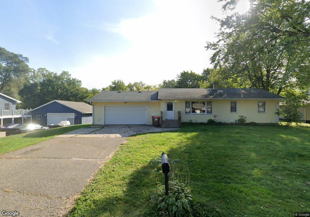
272 Linden Rd Prescott, WI 54021
Estimated Value: $299,000 - $351,791
3
Beds
1
Bath
--
Sq Ft
0.66
Acres
About This Home
This home is located at 272 Linden Rd, Prescott, WI 54021 and is currently estimated at $331,198. 272 Linden Rd is a home located in Pierce County with nearby schools including Malone Elementary School, Prescott Middle School, and Prescott High School.
Ownership History
Date
Name
Owned For
Owner Type
Purchase Details
Closed on
Feb 23, 2005
Sold by
Jansen Christopher F and Jansen Michelle M
Bought by
Hanson Dustin C
Current Estimated Value
Home Financials for this Owner
Home Financials are based on the most recent Mortgage that was taken out on this home.
Original Mortgage
$112,000
Interest Rate
6.12%
Mortgage Type
Adjustable Rate Mortgage/ARM
Purchase Details
Closed on
Feb 1, 2005
Sold by
Skramstad Dennis G
Bought by
M
Home Financials for this Owner
Home Financials are based on the most recent Mortgage that was taken out on this home.
Original Mortgage
$112,000
Interest Rate
6.12%
Mortgage Type
Adjustable Rate Mortgage/ARM
Create a Home Valuation Report for This Property
The Home Valuation Report is an in-depth analysis detailing your home's value as well as a comparison with similar homes in the area
Home Values in the Area
Average Home Value in this Area
Purchase History
| Date | Buyer | Sale Price | Title Company |
|---|---|---|---|
| Hanson Dustin C | $70,000 | Title Recording Services Inc | |
| M | $140,000 | None Available |
Source: Public Records
Mortgage History
| Date | Status | Borrower | Loan Amount |
|---|---|---|---|
| Previous Owner | M | $112,000 |
Source: Public Records
Tax History Compared to Growth
Tax History
| Year | Tax Paid | Tax Assessment Tax Assessment Total Assessment is a certain percentage of the fair market value that is determined by local assessors to be the total taxable value of land and additions on the property. | Land | Improvement |
|---|---|---|---|---|
| 2024 | $5,494 | $310,800 | $98,200 | $212,600 |
| 2023 | $5,322 | $310,800 | $98,200 | $212,600 |
| 2022 | $4,314 | $179,100 | $56,200 | $122,900 |
| 2021 | $4,256 | $179,100 | $56,200 | $122,900 |
| 2020 | $4,278 | $179,100 | $56,200 | $122,900 |
| 2019 | $4,290 | $179,100 | $56,200 | $122,900 |
| 2018 | $4,088 | $179,100 | $56,200 | $122,900 |
| 2017 | $4,647 | $179,100 | $56,200 | $122,900 |
| 2016 | $4,067 | $158,100 | $56,200 | $101,900 |
| 2015 | $4,186 | $158,100 | $56,200 | $101,900 |
| 2014 | $4,055 | $158,100 | $56,200 | $101,900 |
| 2013 | $3,809 | $158,100 | $56,200 | $101,900 |
Source: Public Records
Map
Nearby Homes
- 170 Tower Rd
- 1433 Glenridge Dr
- 155 Linden Rd
- 368 Young St S
- 565 Pleasant Dr
- 284 Elm St S
- 568 Locust St S
- XXX Locust St
- 728 Linn St
- 170 Mississippi St
- 580 Northern Lights Dr
- 482 Delta Queen Ave
- Virginia Plan at Great Rivers
- Tennessee Plan at Great Rivers
- Vermont Plan at Great Rivers
- Sycamore Plan at Great Rivers
- Summerlyn Plan at Great Rivers
- St James Plan at Great Rivers
- Poplar Plan at Great Rivers
- Spruce Plan at Great Rivers