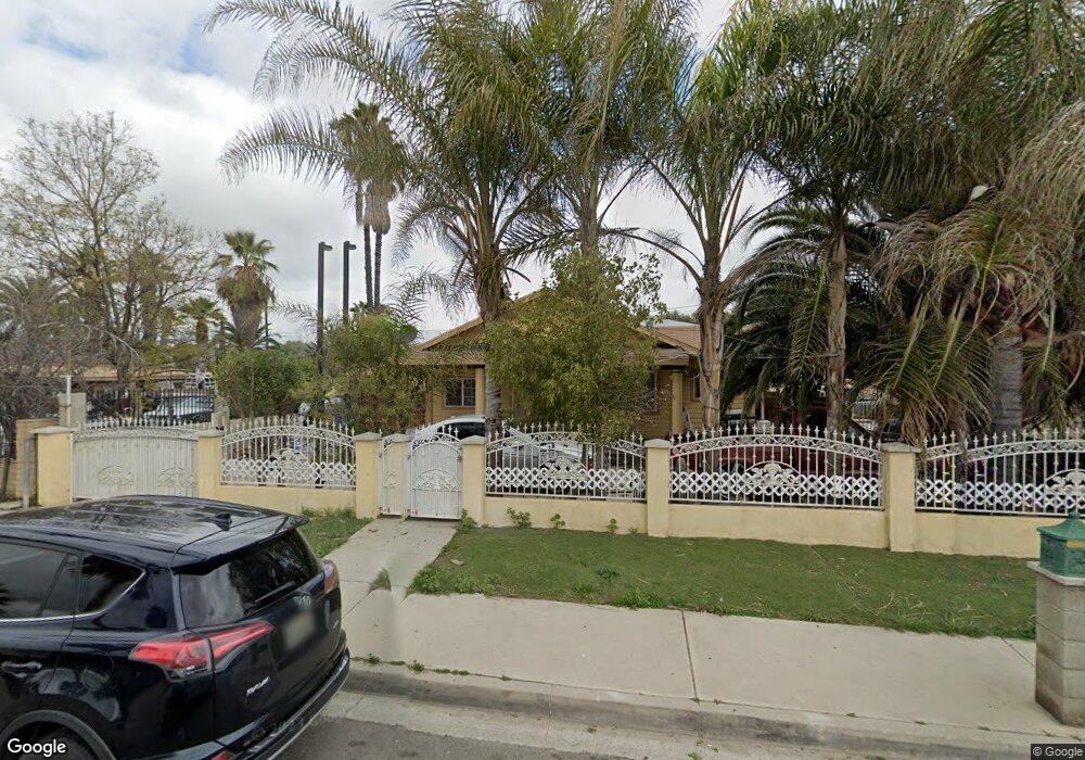
272 W 1st St Perris, CA 92570
Downtown Perris NeighborhoodEstimated Value: $384,000 - $469,000
3
Beds
1
Bath
1,066
Sq Ft
$405/Sq Ft
Est. Value
About This Home
This home is located at 272 W 1st St, Perris, CA 92570 and is currently estimated at $431,668, approximately $404 per square foot. 272 W 1st St is a home located in Riverside County with nearby schools including Perris Elementary School, Pinacate Middle School, and Perris High School.
Ownership History
Date
Name
Owned For
Owner Type
Purchase Details
Closed on
Dec 28, 2005
Sold by
Valle Rosa M
Bought by
Valle Marcos
Current Estimated Value
Home Financials for this Owner
Home Financials are based on the most recent Mortgage that was taken out on this home.
Original Mortgage
$252,000
Outstanding Balance
$146,621
Interest Rate
6.87%
Mortgage Type
Purchase Money Mortgage
Estimated Equity
$285,047
Purchase Details
Closed on
Apr 21, 2004
Sold by
Quiroz Ignacio G and Quiroz Hermila Hermelinda
Bought by
Valle Marcos and Valle Rosa M
Home Financials for this Owner
Home Financials are based on the most recent Mortgage that was taken out on this home.
Original Mortgage
$201,832
Interest Rate
6.27%
Mortgage Type
FHA
Create a Home Valuation Report for This Property
The Home Valuation Report is an in-depth analysis detailing your home's value as well as a comparison with similar homes in the area
Home Values in the Area
Average Home Value in this Area
Purchase History
| Date | Buyer | Sale Price | Title Company |
|---|---|---|---|
| Valle Marcos | -- | United Title Company | |
| Valle Marcos | $205,000 | Stewart Title Riverside |
Source: Public Records
Mortgage History
| Date | Status | Borrower | Loan Amount |
|---|---|---|---|
| Open | Valle Marcos | $252,000 | |
| Previous Owner | Valle Marcos | $201,832 |
Source: Public Records
Tax History Compared to Growth
Tax History
| Year | Tax Paid | Tax Assessment Tax Assessment Total Assessment is a certain percentage of the fair market value that is determined by local assessors to be the total taxable value of land and additions on the property. | Land | Improvement |
|---|---|---|---|---|
| 2025 | $3,845 | $297,589 | $71,075 | $226,514 |
| 2023 | $3,845 | $286,035 | $68,316 | $217,719 |
| 2022 | $3,290 | $259,073 | $62,291 | $196,782 |
| 2021 | $2,505 | $219,553 | $52,789 | $166,764 |
| 2020 | $2,233 | $196,030 | $47,133 | $148,897 |
| 2019 | $2,158 | $190,320 | $45,760 | $144,560 |
| 2018 | $2,019 | $183,000 | $44,000 | $139,000 |
| 2017 | $1,940 | $175,000 | $42,000 | $133,000 |
| 2016 | $1,746 | $158,000 | $38,000 | $120,000 |
| 2015 | $1,568 | $143,000 | $34,000 | $109,000 |
| 2014 | $1,023 | $95,000 | $23,000 | $72,000 |
Source: Public Records
Map
Nearby Homes
- 225 W 4th St
- 0 N Hwy 74 N Unit IV25096943
- 350 W 5th St
- 160 E 3rd St
- 1 W 4th St
- 2 W 4th St
- 0 No Address Unit OC25048615
- 0 E 5th St Unit PW25177191
- 236 W 6th St
- 480 Deerhill Rd
- 0 Highway 74 Hwy Unit IG25175334
- 602 Roadrunner Way
- 641 Dove Dr
- 239 W 7th St
- 144 Kruse St
- 0 Kruse St Unit IV25090710
- 2332 Rivendell Rd
- 2392 Iris Petal Ln
- 2362 Iris Petal Ln
- 2341 Rivendell Rd