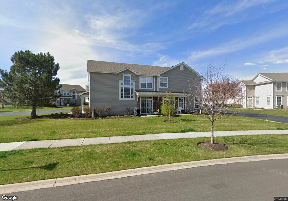
272 Whitfield Dr Unit A Sugar Grove, IL 60554
Estimated Value: $279,270 - $300,000
--
Bed
--
Bath
1,615
Sq Ft
$182/Sq Ft
Est. Value
About This Home
This home is located at 272 Whitfield Dr Unit A, Sugar Grove, IL 60554 and is currently estimated at $294,568, approximately $182 per square foot. 272 Whitfield Dr Unit A is a home located in Kane County with nearby schools including Kaneland John Shields Elementary School, Harter Middle School, and Kaneland Senior High School.
Ownership History
Date
Name
Owned For
Owner Type
Purchase Details
Closed on
Sep 9, 2013
Sold by
Hyde Mark H and Hyde Lauren
Bought by
Chicago Title Land Trust Co and Trust Number 8002362832
Current Estimated Value
Purchase Details
Closed on
Jan 16, 2003
Sold by
Wiseman Hughes Enterprises Inc
Bought by
Hyde Mark H and Hyde Lauren
Home Financials for this Owner
Home Financials are based on the most recent Mortgage that was taken out on this home.
Original Mortgage
$52,000
Interest Rate
6.13%
Mortgage Type
Purchase Money Mortgage
Create a Home Valuation Report for This Property
The Home Valuation Report is an in-depth analysis detailing your home's value as well as a comparison with similar homes in the area
Home Values in the Area
Average Home Value in this Area
Purchase History
| Date | Buyer | Sale Price | Title Company |
|---|---|---|---|
| Chicago Title Land Trust Co | -- | None Available | |
| Hyde Mark H | $173,000 | Multiple |
Source: Public Records
Mortgage History
| Date | Status | Borrower | Loan Amount |
|---|---|---|---|
| Previous Owner | Hyde Mark H | $52,000 |
Source: Public Records
Tax History Compared to Growth
Tax History
| Year | Tax Paid | Tax Assessment Tax Assessment Total Assessment is a certain percentage of the fair market value that is determined by local assessors to be the total taxable value of land and additions on the property. | Land | Improvement |
|---|---|---|---|---|
| 2024 | $4,878 | $78,471 | $13,968 | $64,503 |
| 2023 | $4,561 | $70,771 | $12,597 | $58,174 |
| 2022 | $5,122 | $65,335 | $11,629 | $53,706 |
| 2021 | $4,900 | $62,177 | $11,067 | $51,110 |
| 2020 | $4,854 | $60,851 | $10,831 | $50,020 |
| 2019 | $5,206 | $58,862 | $10,477 | $48,385 |
| 2018 | $4,911 | $54,652 | $8,159 | $46,493 |
| 2017 | $4,748 | $52,194 | $7,792 | $44,402 |
| 2016 | $4,621 | $49,894 | $7,449 | $42,445 |
| 2015 | -- | $50,810 | $6,931 | $43,879 |
| 2014 | -- | $48,584 | $6,627 | $41,957 |
| 2013 | -- | $49,095 | $6,697 | $42,398 |
Source: Public Records
Map
Nearby Homes
- 206 Brompton Ln Unit A
- 208 Belle Vue Ct Unit A
- 174 Brompton Ln Unit A
- 230 St James Pkwy Unit A
- 261 Hampton Rd Unit 1
- 391 Capitol Dr
- 209 Regency Blvd Unit 1
- 209 Somerset Dr Unit 1
- 106 Fairfax Cir
- 5S655 Bliss Rd
- 124 W Park Ave Unit D
- 11 Hardwick Ct
- 6 Saddlewood Ct
- 123 Terry Dr
- 8 Hillcrest Dr
- 199 Vale Ave Unit 1
- 193 W Park Ave Unit A
- 1 Normandie Dr Unit 211
- 226 W Park Ave Unit A
- 7 Douglas Dr Unit 3
- 272 Whitfield Dr Unit B
- 266 St James Pkwy Unit A
- 266 St James Pkwy Unit B
- 266 St James Pkwy Unit A
- 274 Whitfield Dr Unit B
- 274 Whitfield Dr Unit A
- 276 Whitfield Dr Unit B
- 276 Whitfield Dr Unit A
- 260 St James Pkwy Unit B
- 260 St James Pkwy Unit A
- 260 St James Pkwy
- 160 E Park Ave Unit B
- 160 E Park Ave Unit A
- 180 E Park Ave Unit A
- 170 E Park Ave Unit B
- 170 E Park Ave Unit A
- 170 E Park Ave Unit B
- 277 St James Pkwy
- 278 Whitfield Dr Unit B
- 278 Whitfield Dr Unit A