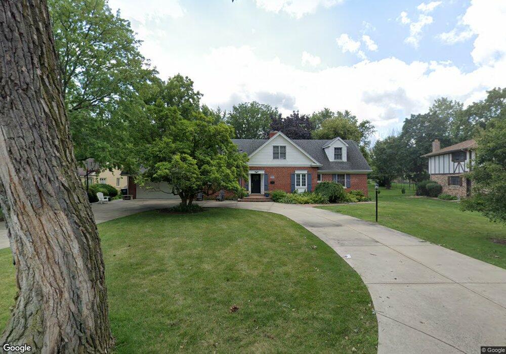
2720 2nd Private Rd Flossmoor, IL 60422
Estimated Value: $365,130 - $493,000
4
Beds
3
Baths
1,732
Sq Ft
$238/Sq Ft
Est. Value
About This Home
This home is located at 2720 2nd Private Rd, Flossmoor, IL 60422 and is currently estimated at $412,033, approximately $237 per square foot. 2720 2nd Private Rd is a home located in Cook County with nearby schools including Western Avenue Elementary School, Parker Junior High School, and Homewood-Flossmoor High School.
Ownership History
Date
Name
Owned For
Owner Type
Purchase Details
Closed on
Sep 27, 2001
Sold by
Howland James H and Howland Irene M
Bought by
Porter Fulton L and Porter Lisa C
Current Estimated Value
Home Financials for this Owner
Home Financials are based on the most recent Mortgage that was taken out on this home.
Original Mortgage
$275,000
Outstanding Balance
$101,578
Interest Rate
6.12%
Estimated Equity
$310,455
Create a Home Valuation Report for This Property
The Home Valuation Report is an in-depth analysis detailing your home's value as well as a comparison with similar homes in the area
Home Values in the Area
Average Home Value in this Area
Purchase History
| Date | Buyer | Sale Price | Title Company |
|---|---|---|---|
| Porter Fulton L | $345,000 | Ticor Title |
Source: Public Records
Mortgage History
| Date | Status | Borrower | Loan Amount |
|---|---|---|---|
| Open | Porter Fulton L | $275,000 | |
| Closed | Porter Fulton L | $51,750 |
Source: Public Records
Tax History Compared to Growth
Tax History
| Year | Tax Paid | Tax Assessment Tax Assessment Total Assessment is a certain percentage of the fair market value that is determined by local assessors to be the total taxable value of land and additions on the property. | Land | Improvement |
|---|---|---|---|---|
| 2024 | $9,656 | $26,000 | $9,020 | $16,980 |
| 2023 | $8,855 | $26,000 | $9,020 | $16,980 |
| 2022 | $8,855 | $19,884 | $9,020 | $10,864 |
| 2021 | $8,920 | $19,884 | $9,020 | $10,864 |
| 2020 | $8,663 | $19,884 | $9,020 | $10,864 |
| 2019 | $11,866 | $25,448 | $8,200 | $17,248 |
| 2018 | $11,417 | $25,448 | $8,200 | $17,248 |
| 2017 | $11,239 | $25,448 | $8,200 | $17,248 |
| 2016 | $10,879 | $23,038 | $7,380 | $15,658 |
| 2015 | $10,864 | $23,038 | $7,380 | $15,658 |
| 2014 | $10,687 | $23,038 | $7,380 | $15,658 |
| 2013 | $10,843 | $25,324 | $7,380 | $17,944 |
Source: Public Records
Map
Nearby Homes
- 2937 Kathleen Ln
- 1402 Berry Ln
- 1430 Brassie Ave
- 3013 Mac Heath Crescent
- 1248 Oakmont Ave
- 1248 Berry Ln
- 1418 Western Ave
- 3045 Scott Crescent
- 1833 Pheasant Ct
- 1141 Leavitt Ave Unit 115
- 1139 Leavitt Ave Unit 212
- 1139 Leavitt Ave Unit 313
- 2633 Hawthorne Ln Unit B
- 1117 Leavitt Ave Unit 110
- 2904 Athena Ct
- 2908 Athena Ct
- 2931 Sunset Ave
- 20015 Delphi Dr
- 1450 Tanglewood St Unit 1B
- 2817 Flossmoor Rd
- 2720 2nd Private Rd
- 2712 2nd Private Rd
- 2748 2nd Private Rd
- 2717 Brassie Ave
- 2717 2nd Private Rd
- 2702 2nd Private Rd
- 2725 Brassie Ave
- 2711 2nd Private Rd
- 2653 Brassie Ave
- 2727 Brassie Ave
- 2703 2nd Private Rd
- 2644 2nd Private Rd
- 2647 Brassie Ave
- 2645 2nd Private Rd
- 1610 Brassie Ave
- 2710 1st Private Rd
- 1622 Brassie Ave
- 2720 Brassie Ave
- 2712 Brassie Ave
- 2730 Brassie Ave