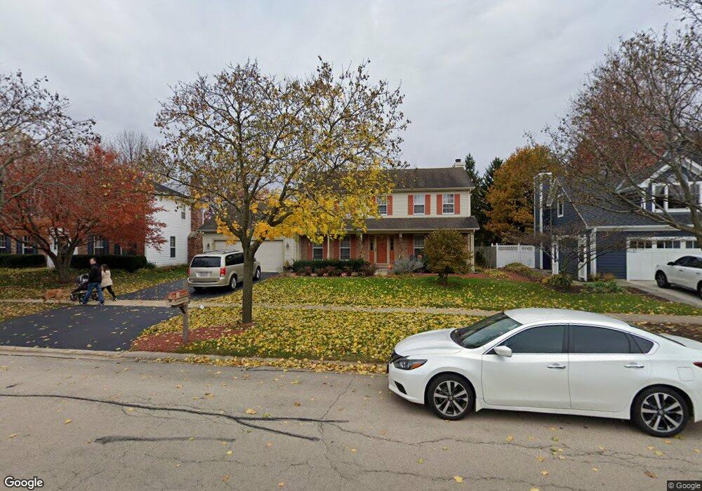
2720 Fargo Blvd Unit 2 Geneva, IL 60134
Southwest Geneva NeighborhoodEstimated Value: $453,000 - $508,000
3
Beds
3
Baths
2,269
Sq Ft
$214/Sq Ft
Est. Value
About This Home
This home is located at 2720 Fargo Blvd Unit 2, Geneva, IL 60134 and is currently estimated at $486,430, approximately $214 per square foot. 2720 Fargo Blvd Unit 2 is a home located in Kane County with nearby schools including Williamsburg Elementary School, Geneva Community High School, and St. Peter School.
Ownership History
Date
Name
Owned For
Owner Type
Purchase Details
Closed on
Jul 26, 2023
Sold by
Kuska Justin and Kuska Gloria
Bought by
Justin And Gloria Joint Trust and Kuska
Current Estimated Value
Purchase Details
Closed on
Jul 12, 2002
Sold by
Seben Paul M and Seben Joyce K
Bought by
Kuska Justin and Kuska Gloria
Home Financials for this Owner
Home Financials are based on the most recent Mortgage that was taken out on this home.
Original Mortgage
$190,000
Interest Rate
4%
Mortgage Type
New Conventional
Create a Home Valuation Report for This Property
The Home Valuation Report is an in-depth analysis detailing your home's value as well as a comparison with similar homes in the area
Home Values in the Area
Average Home Value in this Area
Purchase History
| Date | Buyer | Sale Price | Title Company |
|---|---|---|---|
| Justin And Gloria Joint Trust | -- | None Listed On Document | |
| Kuska Justin | $248,000 | Chicago Title Insurance Co |
Source: Public Records
Mortgage History
| Date | Status | Borrower | Loan Amount |
|---|---|---|---|
| Previous Owner | Kuska Justin | $190,000 |
Source: Public Records
Tax History Compared to Growth
Tax History
| Year | Tax Paid | Tax Assessment Tax Assessment Total Assessment is a certain percentage of the fair market value that is determined by local assessors to be the total taxable value of land and additions on the property. | Land | Improvement |
|---|---|---|---|---|
| 2024 | $9,960 | $137,895 | $33,506 | $104,389 |
| 2023 | $9,680 | $125,359 | $30,460 | $94,899 |
| 2022 | $9,273 | $116,483 | $28,303 | $88,180 |
| 2021 | $8,998 | $112,154 | $27,251 | $84,903 |
| 2020 | $8,893 | $110,442 | $26,835 | $83,607 |
| 2019 | $8,868 | $108,351 | $26,327 | $82,024 |
| 2018 | $8,698 | $106,548 | $26,327 | $80,221 |
| 2017 | $8,599 | $103,707 | $25,625 | $78,082 |
| 2016 | $8,554 | $101,338 | $25,279 | $76,059 |
| 2015 | -- | $96,347 | $24,034 | $72,313 |
| 2014 | -- | $92,201 | $24,034 | $68,167 |
| 2013 | -- | $92,201 | $24,034 | $68,167 |
Source: Public Records
Map
Nearby Homes
- Unit 6A Prairie Grove Dr
- Unit 5B Prairie Grove Dr
- Unit 4A Prairie Grove Dr
- Unit 5A Prairie Grove Dr
- Unit 7A Prairie Grove Dr
- Unit 6C Prairie Grove Dr
- Unit 5C Prairie Grove Dr
- Unit 6B Prairie Grove Dr
- Unit 7C Prairie Grove Dr
- 2528 Heritage Ct Unit 1
- 839 S Randall Rd
- 3497 Winding Meadow Ln
- 2147 Fargo Blvd
- 869 Cambridge Dr
- 2671 Stone Cir Unit 208
- 558 Schroeder Trail
- 2731 Stone Cir
- 2771 Stone Cir
- 2767 Stone Cir
- 1823 Fargo Blvd
- 2700 Fargo Blvd Unit 2
- 2730 Fargo Blvd
- 1209 Herrington Rd
- 1231 Herrington Place
- 2636 Fargo Blvd
- 1229 Herrington Place
- 2740 Fargo Blvd
- 2711 Fargo Blvd
- 2721 Fargo Blvd
- 1109 Shoop Dr
- 2634 Fargo Blvd
- 1219 Herrington Place
- 2731 Fargo Blvd Unit 2
- 1233 Herrington Place
- 1139 Shoop Dr
- 2629 Fargo Blvd
- 2741 Fargo Blvd
- 2632 Fargo Blvd
- 1000 Wood Ave
- 2726 Coventry Ct