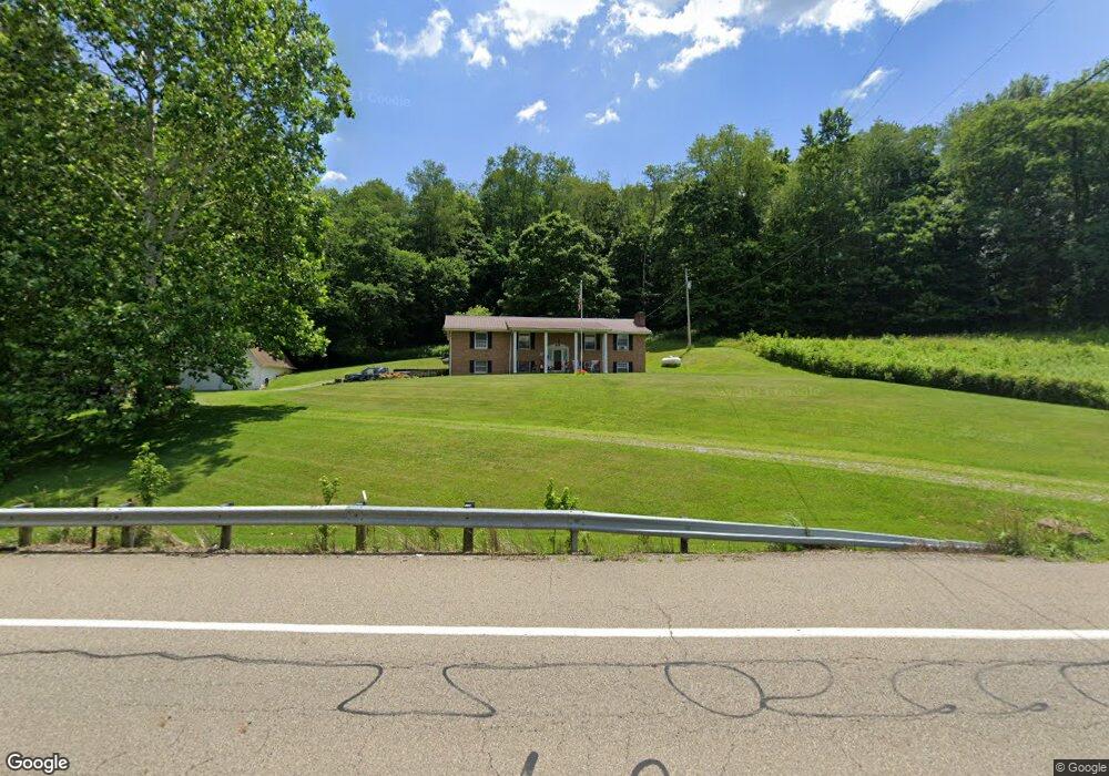
27200 State Route 83 Coshocton, OH 43812
Estimated Value: $181,000 - $338,000
4
Beds
3
Baths
2,168
Sq Ft
$123/Sq Ft
Est. Value
About This Home
This home is located at 27200 State Route 83, Coshocton, OH 43812 and is currently estimated at $267,358, approximately $123 per square foot. 27200 State Route 83 is a home located in Coshocton County with nearby schools including River View High School.
Ownership History
Date
Name
Owned For
Owner Type
Purchase Details
Closed on
Jan 27, 2022
Sold by
Brill John L and Brill Carol A
Bought by
John L Brill And Carol A Brill Revocable Trus and Brill Carol
Current Estimated Value
Purchase Details
Closed on
Dec 12, 2013
Sold by
Brill John L
Bought by
Brill John L and Brill Carol A
Purchase Details
Closed on
Mar 16, 2004
Sold by
Lowe Jack E
Bought by
Lowe Jack E Revocable Living
Create a Home Valuation Report for This Property
The Home Valuation Report is an in-depth analysis detailing your home's value as well as a comparison with similar homes in the area
Home Values in the Area
Average Home Value in this Area
Purchase History
| Date | Buyer | Sale Price | Title Company |
|---|---|---|---|
| John L Brill And Carol A Brill Revocable Trus | -- | None Listed On Document | |
| Brill John L | -- | None Available | |
| Brill John L | $70,000 | None Available | |
| Lowe Jack E Revocable Living | -- | -- |
Source: Public Records
Tax History Compared to Growth
Tax History
| Year | Tax Paid | Tax Assessment Tax Assessment Total Assessment is a certain percentage of the fair market value that is determined by local assessors to be the total taxable value of land and additions on the property. | Land | Improvement |
|---|---|---|---|---|
| 2024 | $1,806 | $62,760 | $11,530 | $51,230 |
| 2023 | $1,806 | $52,623 | $7,711 | $44,912 |
| 2022 | $1,616 | $52,623 | $7,711 | $44,912 |
| 2021 | $1,616 | $52,623 | $7,711 | $44,912 |
| 2020 | $1,289 | $43,492 | $7,725 | $35,767 |
| 2019 | $1,319 | $43,492 | $7,725 | $35,767 |
| 2018 | $1,386 | $43,492 | $7,725 | $35,767 |
| 2017 | $1,494 | $38,945 | $6,885 | $32,060 |
| 2016 | $1,417 | $38,945 | $6,885 | $32,060 |
| 2015 | $708 | $38,945 | $6,885 | $32,060 |
| 2014 | $994 | $36,575 | $4,718 | $31,857 |
Source: Public Records
Map
Nearby Homes
- 0 County Road 1
- 26929 County Road 1
- 26938 County Road 1
- 28427 Ohio 83
- 27892 County Road 25
- 24272 Township Road 1169
- 23900 Airport Rd
- 23749 County Road 621
- 230 Rivercrest Dr
- 217 E Liberty St
- 26405 Township Road 1152
- 77 Retilly Dr
- 23226 Township Road #1194
- 0 Retilley Drive Lot #4784 Dr
- 0 Retilley Drive Lot #4783 Dr
- 0 Retilley Drive Lot #4786 Dr
- 0 Retilley Drive Lot #4785 Dr
- 0 Retilley Drive Lot 4793 Dr
- 0 Retilley Drive Lot 4791 Dr
- 0 Retilley Drive Lot 4789 Dr
- 46785 Township Road 204
- 27101 Township Road 47
- 47023 Township Road 204
- 26906 State Route 83
- 26862 State Route 83
- 47043 Township Road 204
- 27194 Township Road 47
- 47154 Township Road 204
- 47111 Township Road 204
- 47232 Township Road 204
- 47139 Township Road 204
- 26812 Ohio 83
- 47252 Township Road 204
- 47235 Township Road 204
- 26812 State Route 83
- 27256 Township Road 47
- 47249 Township Road 204
- 27149 County Road 1
- 25200 State Route 83
- 25174 State Route 83