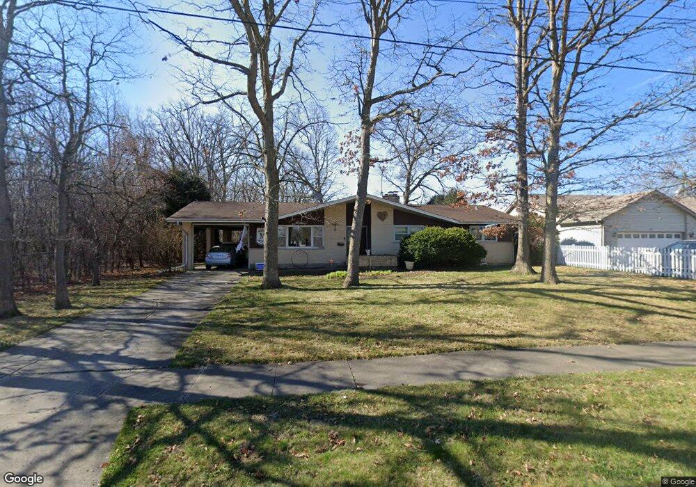
2721 Brookside Ave Waukegan, IL 60085
Washington Hills NeighborhoodEstimated Value: $304,000 - $359,534
3
Beds
2
Baths
2,094
Sq Ft
$160/Sq Ft
Est. Value
About This Home
This home is located at 2721 Brookside Ave, Waukegan, IL 60085 and is currently estimated at $334,384, approximately $159 per square foot. 2721 Brookside Ave is a home located in Lake County with nearby schools including Whittier Elementary School, Robert E. Abbott Middle School, and Waukegan High School.
Ownership History
Date
Name
Owned For
Owner Type
Purchase Details
Closed on
Jun 30, 2004
Sold by
Simpson Paul E and Simpson Phyllis M
Bought by
Moisio Gregory D and Marocco Moisio Gina J
Current Estimated Value
Home Financials for this Owner
Home Financials are based on the most recent Mortgage that was taken out on this home.
Original Mortgage
$181,900
Outstanding Balance
$92,061
Interest Rate
6.42%
Mortgage Type
Purchase Money Mortgage
Estimated Equity
$242,323
Purchase Details
Closed on
Aug 28, 2001
Sold by
Tatem Robert L and Tatem Joyce E
Bought by
Simpson Paul E and Simpson Phyllis M
Home Financials for this Owner
Home Financials are based on the most recent Mortgage that was taken out on this home.
Original Mortgage
$179,000
Interest Rate
6.97%
Purchase Details
Closed on
Apr 11, 1997
Sold by
Tatem Robert L and Tatem Joyce E
Bought by
Tatem Robert L and Tatem Joyce E
Create a Home Valuation Report for This Property
The Home Valuation Report is an in-depth analysis detailing your home's value as well as a comparison with similar homes in the area
Home Values in the Area
Average Home Value in this Area
Purchase History
| Date | Buyer | Sale Price | Title Company |
|---|---|---|---|
| Moisio Gregory D | $214,000 | First American Title Ins Co | |
| Simpson Paul E | -- | Collar Counties Title Plant | |
| Tatem Robert L | -- | -- | |
| Tatem Robert L | -- | -- | |
| Tatem Robert L | -- | -- |
Source: Public Records
Mortgage History
| Date | Status | Borrower | Loan Amount |
|---|---|---|---|
| Open | Moisio Gregory D | $181,900 | |
| Previous Owner | Simpson Paul E | $179,000 |
Source: Public Records
Tax History Compared to Growth
Tax History
| Year | Tax Paid | Tax Assessment Tax Assessment Total Assessment is a certain percentage of the fair market value that is determined by local assessors to be the total taxable value of land and additions on the property. | Land | Improvement |
|---|---|---|---|---|
| 2024 | $9,324 | $119,374 | $19,403 | $99,971 |
| 2023 | $9,324 | $106,877 | $17,372 | $89,505 |
| 2022 | $9,628 | $104,482 | $20,228 | $84,254 |
| 2021 | $8,691 | $89,366 | $17,283 | $72,083 |
| 2020 | $8,757 | $83,255 | $16,101 | $67,154 |
| 2019 | $8,761 | $76,290 | $14,754 | $61,536 |
| 2018 | $8,366 | $71,091 | $18,983 | $52,108 |
| 2017 | $8,093 | $62,896 | $16,795 | $46,101 |
| 2016 | $7,519 | $54,654 | $14,594 | $40,060 |
| 2015 | $7,250 | $48,916 | $13,062 | $35,854 |
| 2014 | $5,018 | $35,201 | $11,293 | $23,908 |
| 2012 | $6,439 | $38,135 | $12,233 | $25,902 |
Source: Public Records
Map
Nearby Homes
- 0 Brookside Ave
- 102 Baldwin Ave
- 24 Washington Terrace
- 3170 W Monroe St Unit 309
- 615 Tiffany Dr
- 621 N Austin Ave
- 34887 N Austin Ave
- 603 N Austin Ave
- 12698 W Grandview Ave
- 1213 Grand Ave
- 12716 W Grandview Ave
- 2726 W Hidden Glen Dr
- 525 Lawrence Ave
- 3210 W Grandview Ave
- 49 S Lewis Ave
- 132 Dorchester Ct
- 12601 W Atlantic Ave
- 2116 & 2101 Williamsburg Dr
- 3482 Ellis Ave
- 2813 Theresa Ave
- 2725 Brookside Ave
- 2720 Brookside Ave
- 215 N Metropolitan Ave
- 2741 Brookside Ave
- 2710 Brookside Ave
- 2730 Brookside Ave
- 335 N Pioneer Rd
- 2700 Brookside Ave
- 405 N Metropolitan Ave
- 338 N Pioneer Rd
- 336 N Evergreen Ave
- 407 N Metropolitan Ave
- 214 N Metropolitan Ave
- 2805 Brookside Ave
- 212 N Metropolitan Ave
- 2800 Brookside Ave
- 400 N Evergreen Ave
- 401 N Pioneer Rd
- 421 N Metropolitan Ave
- 206 N Metropolitan Ave