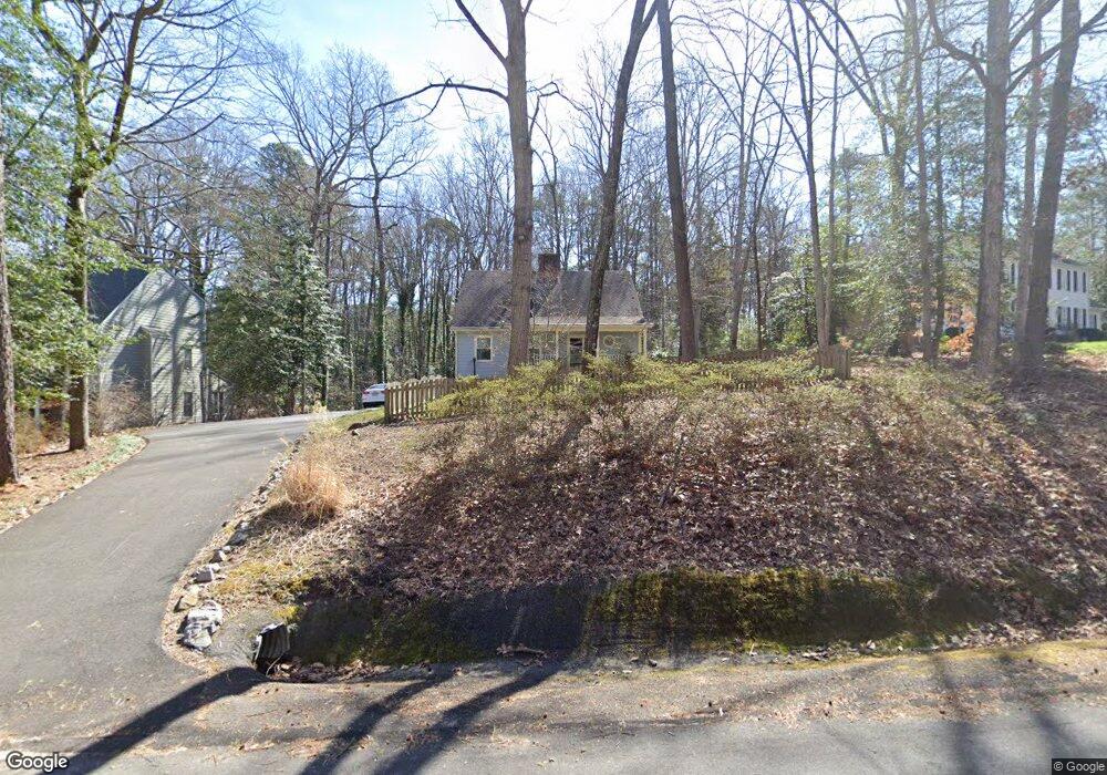
2721 Lansdale Rd Richmond, VA 23225
Oxford NeighborhoodEstimated Value: $459,000 - $495,000
3
Beds
2
Baths
1,666
Sq Ft
$290/Sq Ft
Est. Value
About This Home
This home is located at 2721 Lansdale Rd, Richmond, VA 23225 and is currently estimated at $482,697, approximately $289 per square foot. 2721 Lansdale Rd is a home located in Richmond City with nearby schools including J.B. Fisher Elementary School, Lucille M. Brown Middle, and Huguenot High School.
Ownership History
Date
Name
Owned For
Owner Type
Purchase Details
Closed on
Feb 28, 2008
Sold by
Neighbors Deborah H
Bought by
Burke John J
Current Estimated Value
Home Financials for this Owner
Home Financials are based on the most recent Mortgage that was taken out on this home.
Original Mortgage
$191,920
Outstanding Balance
$119,948
Interest Rate
5.8%
Mortgage Type
New Conventional
Estimated Equity
$362,749
Purchase Details
Closed on
Jun 20, 2001
Bought by
Neighbors Deborah H
Home Financials for this Owner
Home Financials are based on the most recent Mortgage that was taken out on this home.
Original Mortgage
$122,816
Interest Rate
7.09%
Mortgage Type
FHA
Purchase Details
Closed on
Sep 29, 1999
Sold by
Nix Cheryl M
Bought by
Neighbors Deborah H
Home Financials for this Owner
Home Financials are based on the most recent Mortgage that was taken out on this home.
Original Mortgage
$124,503
Interest Rate
7.85%
Mortgage Type
FHA
Create a Home Valuation Report for This Property
The Home Valuation Report is an in-depth analysis detailing your home's value as well as a comparison with similar homes in the area
Home Values in the Area
Average Home Value in this Area
Purchase History
| Date | Buyer | Sale Price | Title Company |
|---|---|---|---|
| Burke John J | $239,900 | -- | |
| Neighbors Deborah H | -- | -- | |
| Neighbors Deborah H | $125,000 | -- |
Source: Public Records
Mortgage History
| Date | Status | Borrower | Loan Amount |
|---|---|---|---|
| Open | Burke John J | $191,920 | |
| Previous Owner | Neighbors Deborah H | $122,816 | |
| Previous Owner | Neighbors Deborah H | $124,503 |
Source: Public Records
Tax History Compared to Growth
Tax History
| Year | Tax Paid | Tax Assessment Tax Assessment Total Assessment is a certain percentage of the fair market value that is determined by local assessors to be the total taxable value of land and additions on the property. | Land | Improvement |
|---|---|---|---|---|
| 2025 | $5,196 | $433,000 | $108,000 | $325,000 |
| 2024 | $5,040 | $420,000 | $96,000 | $324,000 |
| 2023 | $4,776 | $398,000 | $86,000 | $312,000 |
| 2022 | $4,164 | $347,000 | $75,000 | $272,000 |
| 2021 | $3,396 | $286,000 | $55,000 | $231,000 |
| 2020 | $3,871 | $283,000 | $55,000 | $228,000 |
| 2019 | $2,652 | $221,000 | $55,000 | $166,000 |
| 2018 | $2,376 | $198,000 | $55,000 | $143,000 |
| 2017 | $2,688 | $224,000 | $55,000 | $169,000 |
| 2016 | $2,652 | $221,000 | $55,000 | $166,000 |
| 2015 | $2,532 | $211,000 | $50,000 | $161,000 |
| 2014 | $2,532 | $211,000 | $50,000 | $161,000 |
Source: Public Records
Map
Nearby Homes
- 2607 Lansdale Rd
- 8031 Burrundie Dr
- 2313 Stratford Ct
- 3041 Darnley Dr
- 8324 Chelmford Rd
- 3120 Archdale Rd
- 8001 Robert Bruce Dr
- 8265 Halstead Rd
- 3350 E Weyburn Rd
- 3010 Scherer Dr
- 8405 Forest Hill Ave
- 2000 Bloomfield Rd
- 2924 Halstead Rd
- 8208 Avignon Dr
- 8512 Ben Nevis Dr
- 3600 Sherbrook Rd
- 8633 Devara Ct
- 7709 Prairie Rd
- 3006 Bradwill Rd
- 3416 Rivanna Dr
- 2715 Lansdale Rd
- 2731 Lansdale Rd
- 7930 Burrundie Dr
- 2730 Lansdale Rd
- 2720 Lansdale Rd
- 2701 Lansdale Rd
- 2801 Lansdale Rd
- 2740 Lansdale Rd
- 2710 Lansdale Rd
- 7920 Burrundie Dr
- 2800 Lansdale Rd
- 2720 Kenbury Rd
- 2710 Kenbury Rd
- 2811 Lansdale Rd
- 7910 Burrundie Dr
- 2810 Lansdale Rd
- 7945 Burrundie Dr
- 2728 Kenbury Rd
- 2620 Lansdale Rd
- 7935 Burrundie Dr