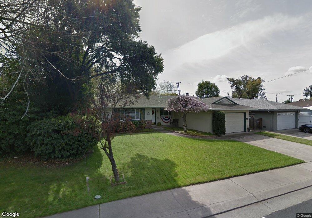
2724 W Swain Rd Stockton, CA 95207
Lincoln Village NeighborhoodEstimated Value: $263,000 - $473,000
3
Beds
2
Baths
1,351
Sq Ft
$302/Sq Ft
Est. Value
About This Home
This home is located at 2724 W Swain Rd, Stockton, CA 95207 and is currently estimated at $407,697, approximately $301 per square foot. 2724 W Swain Rd is a home located in San Joaquin County with nearby schools including Tully C. Knoles School, Sierra Middle School, and Lincoln High School.
Ownership History
Date
Name
Owned For
Owner Type
Purchase Details
Closed on
Apr 19, 2021
Sold by
Thomas David G and Thomas David G
Bought by
Thomas David G and Thomas Delaine I
Current Estimated Value
Purchase Details
Closed on
Feb 18, 2020
Sold by
Thomas Daniel G and Thomas Delaine I
Bought by
Thomas Daniel G and Thomas Delaine L
Home Financials for this Owner
Home Financials are based on the most recent Mortgage that was taken out on this home.
Original Mortgage
$221,000
Interest Rate
3.6%
Mortgage Type
New Conventional
Purchase Details
Closed on
Dec 30, 2009
Sold by
Thomas David G and Thomas Delaine I
Bought by
The David G Thomas & Delaine I Thomas 20
Create a Home Valuation Report for This Property
The Home Valuation Report is an in-depth analysis detailing your home's value as well as a comparison with similar homes in the area
Home Values in the Area
Average Home Value in this Area
Purchase History
| Date | Buyer | Sale Price | Title Company |
|---|---|---|---|
| Thomas David G | -- | Amrock Llc | |
| Thomas Daniel G | -- | Avenue 365 Lender Svcs Llc | |
| The David G Thomas & Delaine I Thomas 20 | -- | None Available |
Source: Public Records
Mortgage History
| Date | Status | Borrower | Loan Amount |
|---|---|---|---|
| Closed | Thomas Daniel G | $221,000 |
Source: Public Records
Tax History Compared to Growth
Tax History
| Year | Tax Paid | Tax Assessment Tax Assessment Total Assessment is a certain percentage of the fair market value that is determined by local assessors to be the total taxable value of land and additions on the property. | Land | Improvement |
|---|---|---|---|---|
| 2025 | $4,644 | $215,727 | $103,174 | $112,553 |
| 2024 | $4,499 | $211,498 | $101,151 | $110,347 |
| 2023 | $4,395 | $207,352 | $99,168 | $108,184 |
| 2022 | $4,007 | $203,287 | $97,224 | $106,063 |
| 2021 | $3,935 | $199,302 | $95,318 | $103,984 |
| 2020 | $3,899 | $197,259 | $94,341 | $102,918 |
| 2019 | $3,862 | $193,392 | $92,492 | $100,900 |
| 2018 | $3,776 | $189,601 | $90,679 | $98,922 |
| 2017 | $3,838 | $185,884 | $88,901 | $96,983 |
| 2016 | $3,520 | $182,239 | $87,158 | $95,081 |
| 2014 | $3,610 | $175,987 | $84,168 | $91,819 |
Source: Public Records
Map
Nearby Homes
- 2914 Prentiss Ct
- 2922 Prentiss Ct
- 6415 Plymouth Rd
- 2935 Prentiss Ct Unit 1844
- 2447 Calhoun Way
- 2921 Rutledge Ct
- 5734 Turtle Valley Dr
- 5713 Turtle Valley Dr
- 3102 W Swain Rd
- 2252 Canyon Creek Dr
- 6078 Carolina Cir
- 6406 Grigsby Place
- 2421 Meadow Lake Dr
- 3115 Polk Way
- 5633 Brush Creek Dr
- 5815 Morgan Place Unit 18
- 5833 Morgan Place Unit 60
- 2252 W Benjamin Holt Dr
- 5522 Teal Ct
- 2128 Canyon Creek Dr
- 2734 W Swain Rd
- 2714 W Swain Rd
- 2744 W Swain Rd
- 2706 W Swain Rd
- 2754 W Swain Rd
- 2725 W Swain Rd
- 2715 W Swain Rd
- 2735 W Swain Rd
- 2644 W Swain Rd
- 2705 W Swain Rd
- 2745 W Swain Rd
- 2764 W Swain Rd
- 2635 W Swain Rd
- 2634 W Swain Rd
- 6104 Culpepper Place
- 2633 Porter Way
- 2804 W Swain Rd
- 2624 W Swain Rd
- 2732 Douglas Rd
- 2744 Douglas Rd Unit 30