Estimated Value: $162,000 - $192,000
3
Beds
3
Baths
1,279
Sq Ft
$137/Sq Ft
Est. Value
About This Home
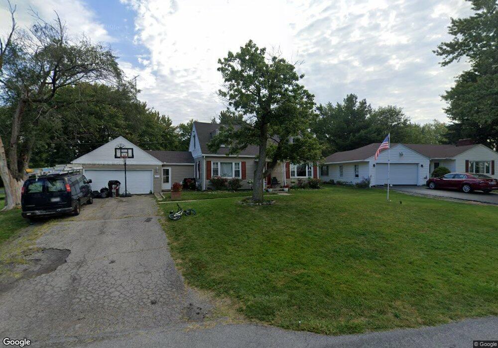
This home is located at 2725 Lost Creek Blvd, Lima, OH 45804 and is currently estimated at $175,170, approximately $136 per square foot. 2725 Lost Creek Blvd is a home located in Allen County with nearby schools including Bath Elementary School, Bath Middle School, and Bath High School.
Ownership History
Date
Name
Owned For
Owner Type
Purchase Details
Closed on
Apr 16, 2018
Sold by
Collins Pamela M
Bought by
Collins Anthony S
Current Estimated Value
Purchase Details
Closed on
May 7, 2012
Sold by
Lawrence Brent J and Lawrence Rebecca K
Bought by
Collins Pamela
Purchase Details
Closed on
Nov 8, 1996
Sold by
Faber James
Bought by
Lawrence Brent
Home Financials for this Owner
Home Financials are based on the most recent Mortgage that was taken out on this home.
Original Mortgage
$45,000
Interest Rate
8.26%
Mortgage Type
New Conventional
Purchase Details
Closed on
Jul 1, 1994
Sold by
Whetsel Lois
Bought by
Faber James and Faber Melissa
Home Financials for this Owner
Home Financials are based on the most recent Mortgage that was taken out on this home.
Original Mortgage
$67,100
Interest Rate
8.66%
Mortgage Type
New Conventional
Purchase Details
Closed on
Mar 23, 1990
Bought by
Whetsel Lois
Create a Home Valuation Report for This Property
The Home Valuation Report is an in-depth analysis detailing your home's value as well as a comparison with similar homes in the area
Home Values in the Area
Average Home Value in this Area
Purchase History
| Date | Buyer | Sale Price | Title Company |
|---|---|---|---|
| Collins Anthony S | -- | None Available | |
| Collins Pamela | $63,000 | Attorney | |
| Lawrence Brent | $85,500 | -- | |
| Faber James | $79,000 | -- | |
| Whetsel Lois | -- | -- |
Source: Public Records
Mortgage History
| Date | Status | Borrower | Loan Amount |
|---|---|---|---|
| Previous Owner | Lawrence Brent | $45,000 | |
| Previous Owner | Faber James | $67,100 |
Source: Public Records
Tax History Compared to Growth
Tax History
| Year | Tax Paid | Tax Assessment Tax Assessment Total Assessment is a certain percentage of the fair market value that is determined by local assessors to be the total taxable value of land and additions on the property. | Land | Improvement |
|---|---|---|---|---|
| 2024 | $2,052 | $45,540 | $8,370 | $37,170 |
| 2023 | $1,673 | $35,840 | $6,580 | $29,260 |
| 2022 | $1,694 | $35,840 | $6,580 | $29,260 |
| 2021 | $1,695 | $35,840 | $6,580 | $29,260 |
| 2020 | $1,616 | $31,300 | $6,340 | $24,960 |
| 2019 | $1,616 | $31,300 | $6,340 | $24,960 |
| 2018 | $1,503 | $31,300 | $6,340 | $24,960 |
| 2017 | $1,410 | $28,040 | $6,340 | $21,700 |
| 2016 | $1,408 | $28,040 | $6,340 | $21,700 |
| 2015 | $1,471 | $28,040 | $6,340 | $21,700 |
| 2014 | $1,471 | $28,530 | $6,340 | $22,190 |
| 2013 | $1,481 | $28,530 | $6,340 | $22,190 |
Source: Public Records
Map
Nearby Homes
- 696 Mount Holyoke Ave
- 120 Barnsbury Dr
- 620 Willard Ave
- 2223 Makin Dr
- 800 Heritage Dr
- 710 Kingswood Dr
- 263 Barnsbury Dr
- 287 Barnsbury Dr
- 524 S Collins Ave
- 573 Waterview Cir
- 00 Bellefontaine Ave
- 1820 Bowman Rd
- 304 Pinewood Cir
- 329 Eastwood Dr
- 3762 Mt Vernon Place Unit . A
- 222 Pinewood Cir
- 3805 Cambridge Place
- 303 Pinewood Cir
- 1093 S Sugar St
- 211 Pinewood Cir