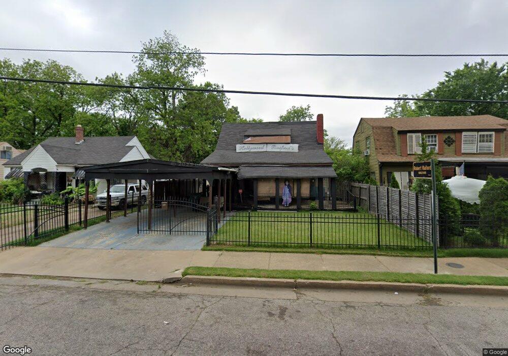
2728 Kimball Ave Memphis, TN 38114
Southeast Memphis NeighborhoodEstimated Value: $67,000 - $117,000
4
Beds
1
Bath
1,592
Sq Ft
$54/Sq Ft
Est. Value
About This Home
This home is located at 2728 Kimball Ave, Memphis, TN 38114 and is currently estimated at $86,152, approximately $54 per square foot. 2728 Kimball Ave is a home located in Shelby County with nearby schools including Bethel Grove Elementary School, Sherwood Middle, and Melrose High School.
Ownership History
Date
Name
Owned For
Owner Type
Purchase Details
Closed on
Jul 16, 2025
Sold by
Raiford Carolyn
Bought by
Raiford Paula
Current Estimated Value
Purchase Details
Closed on
Apr 25, 2014
Sold by
Raiford Paula A
Bought by
Raiford Robert
Purchase Details
Closed on
Jun 10, 2008
Sold by
Railford Robert
Bought by
Raiford Paula A
Purchase Details
Closed on
Jun 26, 2006
Sold by
Mortgage Lenders Electronic Registration
Bought by
Raiford Robert
Purchase Details
Closed on
Apr 14, 2005
Sold by
Ross Diane
Bought by
Mortgage Electronic Registration Systems and Residential Funding Corp
Create a Home Valuation Report for This Property
The Home Valuation Report is an in-depth analysis detailing your home's value as well as a comparison with similar homes in the area
Home Values in the Area
Average Home Value in this Area
Purchase History
| Date | Buyer | Sale Price | Title Company |
|---|---|---|---|
| Raiford Paula | -- | None Listed On Document | |
| Raiford Robert | -- | None Available | |
| Raiford Paula A | -- | None Available | |
| Raiford Robert | $20,000 | Associates Closing & Title H | |
| Mortgage Electronic Registration Systems | $46,955 | -- |
Source: Public Records
Tax History Compared to Growth
Tax History
| Year | Tax Paid | Tax Assessment Tax Assessment Total Assessment is a certain percentage of the fair market value that is determined by local assessors to be the total taxable value of land and additions on the property. | Land | Improvement |
|---|---|---|---|---|
| 2025 | $429 | $16,850 | $2,450 | $14,400 |
| 2024 | $429 | $12,650 | $1,125 | $11,525 |
| 2023 | $771 | $12,650 | $1,125 | $11,525 |
| 2022 | $771 | $12,650 | $1,125 | $11,525 |
| 2021 | $780 | $12,650 | $1,125 | $11,525 |
| 2020 | $643 | $8,875 | $1,125 | $7,750 |
| 2019 | $643 | $8,875 | $1,125 | $7,750 |
| 2018 | $643 | $8,875 | $1,125 | $7,750 |
| 2017 | $365 | $8,875 | $1,125 | $7,750 |
| 2016 | $392 | $8,975 | $0 | $0 |
| 2014 | $392 | $8,975 | $0 | $0 |
Source: Public Records
Map
Nearby Homes
- 2764 Burns Ave
- 2768 Burns Ave
- 2637 Arlington Ave
- 1928 Brandon Cir
- 2727 Dunn Ave
- 2589 Browning Ave
- 2481 Browning Ave
- 2763 Fizer Rd
- 2585 Filmore Ave
- 2621 Dunn Ave
- 2758 Smith Haven Dr
- 2607 Barron Ave
- 2481 Kimball Ave
- 2715 Donna Ave
- 1580 Marianna St
- 1609 Hugenot St
- 2126 Labelle St
- 2904 Barron Ave
- 3017 Gulf Ave Unit 7
- 2901 N Harris Cir
- 2724 Kimball Ave
- 2734 Kimball Ave
- 2718 Kimball Ave
- 2738 Kimball Ave
- 2744 Kimball Ave Unit 1
- 2744 Kimball Ave
- 2714 Kimball Ave
- 2717 Lowell Ave
- 2727 Kimball Ave
- 2708 Kimball Ave
- 2733 Kimball Ave
- 2719 Kimball Ave
- 2711 Lowell Ave
- 2737 Kimball Ave
- 2715 Kimball Ave
- 2704 Kimball Ave
- 2741 Kimball Ave
- 2707 Lowell Ave
- 2707 Kimball Ave
- 2703 Lowell Ave