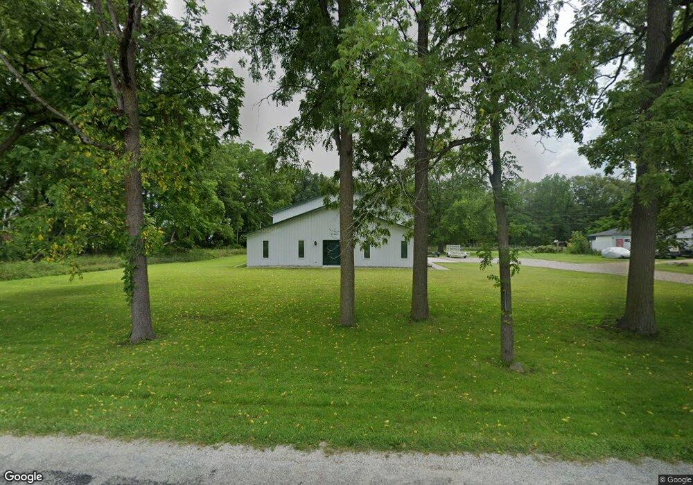
27320 R-Drive N Albion, MI 49224
--
Bed
--
Bath
4,224
Sq Ft
3.23
Acres
About This Home
This home is located at 27320 R-Drive N, Albion, MI 49224. 27320 R-Drive N is a home located in Calhoun County with nearby schools including Springport Elementary School, Springport Middle School, and Springport High School.
Ownership History
Date
Name
Owned For
Owner Type
Purchase Details
Closed on
Sep 7, 2012
Sold by
Okeefe Road Family Limited Partnership
Bought by
Konkle Bernard L and Konkle Amy L
Home Financials for this Owner
Home Financials are based on the most recent Mortgage that was taken out on this home.
Original Mortgage
$92,000
Outstanding Balance
$41,873
Interest Rate
4.5%
Mortgage Type
Commercial
Purchase Details
Closed on
Apr 14, 2011
Sold by
Chemical Bank
Bought by
O Keefe Road Family Limited Partnership
Purchase Details
Closed on
Nov 17, 2010
Sold by
Durelle Manufacturing Inc
Bought by
Burnett John W and Burnett Martha S
Create a Home Valuation Report for This Property
The Home Valuation Report is an in-depth analysis detailing your home's value as well as a comparison with similar homes in the area
Home Values in the Area
Average Home Value in this Area
Purchase History
| Date | Buyer | Sale Price | Title Company |
|---|---|---|---|
| Konkle Bernard L | -- | Chicago Title | |
| O Keefe Road Family Limited Partnership | $120,000 | None Available | |
| Burnett John W | -- | None Available |
Source: Public Records
Mortgage History
| Date | Status | Borrower | Loan Amount |
|---|---|---|---|
| Open | Konkle Bernard L | $92,000 |
Source: Public Records
Tax History Compared to Growth
Tax History
| Year | Tax Paid | Tax Assessment Tax Assessment Total Assessment is a certain percentage of the fair market value that is determined by local assessors to be the total taxable value of land and additions on the property. | Land | Improvement |
|---|---|---|---|---|
| 2025 | $3,286 | $80,500 | $0 | $0 |
| 2024 | $735 | $76,000 | $0 | $0 |
| 2023 | $2,890 | $74,300 | $0 | $0 |
| 2022 | $2,890 | $64,600 | $0 | $0 |
| 2021 | $2,765 | $59,000 | $0 | $0 |
| 2020 | $2,765 | $59,300 | $0 | $0 |
| 2019 | $0 | $68,200 | $0 | $0 |
| 2018 | $0 | $55,800 | $22,700 | $33,100 |
| 2017 | $0 | $67,200 | $0 | $0 |
| 2016 | $0 | $66,200 | $0 | $0 |
| 2015 | -- | $54,100 | $37,869 | $16,231 |
| 2014 | -- | $58,200 | $37,740 | $20,460 |
Source: Public Records
Map
Nearby Homes
- 2321 Country Club Way
- 26838 Q-Drive N
- 4643 Anderson Rd
- 1551 Charlotte Landing Rd
- 20933 26 Mile Rd
- 19822 27 1 2 Mile Rd
- 21602 26 Mile Rd
- 29510 S Dr N
- 0 R-Drive N
- 26506 E Baseline Hwy
- 16711 Stark Rd
- 16594 Stark Rd
- 17208 28 Mile Rd
- 8746 Lake Dr
- 15885 Mcclellan Rd
- 406 Green St
- 0 Green St
- 8659 Narrow Lake Rd
- 3040 Luella Ln
- 231 Bay Port Cir Unit 68
- 27300 R Dr N
- 27382 R Dr N
- 27450 R Dr N
- 20065 27 1/2 Mile Rd
- 0 R Dr N Unit 201603593
- 0 R Dr N Unit 201604538
- 0 R Dr N Unit 55021038900
- 0 R Dr N Unit 55021039008
- 0 R Dr N Unit M21039008
- 0 R Dr N Unit M21038900
- 20985 27 1 2 Mile Rd
- 20985 27 1/2 Mile Rd
- 21179 27 1/2 Mile Rd
- 20711 27 1/2 Mile Rd
- 21407 27 1/2 Mile Rd
- 27512 S Dr N
- 3481 Country Club Way
- 3461 Country Club Way
- 3471 Country Club Way
- 3401 Country Club Way
