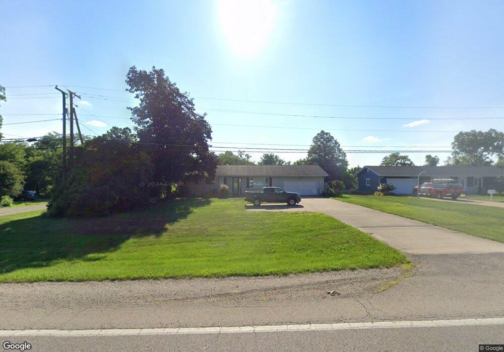
2733 Shreve Rd Wooster, OH 44691
Estimated Value: $277,000 - $327,000
3
Beds
2
Baths
1,344
Sq Ft
$217/Sq Ft
Est. Value
About This Home
This home is located at 2733 Shreve Rd, Wooster, OH 44691 and is currently estimated at $291,418, approximately $216 per square foot. 2733 Shreve Rd is a home located in Wayne County with nearby schools including Triway High School, St. Mary of Immaculate Conception School, and Country Corner.
Ownership History
Date
Name
Owned For
Owner Type
Purchase Details
Closed on
Mar 24, 2021
Sold by
Lindeman Michael S and Lindeman Sarah E
Bought by
Grosjean Ronald and Grosjean Jane
Current Estimated Value
Purchase Details
Closed on
Sep 13, 2004
Sold by
Wise Kenneth A and Wise Cindy R
Bought by
Lindeman Michael S and Lindeman Sarah E
Home Financials for this Owner
Home Financials are based on the most recent Mortgage that was taken out on this home.
Original Mortgage
$99,000
Interest Rate
6.08%
Mortgage Type
Unknown
Purchase Details
Closed on
Jul 12, 2001
Sold by
Davenport Douglas D
Bought by
Wise Ii Kenneth A Cindy R
Home Financials for this Owner
Home Financials are based on the most recent Mortgage that was taken out on this home.
Original Mortgage
$107,942
Interest Rate
7.27%
Mortgage Type
New Conventional
Create a Home Valuation Report for This Property
The Home Valuation Report is an in-depth analysis detailing your home's value as well as a comparison with similar homes in the area
Home Values in the Area
Average Home Value in this Area
Purchase History
| Date | Buyer | Sale Price | Title Company |
|---|---|---|---|
| Grosjean Ronald | $235,000 | None Available | |
| Lindeman Michael S | $127,000 | Service First Title Agency L | |
| Wise Ii Kenneth A Cindy R | $117,469 | -- |
Source: Public Records
Mortgage History
| Date | Status | Borrower | Loan Amount |
|---|---|---|---|
| Previous Owner | Lindeman Michael S | $99,000 | |
| Previous Owner | Wise Ii Kenneth A Cindy R | $107,942 |
Source: Public Records
Tax History Compared to Growth
Tax History
| Year | Tax Paid | Tax Assessment Tax Assessment Total Assessment is a certain percentage of the fair market value that is determined by local assessors to be the total taxable value of land and additions on the property. | Land | Improvement |
|---|---|---|---|---|
| 2024 | $2,936 | $78,300 | $10,010 | $68,290 |
| 2023 | $2,936 | $78,300 | $10,010 | $68,290 |
| 2022 | $2,029 | $48,880 | $7,470 | $41,410 |
| 2021 | $1,849 | $48,880 | $7,470 | $41,410 |
| 2020 | $1,871 | $48,880 | $7,470 | $41,410 |
| 2019 | $1,612 | $40,590 | $6,480 | $34,110 |
| 2018 | $1,641 | $40,590 | $6,480 | $34,110 |
| 2017 | $1,592 | $40,590 | $6,480 | $34,110 |
| 2016 | $1,586 | $38,960 | $6,480 | $32,480 |
| 2015 | $1,550 | $38,960 | $6,480 | $32,480 |
| 2014 | $1,551 | $38,960 | $6,480 | $32,480 |
| 2013 | $1,692 | $40,790 | $6,220 | $34,570 |
Source: Public Records
Map
Nearby Homes
- 2430 S Columbus Rd
- 0 Batdorf Rd
- 1131 Curtwood Dr
- 2844 Morning Hill Dr
- 1970 Batdorf Rd
- 2560 Rutt Ct
- 0 Blachleyville Rd
- 3979 Batdorf Rd
- 3940 Batdorf Rd
- 3532 Triway Ln
- 1740 Barnes Dr
- 0 Heyl Rd
- 1174 Columbus Rd
- 349 W North St
- 323 N Grant St
- 229 N Walnut St
- 227 N Walnut St
- 450 N Grant St
- 537 N Grant St
- 423 N Market St