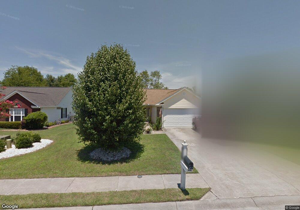
2734 Canvasback Trail Myrtle Beach, SC 29588
Estimated Value: $288,000 - $314,000
3
Beds
2
Baths
1,430
Sq Ft
$209/Sq Ft
Est. Value
About This Home
This home is located at 2734 Canvasback Trail, Myrtle Beach, SC 29588 and is currently estimated at $299,500, approximately $209 per square foot. 2734 Canvasback Trail is a home located in Horry County with nearby schools including Forestbrook Elementary School, Forestbrook Middle School, and Socastee High School.
Ownership History
Date
Name
Owned For
Owner Type
Purchase Details
Closed on
Sep 7, 2001
Sold by
Covenant Construction Inc
Bought by
Andrews Thomas Woodson
Current Estimated Value
Home Financials for this Owner
Home Financials are based on the most recent Mortgage that was taken out on this home.
Original Mortgage
$111,920
Outstanding Balance
$47,623
Interest Rate
8.25%
Mortgage Type
Purchase Money Mortgage
Estimated Equity
$251,877
Purchase Details
Closed on
Nov 8, 2000
Sold by
Hunters Ridge Of Myrtle Beach Inc
Bought by
Covenant Construction Inc
Home Financials for this Owner
Home Financials are based on the most recent Mortgage that was taken out on this home.
Original Mortgage
$106,400
Interest Rate
7.87%
Mortgage Type
Purchase Money Mortgage
Create a Home Valuation Report for This Property
The Home Valuation Report is an in-depth analysis detailing your home's value as well as a comparison with similar homes in the area
Home Values in the Area
Average Home Value in this Area
Purchase History
| Date | Buyer | Sale Price | Title Company |
|---|---|---|---|
| Andrews Thomas Woodson | $139,900 | -- | |
| Covenant Construction Inc | $24,900 | -- |
Source: Public Records
Mortgage History
| Date | Status | Borrower | Loan Amount |
|---|---|---|---|
| Open | Andrews Thomas Woodson | $111,920 | |
| Previous Owner | Covenant Construction Inc | $106,400 |
Source: Public Records
Tax History Compared to Growth
Tax History
| Year | Tax Paid | Tax Assessment Tax Assessment Total Assessment is a certain percentage of the fair market value that is determined by local assessors to be the total taxable value of land and additions on the property. | Land | Improvement |
|---|---|---|---|---|
| 2024 | $722 | $11,152 | $4,402 | $6,750 |
| 2023 | $722 | $5,984 | $1,536 | $4,448 |
| 2021 | $656 | $7,093 | $1,829 | $5,264 |
| 2020 | $566 | $7,093 | $1,829 | $5,264 |
| 2019 | $566 | $7,093 | $1,829 | $5,264 |
| 2018 | $510 | $5,204 | $1,336 | $3,868 |
| 2017 | $495 | $5,204 | $1,336 | $3,868 |
| 2016 | -- | $5,204 | $1,336 | $3,868 |
| 2015 | $495 | $5,204 | $1,336 | $3,868 |
| 2014 | $458 | $5,204 | $1,336 | $3,868 |
Source: Public Records
Map
Nearby Homes
- 2723 Canvasback Trail
- 2707 Canvasback Trail
- 2540 Bearstand Trail
- 2459 Hunters Trail
- 2425 Hunters Trail
- 3007 Visionary Dr
- 3845 Camden Dr
- 781 Harrison Mill St
- 4121 Whatuthink Rd
- 621 Cottontail Trail
- 2012 Felicity Place
- 3312 Piney Woods Way
- 916 Laconic Dr
- 133 Marsh Rabbit Dr
- 837 Harrison Mill St
- 795 Laconic Dr Unit Starling Model Home
- 221 Black Bear Rd
- 3217 Shadowpine Ct
- 343 Forestbrook Cove Cir
- 3122 Visionary Dr Unit 776
- 2736 Canvasback Trail
- 2732 Canvasback Trail
- 2738 Canvasback Trail
- 2730 Canvasback Trail
- 2601 Corn Pile Rd
- 2601 Corn Pile Rd
- 2600 Corn Pile Rd
- 2731 Canvasback Trail
- 2740 Canvasback Trail
- 2728 Canvasback Trail
- 2729 Canvasback Trail
- 2602 Corn Pile Rd
- 2726 Canvasback Trail Unit Hunters Ridge
- 2726 Canvasback Trail
- 2605 Corn Pile Rd
- 2727 Canvasback Trail
- 2802 Six Shot Ct
- 2607 Corn Pile Rd
- 2599 Buck Scrape Rd
- 2800 Six Shot Ct