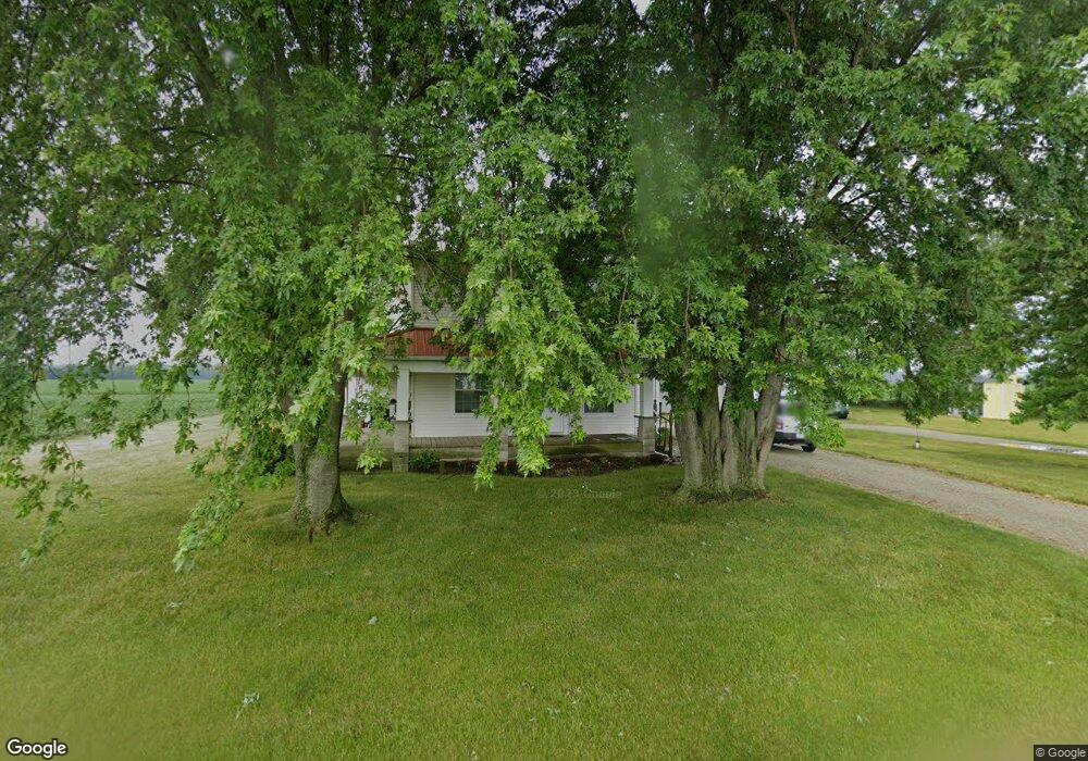
2737 W 600 N Leesburg, IN 46538
Estimated Value: $228,216 - $419,000
5
Beds
2
Baths
1,996
Sq Ft
$155/Sq Ft
Est. Value
About This Home
This home is located at 2737 W 600 N, Leesburg, IN 46538 and is currently estimated at $308,804, approximately $154 per square foot. 2737 W 600 N is a home located in Kosciusko County with nearby schools including Madison Elementary School, Edgewood Middle School, and Warsaw Community High School.
Ownership History
Date
Name
Owned For
Owner Type
Purchase Details
Closed on
Dec 1, 2022
Sold by
Lenfestey Cawren
Bought by
Lenfestey Cawren and Rich Kristie N
Current Estimated Value
Purchase Details
Closed on
Apr 30, 2007
Sold by
Hammack Charles E
Bought by
Young Kolin and Young Sherry
Home Financials for this Owner
Home Financials are based on the most recent Mortgage that was taken out on this home.
Original Mortgage
$106,500
Interest Rate
7%
Mortgage Type
Adjustable Rate Mortgage/ARM
Purchase Details
Closed on
Apr 27, 2007
Sold by
Young Kolin and Young Sherry
Bought by
Lenfesley Cawren
Home Financials for this Owner
Home Financials are based on the most recent Mortgage that was taken out on this home.
Original Mortgage
$106,500
Interest Rate
7%
Mortgage Type
Adjustable Rate Mortgage/ARM
Purchase Details
Closed on
Aug 13, 1999
Sold by
Metz Doris A
Bought by
Hammack Charles E
Create a Home Valuation Report for This Property
The Home Valuation Report is an in-depth analysis detailing your home's value as well as a comparison with similar homes in the area
Home Values in the Area
Average Home Value in this Area
Purchase History
| Date | Buyer | Sale Price | Title Company |
|---|---|---|---|
| Lenfestey Cawren | -- | None Listed On Document | |
| Young Kolin | -- | None Available | |
| Lenfesley Cawren | -- | None Available | |
| Hammack Charles E | $10,629 | -- |
Source: Public Records
Mortgage History
| Date | Status | Borrower | Loan Amount |
|---|---|---|---|
| Previous Owner | Young Kolin | $106,500 | |
| Previous Owner | Lenfesley Cawren | $106,500 |
Source: Public Records
Tax History Compared to Growth
Tax History
| Year | Tax Paid | Tax Assessment Tax Assessment Total Assessment is a certain percentage of the fair market value that is determined by local assessors to be the total taxable value of land and additions on the property. | Land | Improvement |
|---|---|---|---|---|
| 2024 | $1,179 | $198,200 | $22,000 | $176,200 |
| 2023 | $1,055 | $183,800 | $22,000 | $161,800 |
| 2022 | $1,103 | $183,300 | $22,000 | $161,300 |
| 2021 | $899 | $158,600 | $22,000 | $136,600 |
| 2020 | $873 | $152,500 | $20,000 | $132,500 |
| 2019 | $792 | $146,600 | $20,000 | $126,600 |
| 2018 | $743 | $138,600 | $20,000 | $118,600 |
| 2017 | $706 | $140,000 | $20,000 | $120,000 |
| 2016 | $705 | $134,000 | $19,000 | $115,000 |
| 2014 | $602 | $128,700 | $19,000 | $109,700 |
| 2013 | $602 | $124,800 | $19,000 | $105,800 |
Source: Public Records
Map
Nearby Homes
- 2610 Nature View Dr
- 4562 N 450 W
- 3302 N 200 W
- 5708 N Old State Road 15
- 278 E 575 N
- 4155 N Runkle Dr
- TBD Lot 8 Acorn Dr
- 0 Rd N Unit 202442949
- 2250 N 350 W
- 2866 Greenville Ct
- 2858 Greenville Ct
- 2881 Greenacre Ct
- 2891 Greenacre Ct
- Pine Plan at Greenbrier
- Cabral Plan at Greenbrier
- Edler Plan at Greenbrier
- Taylor Plan at Greenbrier
- Chatham Plan at Greenbrier
- Bellamy Plan at Greenbrier
- Fairton Plan at Greenbrier
- 2990 W 600 N
- 5891 N 300 W
- 3254 W 600 N
- 2355 W 600 N
- 5492 N 300 W
- 3422 W 600 N
- 1984 W 600 N Unit East of Clunette
- 1984 W 600 N
- 5310 N Bobwhite Dr
- 5314 N Bobwhite Dr
- 3414 W 550 N
- 3401 W 550 N
- 3444 W 550 N
- 5313 N Bobwhite Dr
- 5300 N Bobwhite Dr
- 3618 W 600 N
- 3478 W 550 N Unit (Clunette area)
- 3478 W 550 N
- 5268 N Bobwhite Dr
- 5228 N Bobwhite Dr