Estimated Value: $274,792 - $306,000
4
Beds
2
Baths
1,592
Sq Ft
$185/Sq Ft
Est. Value
About This Home
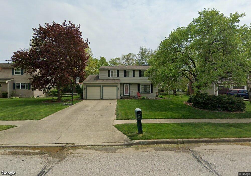
This home is located at 2738 Wexford Blvd, Stow, OH 44224 and is currently estimated at $294,448, approximately $184 per square foot. 2738 Wexford Blvd is a home located in Summit County with nearby schools including Stow-Munroe Falls High School and Walsh Jesuit High School.
Ownership History
Date
Name
Owned For
Owner Type
Purchase Details
Closed on
Oct 16, 2006
Sold by
Costa Alan A and Costa Pamela E
Bought by
Striner Matthew A and Striner Paula L
Current Estimated Value
Home Financials for this Owner
Home Financials are based on the most recent Mortgage that was taken out on this home.
Original Mortgage
$142,800
Interest Rate
6.5%
Mortgage Type
Purchase Money Mortgage
Create a Home Valuation Report for This Property
The Home Valuation Report is an in-depth analysis detailing your home's value as well as a comparison with similar homes in the area
Home Values in the Area
Average Home Value in this Area
Purchase History
| Date | Buyer | Sale Price | Title Company |
|---|---|---|---|
| Striner Matthew A | $178,500 | First American Title Akron |
Source: Public Records
Mortgage History
| Date | Status | Borrower | Loan Amount |
|---|---|---|---|
| Closed | Striner Matthew A | $142,800 |
Source: Public Records
Tax History Compared to Growth
Tax History
| Year | Tax Paid | Tax Assessment Tax Assessment Total Assessment is a certain percentage of the fair market value that is determined by local assessors to be the total taxable value of land and additions on the property. | Land | Improvement |
|---|---|---|---|---|
| 2025 | $4,513 | $79,930 | $15,778 | $64,152 |
| 2024 | $4,513 | $79,930 | $15,778 | $64,152 |
| 2023 | $4,513 | $79,930 | $15,778 | $64,152 |
| 2022 | $3,949 | $61,688 | $12,138 | $49,550 |
| 2021 | $3,537 | $61,688 | $12,138 | $49,550 |
| 2020 | $3,476 | $61,690 | $12,140 | $49,550 |
| 2019 | $3,596 | $59,690 | $12,020 | $47,670 |
| 2018 | $3,537 | $59,690 | $12,020 | $47,670 |
| 2017 | $3,252 | $59,690 | $12,020 | $47,670 |
| 2016 | $3,347 | $53,280 | $12,020 | $41,260 |
| 2015 | $3,252 | $53,280 | $12,020 | $41,260 |
| 2014 | $3,255 | $53,280 | $12,020 | $41,260 |
| 2013 | $3,330 | $54,900 | $12,020 | $42,880 |
Source: Public Records
Map
Nearby Homes
- 2714 Wexford Blvd
- 2908 Wexford Blvd
- 2831 Saybrooke Blvd
- 4444 Hickory Trail
- 4556 Fishcreek Rd
- 4445 Kenneth Trail
- 4638 Dresher Trail
- 4155 Burton Dr
- 4910 Independence Cir Unit D
- 4131 Burton Dr
- 4078 Pardee Rd
- 4916 Friar Rd Unit B
- 3860 Lake Run Blvd
- 2410 Wrens Dr S
- 3788 Woodbury Oval Unit 60
- 0 Vira Rd
- 2260 E Gilwood Dr
- 4322 Lorwood Dr
- 0 Stow Rd Unit 5102979
- 3801 Baird Rd
- 2746 Wexford Blvd
- 2730 Wexford Blvd
- 2749 Williamsburg Cir
- 2754 Wexford Blvd
- 2722 Wexford Blvd
- 2753 Williamsburg Cir
- 2745 Williamsburg Cir
- 4389 Stafford Cir
- 2741 Wexford Blvd
- 2764 Wexford Blvd
- 2779 Williamsburg Cir
- 4388 Stafford Cir
- 2749 Wexford Blvd
- 2739 Williamsburg Cir
- 4313 Smokerise Dr
- 2759 Wexford Blvd
- 2774 Wexford Blvd
- 2787 Williamsburg Cir
- 2709 Wexford Blvd
- 4305 Smokerise Dr