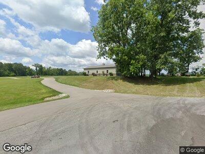
27398 Us Highway 12 Edwardsburg, MI 49112
Estimated Value: $37,788 - $335,000
--
Bed
--
Bath
--
Sq Ft
4,792
Sq Ft Lot
About This Home
This home is located at 27398 Us Highway 12, Edwardsburg, MI 49112 and is currently estimated at $135,197. 27398 Us Highway 12 is a home located in Cass County with nearby schools including Eagle Lake Elementary School, Edwardsburg Intermediate School, and Edwardsburg Primary School.
Ownership History
Date
Name
Owned For
Owner Type
Purchase Details
Closed on
Jun 30, 2020
Sold by
Stewart Mark G and Stewart Angela L
Bought by
Stewart Mark G and Stewart Angela L
Current Estimated Value
Purchase Details
Closed on
Sep 18, 2013
Sold by
Smith Michael and Smith Patricia
Bought by
Stewart Mark and Stewart Angela
Purchase Details
Closed on
Jun 21, 2012
Sold by
Feltzer Jeffrey S and Feltzer Rhona E
Bought by
Smith Michael and Smith Patricia
Purchase Details
Closed on
May 11, 2010
Sold by
Melke Larry
Bought by
Feltzer Jeffrey S and Feltzer Rhona E
Home Financials for this Owner
Home Financials are based on the most recent Mortgage that was taken out on this home.
Original Mortgage
$260,742
Interest Rate
5.16%
Mortgage Type
Future Advance Clause Open End Mortgage
Purchase Details
Closed on
Dec 20, 2006
Sold by
Tolbert Jeffrey L and Tolbert Jan M
Bought by
Pleasant Lake Land Trust #1
Create a Home Valuation Report for This Property
The Home Valuation Report is an in-depth analysis detailing your home's value as well as a comparison with similar homes in the area
Home Values in the Area
Average Home Value in this Area
Purchase History
| Date | Buyer | Sale Price | Title Company |
|---|---|---|---|
| Stewart Mark G | -- | None Available | |
| Stewart Mark | $19,000 | None Available | |
| Smith Michael | $10,000 | Lawyers Title | |
| Feltzer Jeffrey S | $360,000 | None Available | |
| Lemke Larry | -- | None Available | |
| Pleasant Lake Land Trust #1 | $350,000 | Meridian Title Corp |
Source: Public Records
Mortgage History
| Date | Status | Borrower | Loan Amount |
|---|---|---|---|
| Previous Owner | Lemke Larry | $260,742 | |
| Previous Owner | Tolbert Jeffrey L | $150,000 |
Source: Public Records
Tax History Compared to Growth
Tax History
| Year | Tax Paid | Tax Assessment Tax Assessment Total Assessment is a certain percentage of the fair market value that is determined by local assessors to be the total taxable value of land and additions on the property. | Land | Improvement |
|---|---|---|---|---|
| 2024 | $92 | $17,500 | $17,500 | $0 |
| 2023 | $450 | $15,000 | $0 | $0 |
| 2022 | $450 | $12,500 | $0 | $0 |
| 2021 | $340 | $11,000 | $0 | $0 |
| 2020 | $449 | $10,000 | $0 | $0 |
| 2019 | $439 | $7,500 | $0 | $0 |
| 2018 | $77 | $7,300 | $0 | $0 |
| 2017 | $75 | $7,800 | $0 | $0 |
| 2016 | $75 | $7,500 | $0 | $0 |
| 2015 | -- | $7,500 | $0 | $0 |
| 2011 | -- | $6,900 | $0 | $0 |
Source: Public Records
Map
Nearby Homes
- 27210 Us Highway 12
- 68880 Circle Dr
- 69218 Sundance Dr
- 26828 W Main St
- 27234 Curtis Dr
- 36.5A Michigan 62
- 68410 Dailey Rd
- 68398 Dailey Rd
- 68371 Dailey Rd
- 68740 East St
- 5 Caroline Ct
- 6 Caroline Ct
- 7 Caroline Ct
- 4 Caroline Ct
- 2 Ashley Rd
- 3 Caroline Ct
- 1 Ashley Rd
- 8 Caroline Ct
- 39 Tiffany Dr
- 38 Tiffany Dr
- 27398 Us Highway 12
- 27398 Us Highway 12
- 27311 Us Highway 12
- 27262 U S 12
- 27279 Us Highway 12
- 27251 Us Highway 12
- 27232 Main St
- 27203 Us Highway 12
- 27398 Us-12
- 27210 U S 12
- 27210 U S 12
- 68900 Claire St
- 68924 Claire St
- 68958 Claire St
- 68882 Claire St
- 49082 U S 12
- 27184 Us Highway 12
- 49220 U S 12 Unit 13001 Chicago Rd
- 68860 Claire St
- 27232 Us Highway 12