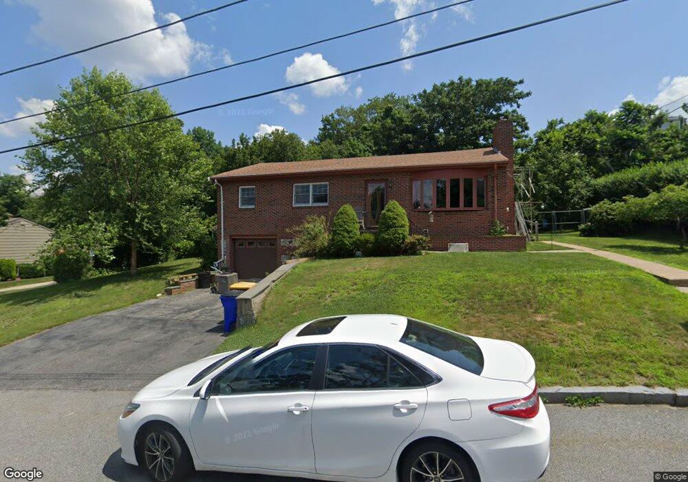
274 Bailey St Fall River, MA 02724
Sandy Beach NeighborhoodEstimated Value: $502,155 - $539,000
3
Beds
2
Baths
2,408
Sq Ft
$219/Sq Ft
Est. Value
About This Home
This home is located at 274 Bailey St, Fall River, MA 02724 and is currently estimated at $526,539, approximately $218 per square foot. 274 Bailey St is a home located in Bristol County with nearby schools including Carlton M. Viveiros Elementary School, Matthew J. Kuss Middle School, and B M C Durfee High School.
Ownership History
Date
Name
Owned For
Owner Type
Purchase Details
Closed on
May 5, 2009
Sold by
Gagliardi Joan Ann Est
Bought by
Gagliardi Angela M and Kut David P
Current Estimated Value
Home Financials for this Owner
Home Financials are based on the most recent Mortgage that was taken out on this home.
Original Mortgage
$181,600
Outstanding Balance
$114,801
Interest Rate
4.86%
Mortgage Type
Purchase Money Mortgage
Estimated Equity
$411,738
Purchase Details
Closed on
Mar 24, 2006
Sold by
Gagliardi Frank S
Bought by
Gagliardi Frank and Gagliardi Joan
Create a Home Valuation Report for This Property
The Home Valuation Report is an in-depth analysis detailing your home's value as well as a comparison with similar homes in the area
Home Values in the Area
Average Home Value in this Area
Purchase History
| Date | Buyer | Sale Price | Title Company |
|---|---|---|---|
| Gagliardi Angela M | $227,000 | -- | |
| Gagliardi Frank | -- | -- |
Source: Public Records
Mortgage History
| Date | Status | Borrower | Loan Amount |
|---|---|---|---|
| Open | Gagliardi Angela M | $181,600 |
Source: Public Records
Tax History
| Year | Tax Paid | Tax Assessment Tax Assessment Total Assessment is a certain percentage of the fair market value that is determined by local assessors to be the total taxable value of land and additions on the property. | Land | Improvement |
|---|---|---|---|---|
| 2025 | $4,657 | $406,700 | $122,600 | $284,100 |
| 2024 | $4,386 | $381,700 | $120,200 | $261,500 |
| 2023 | $4,243 | $345,800 | $108,300 | $237,500 |
| 2022 | $3,765 | $298,300 | $102,200 | $196,100 |
| 2021 | $4,335 | $237,700 | $97,600 | $140,100 |
| 2020 | $3,169 | $219,300 | $93,200 | $126,100 |
| 2019 | $3,135 | $215,000 | $97,400 | $117,600 |
| 2018 | $3,113 | $212,900 | $98,100 | $114,800 |
| 2017 | $2,954 | $211,000 | $98,100 | $112,900 |
| 2016 | $2,846 | $208,800 | $101,100 | $107,700 |
| 2015 | $2,740 | $209,500 | $101,100 | $108,400 |
| 2014 | $2,636 | $209,500 | $101,100 | $108,400 |
Source: Public Records
Map
Nearby Homes
Your Personal Tour Guide
Ask me questions while you tour the home.