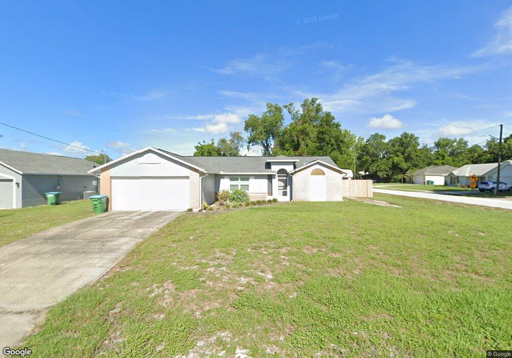
2743 Dristol Ln Deltona, FL 32738
Estimated Value: $286,855 - $308,000
3
Beds
2
Baths
1,472
Sq Ft
$202/Sq Ft
Est. Value
About This Home
This home is located at 2743 Dristol Ln, Deltona, FL 32738 and is currently estimated at $296,714, approximately $201 per square foot. 2743 Dristol Ln is a home located in Volusia County with nearby schools including Timbercrest Elementary School, Deltona Lakes Elementary School, and Galaxy Middle School.
Ownership History
Date
Name
Owned For
Owner Type
Purchase Details
Closed on
May 12, 2006
Sold by
Ortiz Armando and Ortiz Haydee
Bought by
Ortiz Armando and Ortiz Haydee
Current Estimated Value
Home Financials for this Owner
Home Financials are based on the most recent Mortgage that was taken out on this home.
Original Mortgage
$60,000
Outstanding Balance
$3,464
Interest Rate
6.39%
Mortgage Type
Credit Line Revolving
Estimated Equity
$293,250
Purchase Details
Closed on
Nov 10, 1995
Sold by
Ayala Noemi G
Bought by
Ortiz Armando and Norda Haydee
Home Financials for this Owner
Home Financials are based on the most recent Mortgage that was taken out on this home.
Original Mortgage
$61,750
Interest Rate
7.55%
Purchase Details
Closed on
Apr 15, 1989
Bought by
Ortiz Armando
Purchase Details
Closed on
Aug 15, 1975
Bought by
Ortiz Armando
Create a Home Valuation Report for This Property
The Home Valuation Report is an in-depth analysis detailing your home's value as well as a comparison with similar homes in the area
Home Values in the Area
Average Home Value in this Area
Purchase History
| Date | Buyer | Sale Price | Title Company |
|---|---|---|---|
| Ortiz Armando | -- | American Title Inc | |
| Ortiz Armando | $65,000 | -- | |
| Ortiz Armando | $9,500 | -- | |
| Ortiz Armando | $1,800 | -- |
Source: Public Records
Mortgage History
| Date | Status | Borrower | Loan Amount |
|---|---|---|---|
| Open | Ortiz Armando | $60,000 | |
| Closed | Ortiz Armando | $61,750 |
Source: Public Records
Tax History Compared to Growth
Tax History
| Year | Tax Paid | Tax Assessment Tax Assessment Total Assessment is a certain percentage of the fair market value that is determined by local assessors to be the total taxable value of land and additions on the property. | Land | Improvement |
|---|---|---|---|---|
| 2025 | $951 | $78,485 | -- | -- |
| 2024 | $951 | $76,274 | -- | -- |
| 2023 | $951 | $74,053 | $0 | $0 |
| 2022 | $955 | $71,896 | $0 | $0 |
| 2021 | $986 | $69,802 | $0 | $0 |
| 2020 | $984 | $68,838 | $0 | $0 |
| 2019 | $1,002 | $67,290 | $0 | $0 |
| 2018 | $993 | $66,035 | $0 | $0 |
| 2017 | $980 | $64,677 | $0 | $0 |
| 2016 | $967 | $63,347 | $0 | $0 |
| 2015 | $986 | $62,907 | $0 | $0 |
| 2014 | $963 | $62,408 | $0 | $0 |
Source: Public Records
Map
Nearby Homes
- 1995 Brewster Dr
- 2599 Hillview Cir
- 2699 Providence Blvd
- 2832 Howland Blvd
- 1727 Barrow St
- 2582 Providence Blvd
- 2761 Bishop Ln
- 1849 Bonkirk Dr
- 1843 Bonkirk Dr
- 0 Kentucky Ave Unit MFRO6301030
- 0 Kentucky Ave Unit MFRO6301026
- 0 Kentucky Ave Unit MFRO6301008
- 2163 Fireside Rd
- 0 Catalina Blvd
- 2169 Fireside Rd
- 2741 Beaver Dr
- 1622 Catalina Blvd
- 1672 Catalina Blvd
- 1684 Catalina Blvd
- 1688 Catalina Blvd
- 2735 Dristol Ln
- 2727 Dristol Ln
- 1968 Brewster Dr
- 1965 Brewster Dr
- 1957 Brewster Dr
- 1938 Brewster Dr
- 1928 Brewster Dr
- 1973 Brewster Dr
- 2734 Dristol Ln
- 1949 Brewster Dr
- 1978 Brewster Dr
- 2719 Dristol Ln
- 1981 Brewster Dr
- 2726 Dristol Ln
- 1941 Brewster Dr
- 1918 Brewster Dr
- 1933 Brewster Dr
- 1987 Brewster Dr
- 2728 Howland Blvd
- 2711 Dristol Ln