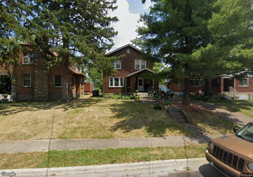
2744 Faber Ave Cincinnati, OH 45211
Westwood NeighborhoodEstimated Value: $108,000 - $151,587
2
Beds
2
Baths
1,092
Sq Ft
$119/Sq Ft
Est. Value
About This Home
This home is located at 2744 Faber Ave, Cincinnati, OH 45211 and is currently estimated at $129,897, approximately $118 per square foot. 2744 Faber Ave is a home located in Hamilton County with nearby schools including Western Hills High School, Gilbert A. Dater High School, and Robert A. Taft Information Technology High School.
Ownership History
Date
Name
Owned For
Owner Type
Purchase Details
Closed on
Apr 30, 2009
Sold by
Boenning Richard A
Bought by
Carr Thembi R
Current Estimated Value
Home Financials for this Owner
Home Financials are based on the most recent Mortgage that was taken out on this home.
Original Mortgage
$49,094
Outstanding Balance
$30,985
Interest Rate
4.83%
Mortgage Type
FHA
Estimated Equity
$98,912
Purchase Details
Closed on
Aug 16, 2000
Sold by
Burnett Darryl E and Burnett Lisa D
Bought by
Boenning Richard A
Purchase Details
Closed on
May 30, 1995
Sold by
Adams Ronald L and Adams Agnes M
Bought by
Burnett Darryl and Burnett Lisa
Home Financials for this Owner
Home Financials are based on the most recent Mortgage that was taken out on this home.
Original Mortgage
$49,600
Interest Rate
8.26%
Create a Home Valuation Report for This Property
The Home Valuation Report is an in-depth analysis detailing your home's value as well as a comparison with similar homes in the area
Home Values in the Area
Average Home Value in this Area
Purchase History
| Date | Buyer | Sale Price | Title Company |
|---|---|---|---|
| Carr Thembi R | $50,000 | Attorney | |
| Boenning Richard A | $53,100 | -- | |
| Burnett Darryl | -- | -- |
Source: Public Records
Mortgage History
| Date | Status | Borrower | Loan Amount |
|---|---|---|---|
| Open | Carr Thembi R | $49,094 | |
| Previous Owner | Burnett Darryl | $49,600 |
Source: Public Records
Tax History Compared to Growth
Tax History
| Year | Tax Paid | Tax Assessment Tax Assessment Total Assessment is a certain percentage of the fair market value that is determined by local assessors to be the total taxable value of land and additions on the property. | Land | Improvement |
|---|---|---|---|---|
| 2024 | $1,763 | $29,344 | $5,712 | $23,632 |
| 2023 | $1,803 | $29,344 | $5,712 | $23,632 |
| 2022 | $975 | $14,130 | $4,991 | $9,139 |
| 2021 | $935 | $14,130 | $4,991 | $9,139 |
| 2020 | $962 | $14,130 | $4,991 | $9,139 |
| 2019 | $956 | $12,845 | $4,536 | $8,309 |
| 2018 | $958 | $12,845 | $4,536 | $8,309 |
| 2017 | $909 | $12,845 | $4,536 | $8,309 |
| 2016 | $1,153 | $16,100 | $5,796 | $10,304 |
| 2015 | $1,040 | $16,100 | $5,796 | $10,304 |
| 2014 | $1,047 | $16,100 | $5,796 | $10,304 |
| 2013 | $1,157 | $17,500 | $6,300 | $11,200 |
Source: Public Records
Map
Nearby Homes
- 2340 Harrison Ave
- 2266 Harrison Ave
- 2962 Aquadale Ln
- 2656 Fenton Ave
- 2722 Orland Ave Unit 2
- 2828 Ruberg Ave
- 2630 Cora Ave
- 2195 Harrison Ave
- 2504 Forthmann Place
- 3025 Mchenry Ave
- 2711 Baker Ave
- 3064 Mchenry Ave
- 2117 Saint Leo Place
- 3355 Cavanaugh Ave
- 3295 Fyffe Ave
- 2114 Saint Leo Place
- 3042 Percy Ave
- 3072 Worthington Ave
- 2082 Harrison Ave
- 2473 Wahl Terrace
- 2746 Faber Ave
- 2740 Faber Ave
- 2748 Faber Ave
- 2732 Faber Ave
- 2917 Westknolls Ln
- 2752 Faber Ave
- 2921 Westknolls Ln
- 2913 Westknolls Ln
- 2925 Westknolls Ln
- 2909 Westknolls Ln
- 2741 Faber Ave
- 2743 Faber Ave
- 2929 Westknolls Ln
- 2905 Westknolls Ln
- 2735 Faber Ave
- 2745 Faber Ave
- 2933 Westknolls Ln
- 2901 Westknolls Ln
- 2751 Faber Ave
- 2753 Faber Ave