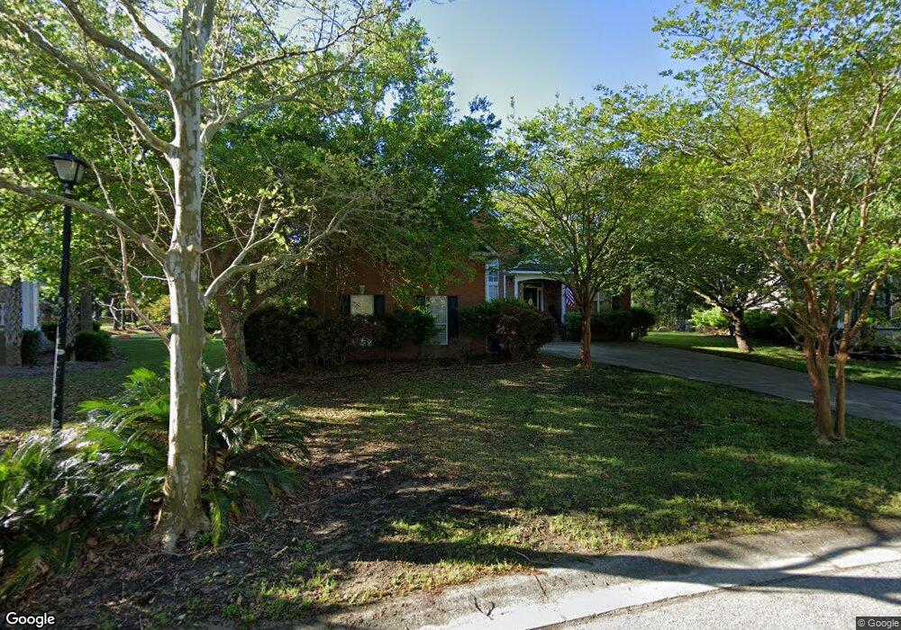
2744 Waterpointe Cir Mount Pleasant, SC 29466
Brickyard NeighborhoodEstimated Value: $754,627 - $949,000
4
Beds
2
Baths
2,185
Sq Ft
$397/Sq Ft
Est. Value
About This Home
This home is located at 2744 Waterpointe Cir, Mount Pleasant, SC 29466 and is currently estimated at $867,157, approximately $396 per square foot. 2744 Waterpointe Cir is a home located in Charleston County with nearby schools including Jennie Moore Elementary School, Laing Middle School, and Wando High School.
Ownership History
Date
Name
Owned For
Owner Type
Purchase Details
Closed on
Aug 10, 2011
Sold by
Hood Gerald Edward
Bought by
Hood Gina Albert
Current Estimated Value
Purchase Details
Closed on
Jan 25, 2005
Sold by
Ray Gregory A and Ray Ingrid S
Bought by
Hood Gerald Edward and Hood Gina Alberti
Home Financials for this Owner
Home Financials are based on the most recent Mortgage that was taken out on this home.
Original Mortgage
$200,000
Interest Rate
4.62%
Mortgage Type
Adjustable Rate Mortgage/ARM
Purchase Details
Closed on
Nov 7, 1999
Sold by
Edward Wilkes
Bought by
Ray Gregory A and Ray Ingrid S
Create a Home Valuation Report for This Property
The Home Valuation Report is an in-depth analysis detailing your home's value as well as a comparison with similar homes in the area
Home Values in the Area
Average Home Value in this Area
Purchase History
| Date | Buyer | Sale Price | Title Company |
|---|---|---|---|
| Hood Gina Albert | $12,000 | -- | |
| Hood Gerald Edward | $330,500 | -- | |
| Ray Gregory A | $234,000 | -- |
Source: Public Records
Mortgage History
| Date | Status | Borrower | Loan Amount |
|---|---|---|---|
| Previous Owner | Hood Gerald Edward | $200,000 |
Source: Public Records
Tax History Compared to Growth
Tax History
| Year | Tax Paid | Tax Assessment Tax Assessment Total Assessment is a certain percentage of the fair market value that is determined by local assessors to be the total taxable value of land and additions on the property. | Land | Improvement |
|---|---|---|---|---|
| 2024 | $6,170 | $24,180 | $0 | $0 |
| 2023 | $6,170 | $24,180 | $0 | $0 |
| 2022 | $5,655 | $24,180 | $0 | $0 |
| 2021 | $5,651 | $24,180 | $0 | $0 |
| 2020 | $5,583 | $24,180 | $0 | $0 |
| 2019 | $5,077 | $21,030 | $0 | $0 |
| 2017 | $4,884 | $21,030 | $0 | $0 |
| 2016 | $4,711 | $21,030 | $0 | $0 |
| 2015 | $4,484 | $21,030 | $0 | $0 |
| 2014 | $3,841 | $0 | $0 | $0 |
| 2011 | -- | $0 | $0 | $0 |
Source: Public Records
Map
Nearby Homes
- 1264 Colfax Ct
- 3904 Delinger Dr
- 1333 Merchant Ct
- 3010 Emma Ln
- 1263 Allusion Ln Unit 402
- 1353 Black River Dr
- 1185 W Park View Place
- 1365 Black River Dr
- 3046 Emma Ln
- 1417 S Jetties Ct
- 1166 Old Ivy Way
- 1208 Wynnwood Ct
- 3205 Morningdale Dr
- 1320 Lexington Dr
- 0 Coakley Rd Unit 23016313
- 2770 Christ Church Ct
- 2834 Parkers Landing Rd
- 3245 Morningdale Dr
- 0 Huro Dr
- 1175 Dingle Rd
- 2740 Waterpointe Cir
- 2748 Waterpointe Cir
- 2736 Waterpointe Cir
- 2743 Waterpointe Cir
- 2739 Waterpointe Cir
- 1260 Colfax Ct
- 2732 Waterpointe Cir
- 2752 Waterpointe Cir
- 2735 Waterpointe Cir
- 1351 Wynbrook Trace
- 2896 Colonnade Dr
- 2759 Waterpointe Cir
- 2892 Colonnade Dr
- 1349 Wynbrook Trace
- 2756 Waterpointe Cir
- 1256 Colfax Ct
- 1263 Colfax Ct
- 2728 Waterpointe Cir
- 2731 Waterpointe Cir
- 1352 Wynbrook Trace