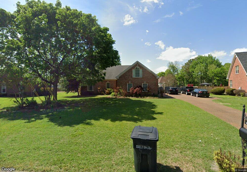
2745 New Port Royal Rd Thompsons Station, TN 37179
Estimated Value: $499,000 - $562,000
--
Bed
3
Baths
2,040
Sq Ft
$262/Sq Ft
Est. Value
About This Home
This home is located at 2745 New Port Royal Rd, Thompsons Station, TN 37179 and is currently estimated at $535,119, approximately $262 per square foot. 2745 New Port Royal Rd is a home located in Williamson County with nearby schools including Primrose School of Spring Hill.
Ownership History
Date
Name
Owned For
Owner Type
Purchase Details
Closed on
Dec 22, 1997
Sold by
Southeastern Construction Inc
Bought by
Whitlow Brian H and Whitlow Kellye M
Current Estimated Value
Home Financials for this Owner
Home Financials are based on the most recent Mortgage that was taken out on this home.
Original Mortgage
$134,300
Outstanding Balance
$22,781
Interest Rate
7.26%
Estimated Equity
$512,338
Create a Home Valuation Report for This Property
The Home Valuation Report is an in-depth analysis detailing your home's value as well as a comparison with similar homes in the area
Home Values in the Area
Average Home Value in this Area
Purchase History
| Date | Buyer | Sale Price | Title Company |
|---|---|---|---|
| Whitlow Brian H | $167,900 | -- |
Source: Public Records
Mortgage History
| Date | Status | Borrower | Loan Amount |
|---|---|---|---|
| Open | Whitlow Brian H | $134,300 |
Source: Public Records
Tax History Compared to Growth
Tax History
| Year | Tax Paid | Tax Assessment Tax Assessment Total Assessment is a certain percentage of the fair market value that is determined by local assessors to be the total taxable value of land and additions on the property. | Land | Improvement |
|---|---|---|---|---|
| 2025 | $666 | $135,600 | $38,750 | $96,850 |
| 2024 | $666 | $90,175 | $20,000 | $70,175 |
| 2023 | $666 | $90,175 | $20,000 | $70,175 |
| 2022 | $1,650 | $90,175 | $20,000 | $70,175 |
| 2021 | $1,650 | $90,175 | $20,000 | $70,175 |
| 2020 | $1,498 | $69,350 | $15,000 | $54,350 |
| 2019 | $1,498 | $69,350 | $15,000 | $54,350 |
| 2018 | $1,449 | $69,350 | $15,000 | $54,350 |
| 2017 | $1,436 | $69,350 | $15,000 | $54,350 |
| 2016 | $1,415 | $69,350 | $15,000 | $54,350 |
| 2015 | -- | $55,425 | $12,500 | $42,925 |
| 2014 | -- | $55,425 | $12,500 | $42,925 |
Source: Public Records
Map
Nearby Homes
- 2165 Loudenslager Dr
- 2127 Loudenslager Dr
- 2836 Pedigo Place
- 2785 Rutland Ct
- 2112 Loudenslager Dr
- 2184 Loudenslager Dr
- 403 Preakness Dr
- 2863 Windy Way
- 1083 Auldridge Dr
- 2104 Loudenslager Dr
- 2641 Buckner Rd
- 446 Buckwood Ave W
- 307 Buckwood Ln N
- 303 Buckwood Ln N
- 309 Buckwood Ln W
- 464 Buckwood Ave W
- 317 Buckwood Ln N
- 456 Buckwood Ave N
- 301 Buckwood Ave N
- 319 Buckwood Ln N
- 2743 New Port Royal Rd
- 2747 New Port Royal Rd
- 2148 Loudenslager Dr
- 2150 Loudenslager Dr
- 2146 Loudenslager Dr
- 2152 Loudenslager Dr
- 2751 Durham Ct
- 2747 Durham Ct
- 2749 New Port Royal Rd
- 2751 Durham Ct
- 2144 Loudenslager Dr
- 2154 Loudenslager Dr
- 2744 New Port Royal Rd
- 2748 New Port Royal Rd
- 2755 Durham Ct
- 2156 Loudenslager Dr
- 2142 Loudenslager Dr
- 2740 New Port Royal Rd
- 2751 New Port Royal Rd
- 2147 Loudenslager Dr